

Bush Beeline Loop
Un itinéraire vélo au départ de Mesa, Arizona, États Unis.
Vue d'ensemble
À propos du circuit
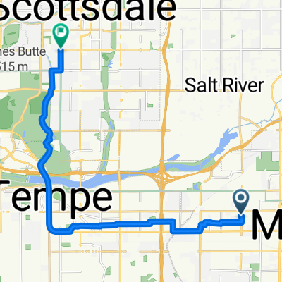
Ride out to Saguaro Lake via Bush Highway, following Salt River; return on Beeline Highway. While there are large shoulders on highways at nearly all parts, be aware that Bush Highway is used heavily by boaters, and the Beeline is a 4-lane mostly-divided highway with very heavy traffic at times. Alternatives: Ride McKellips to Ellsworth and take the Usery Pass road, Take McDowell instead of McKellips, Use Gilbert Rd as a shortcut (places not rider friendly). Note that most of the route is through park/forest/reservation, so services (restrooms, water stops, etc) are limited. On the Beeline, a good stopping point is at the Fort McDowell Rd junction, or at Shea Blvd turn to Fountain Hills.
- -:--
- Durée
- 81,4 km
- Distance
- 2 229 m
- Montée
- 2 229 m
- Descente
- ---
- Vit. moyenne
- ---
- Altitude max.
Continuer avec Bikemap
Utilise, modifie ou télécharge cet itinéraire vélo
Tu veux parcourir Bush Beeline Loop ou l’adapter à ton propre voyage ? Voici ce que tu peux faire avec cet itinéraire Bikemap :
Fonctionnalités gratuites
- Enregistre cet itinéraire comme favori ou dans une collection
- Copie et planifie ta propre version de cet itinéraire
- Divise-le en étapes pour créer un tour sur plusieurs jours
- Synchronise ton itinéraire avec Garmin ou Wahoo
Fonctionnalités Premium
Essai gratuit de 3 jours, ou paiement unique. En savoir plus sur Bikemap Premium.
- Navigue sur cet itinéraire sur iOS et Android
- Exporter un fichier GPX / KML de cet itinéraire
- Crée ton impression personnalisée (essaie-la gratuitement)
- Télécharge cet itinéraire pour la navigation hors ligne
Découvre plus de fonctionnalités Premium.
Obtiens Bikemap PremiumDe notre communauté
Mesa : Autres itinéraires populaires qui commencent ici
 East Jaeger Street 2235, Mesa to East Jaeger Street 2235, Mesa
- Distance
- 32,6 km
- Montée
- 37 m
- Descente
- 9 m
- Emplacement
- Mesa, Arizona, États Unis
 24km morning ride
- Distance
- 24 km
- Montée
- 29 m
- Descente
- 27 m
- Emplacement
- Mesa, Arizona, États Unis
 canal-pecans-Lindsey-brown-power-Alma school
- Distance
- 70,2 km
- Montée
- 90 m
- Descente
- 89 m
- Emplacement
- Mesa, Arizona, États Unis
 60km Mesa
- Distance
- 60,5 km
- Montée
- 47 m
- Descente
- 47 m
- Emplacement
- Mesa, Arizona, États Unis
 East Jaeger Street 2235, Mesa to East Jaeger Street 2235, Mesa
- Distance
- 31,5 km
- Montée
- 40 m
- Descente
- 19 m
- Emplacement
- Mesa, Arizona, États Unis
 Steady ride in Tempe
- Distance
- 15,9 km
- Montée
- 38 m
- Descente
- 64 m
- Emplacement
- Mesa, Arizona, États Unis
 Home - Echo Coffee
- Distance
- 17,4 km
- Montée
- 46 m
- Descente
- 39 m
- Emplacement
- Mesa, Arizona, États Unis
 73km Uptown Market
- Distance
- 73,4 km
- Montée
- 67 m
- Descente
- 65 m
- Emplacement
- Mesa, Arizona, États Unis
Ouvre-la dans l’app