

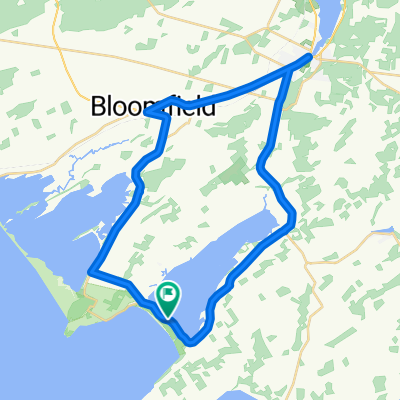
Recreational Trails Map - Gateway Country - Route 5
Un itinéraire vélo au départ de Prince Edward, Ontario, Canada.
Vue d'ensemble
À propos du circuit
I just traced the route as outlined to get a reading on the distance because it was not included on the Recreational Trails Map (a large oversite in my opinion). The description given:<br />Picton - Sand Banks Loop - This is the beach tour, so be prpared for traffic on the weekends. Head west out of Picton on Hwy 33 to CR10 and follow south to Cherry Valley. Hug the shore of East Lake. At Salmon Point, turn right and pass through The Outlet and over to Sandbanks PP, or West Lake, as you chosse. Head back up West Lake Rd to the pretty village of Bloomfield, featuring a vibrant main street. Return to Picton along Hwy33. Generally flat, a few rolling hills on the last stretch.<br /><br /><br />If we bike it, I will add details.
- -:--
- Durée
- 40,4 km
- Distance
- 107 m
- Montée
- 109 m
- Descente
- ---
- Vit. moyenne
- ---
- Altitude max.
Continuer avec Bikemap
Utilise, modifie ou télécharge cet itinéraire vélo
Tu veux parcourir Recreational Trails Map - Gateway Country - Route 5 ou l’adapter à ton propre voyage ? Voici ce que tu peux faire avec cet itinéraire Bikemap :
Fonctionnalités gratuites
- Enregistre cet itinéraire comme favori ou dans une collection
- Copie et planifie ta propre version de cet itinéraire
- Synchronise ton itinéraire avec Garmin ou Wahoo
Fonctionnalités Premium
Essai gratuit de 3 jours, ou paiement unique. En savoir plus sur Bikemap Premium.
- Navigue sur cet itinéraire sur iOS et Android
- Exporter un fichier GPX / KML de cet itinéraire
- Crée ton impression personnalisée (essaie-la gratuitement)
- Télécharge cet itinéraire pour la navigation hors ligne
Découvre plus de fonctionnalités Premium.
Obtiens Bikemap PremiumDe notre communauté
Prince Edward : Autres itinéraires populaires qui commencent ici
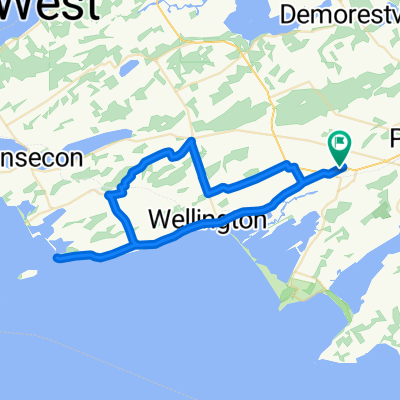
 BloomfieldSandbanksloop
- Distance
- 51,9 km
- Montée
- 127 m
- Descente
- 134 m
- Emplacement
- Prince Edward, Ontario, Canada
 swamp college to church camp
- Distance
- 33,4 km
- Montée
- 62 m
- Descente
- 60 m
- Emplacement
- Prince Edward, Ontario, Canada
 May 17, 2015, 3:28 PM
- Distance
- 38,3 km
- Montée
- 110 m
- Descente
- 109 m
- Emplacement
- Prince Edward, Ontario, Canada
 Recreational Trails Map - Gateway Country - Route 5
- Distance
- 40,4 km
- Montée
- 107 m
- Descente
- 109 m
- Emplacement
- Prince Edward, Ontario, Canada
 Bloomfield to County Cider Factory and back
- Distance
- 65,7 km
- Montée
- 261 m
- Descente
- 261 m
- Emplacement
- Prince Edward, Ontario, Canada
 classic western wine route
- Distance
- 59,9 km
- Montée
- 76 m
- Descente
- 76 m
- Emplacement
- Prince Edward, Ontario, Canada
 canada day 100k
- Distance
- 104,5 km
- Montée
- 126 m
- Descente
- 126 m
- Emplacement
- Prince Edward, Ontario, Canada
 Bloomfield to County Cider Factory and back
- Distance
- 66,5 km
- Montée
- 248 m
- Descente
- 245 m
- Emplacement
- Prince Edward, Ontario, Canada
Ouvre-la dans l’app