

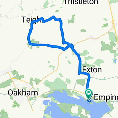
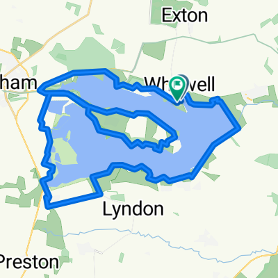
Scotty Ash scenic route.
Un itinéraire vélo au départ de Empingham, Angleterre, Royaume-Uni.
Vue d'ensemble
À propos du circuit
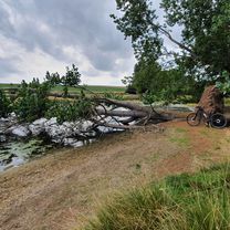
A gentle route from the north or south Carpark / bikehire, use the lakeside path to start and finish, if you are starting from the north car park use the path as its steadier to start for those not used to the bikes, nice flat roads to start with to get used to the bikes then a few slopes around Braunston / knossington then the pretty vilage of Lyndon. if you enter the south car park at Normanton and follow the riverside path, they have giant Zorbs on the dam wall which you can pay to go in. Good luck, will come if I can ! M.
- -:--
- Durée
- 43,3 km
- Distance
- 277 m
- Montée
- 276 m
- Descente
- ---
- Vit. moyenne
- ---
- Altitude max.
Qualité de l’itinéraire
Types de voies et surfaces le long de l’itinéraire
Types de routes
Route tranquille
28,5 km
(66 %)
Route
9,9 km
(23 %)
surfaces
Pavé
8,7 km
(20 %)
Asphalte
8,7 km
(20 %)
Indéfini
34,6 km
(80 %)
Continuer avec Bikemap
Utilise, modifie ou télécharge cet itinéraire vélo
Tu veux parcourir Scotty Ash scenic route. ou l’adapter à ton propre voyage ? Voici ce que tu peux faire avec cet itinéraire Bikemap :
Fonctionnalités gratuites
- Enregistre cet itinéraire comme favori ou dans une collection
- Copie et planifie ta propre version de cet itinéraire
- Synchronise ton itinéraire avec Garmin ou Wahoo
Fonctionnalités Premium
Essai gratuit de 3 jours, ou paiement unique. En savoir plus sur Bikemap Premium.
- Navigue sur cet itinéraire sur iOS et Android
- Exporter un fichier GPX / KML de cet itinéraire
- Crée ton impression personnalisée (essaie-la gratuitement)
- Télécharge cet itinéraire pour la navigation hors ligne
Découvre plus de fonctionnalités Premium.
Obtiens Bikemap PremiumDe notre communauté
Empingham : Autres itinéraires populaires qui commencent ici
 Bull Brig Lane 2, Whitwell to Bull Brig Lane 2, Whitwell
- Distance
- 35 km
- Montée
- 119 m
- Descente
- 119 m
- Emplacement
- Empingham, Angleterre, Royaume-Uni
 Recovered Route
- Distance
- 9 km
- Montée
- 66 m
- Descente
- 68 m
- Emplacement
- Empingham, Angleterre, Royaume-Uni
 Rutland Water w/o family 😜
- Distance
- 34,9 km
- Montée
- 30 m
- Descente
- 80 m
- Emplacement
- Empingham, Angleterre, Royaume-Uni
 Rutland Water loop and next Fineshade Woods 2 loops
- Distance
- 79,5 km
- Montée
- 720 m
- Descente
- 706 m
- Emplacement
- Empingham, Angleterre, Royaume-Uni
 Vitruvian Bike Course
- Distance
- 41,4 km
- Montée
- 318 m
- Descente
- 317 m
- Emplacement
- Empingham, Angleterre, Royaume-Uni
 Whitwell 10 Miler
- Distance
- 27,6 km
- Montée
- 162 m
- Descente
- 161 m
- Emplacement
- Empingham, Angleterre, Royaume-Uni
 Route in Oakham
- Distance
- 37,1 km
- Montée
- 242 m
- Descente
- 239 m
- Emplacement
- Empingham, Angleterre, Royaume-Uni
 rutland west
- Distance
- 34,9 km
- Montée
- 351 m
- Descente
- 351 m
- Emplacement
- Empingham, Angleterre, Royaume-Uni
Ouvre-la dans l’app