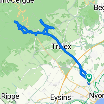
Nyon-Col de la Givrine-Lausanne-Nyon
Un itinéraire vélo au départ de Nyon, Canton de Vaud, Suisse.
Vue d'ensemble
À propos du circuit
Von Nyon direkt zum Col hoch, dannach durch die höher gelegenen Weingüter im Hinterland langsam runter bis Lausanne. In Lausanne natürlich ordentlich wieder hochgreschraubt und dann retour
- -:--
- Durée
- 128,3 km
- Distance
- 1 876 m
- Montée
- 1 871 m
- Descente
- ---
- Vit. moyenne
- 1 237 m
- Altitude max.
Qualité de l’itinéraire
Types de voies et surfaces le long de l’itinéraire
Types de routes
Route
30,8 km
(24 %)
Route tranquille
14,1 km
(11 %)
surfaces
Pavé
85,9 km
(67 %)
Asphalte
84,6 km
(66 %)
Pavé (non défini)
1,3 km
(1 %)
Indéfini
42,3 km
(33 %)
Continuer avec Bikemap
Utilise, modifie ou télécharge cet itinéraire vélo
Tu veux parcourir Nyon-Col de la Givrine-Lausanne-Nyon ou l’adapter à ton propre voyage ? Voici ce que tu peux faire avec cet itinéraire Bikemap :
Fonctionnalités gratuites
- Enregistre cet itinéraire comme favori ou dans une collection
- Copie et planifie ta propre version de cet itinéraire
- Divise-le en étapes pour créer un tour sur plusieurs jours
- Synchronise ton itinéraire avec Garmin ou Wahoo
Fonctionnalités Premium
Essai gratuit de 3 jours, ou paiement unique. En savoir plus sur Bikemap Premium.
- Navigue sur cet itinéraire sur iOS et Android
- Exporter un fichier GPX / KML de cet itinéraire
- Crée ton impression personnalisée (essaie-la gratuitement)
- Télécharge cet itinéraire pour la navigation hors ligne
Découvre plus de fonctionnalités Premium.
Obtiens Bikemap PremiumDe notre communauté
Nyon : Autres itinéraires populaires qui commencent ici
 2016_Traversée du Jura
- Distance
- 369 km
- Montée
- 2 873 m
- Descente
- 2 995 m
- Emplacement
- Nyon, Canton de Vaud, Suisse
 Nyon-Col de la Givrine-Lausanne-Nyon
- Distance
- 128,3 km
- Montée
- 1 876 m
- Descente
- 1 871 m
- Emplacement
- Nyon, Canton de Vaud, Suisse
 bike tour through Nyon
- Distance
- 20,6 km
- Montée
- 505 m
- Descente
- 504 m
- Emplacement
- Nyon, Canton de Vaud, Suisse
 Nyon Trelex Arzier Mtb
- Distance
- 24,8 km
- Montée
- 613 m
- Descente
- 616 m
- Emplacement
- Nyon, Canton de Vaud, Suisse
 Tour du lac
- Distance
- 181,9 km
- Montée
- 1 157 m
- Descente
- 1 178 m
- Emplacement
- Nyon, Canton de Vaud, Suisse
 Stäfa - Tarifa Stage #3 Nyon - Saint Marie de Cuines
- Distance
- 154,1 km
- Montée
- 1 316 m
- Descente
- 1 209 m
- Emplacement
- Nyon, Canton de Vaud, Suisse
 Juro-Route Teil 1 von Nyon-Lucelle
- Distance
- 229,2 km
- Montée
- 4 773 m
- Descente
- 4 582 m
- Emplacement
- Nyon, Canton de Vaud, Suisse
 De Route de Genève, Nyon à Route de Genève, Nyon
- Distance
- 32,7 km
- Montée
- 400 m
- Descente
- 845 m
- Emplacement
- Nyon, Canton de Vaud, Suisse
Ouvre-la dans l’app

