

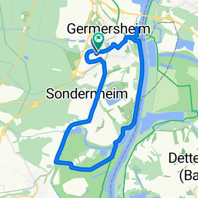
Germersheim/Speyer
Un itinéraire vélo au départ de Germersheim, Rhénanie-Palatinat, Allemagne.
Vue d'ensemble
À propos du circuit
Le salon annuel Spezialradmesse se tient à Germersheim fin avril ; Speyer dispose de quelques bons hébergements, donc faire du vélo aller-retour est pratique. Mais ici, le Rhein Radweg est une zone tampon, et le Spezi a lieu pendant la montée des eaux du printemps – donc certaines parties du Radweg peuvent être presque impraticables à cause de la boue. En 2013, nous avons exploré plusieurs itinéraires possibles et avons utilisé celui-ci. Il y avait une Umleitung affichée et assez bien indiquée, que nous avons utilisée entre Lingenfeld et Mechtersheim. L'itinéraire représenté va de la Stadthalle Germersheim jusqu'à l'hôtel Domhof à Speyer. Il est légèrement plus long que ce qui est indiqué, car les pistes cyclables s'écartaient parfois un peu des routes pour contourner les ronds-points et autres échangeurs ; la plus grande échelle des cartes BikeMap n'était toujours pas suffisante pour représenter facilement ces détails.
Un autre itinéraire que nous avons exploré restait beaucoup plus longtemps sur la Germersheimer Strasse en allant de Speyer à Germersheim ; ce parcours était aussi potentiellement bon, mais comprenait un tronçon assez long sans accotement et avec un trafic assez dense, ce qui le rendait moins attractif à notre avis.
- -:--
- Durée
- 19,2 km
- Distance
- 56 m
- Montée
- 55 m
- Descente
- ---
- Vit. moyenne
- ---
- Altitude max.

Qualité de l’itinéraire
Types de voies et surfaces le long de l’itinéraire
Types de routes
Route tranquille
4,4 km
(23 %)
Sentier
3,5 km
(18 %)
surfaces
Pavé
16,9 km
(88 %)
Asphalte
15,9 km
(83 %)
Pavé (non défini)
1 km
(5 %)
Indéfini
2,3 km
(12 %)
Continuer avec Bikemap
Utilise, modifie ou télécharge cet itinéraire vélo
Tu veux parcourir Germersheim/Speyer ou l’adapter à ton propre voyage ? Voici ce que tu peux faire avec cet itinéraire Bikemap :
Fonctionnalités gratuites
- Enregistre cet itinéraire comme favori ou dans une collection
- Copie et planifie ta propre version de cet itinéraire
- Synchronise ton itinéraire avec Garmin ou Wahoo
Fonctionnalités Premium
Essai gratuit de 3 jours, ou paiement unique. En savoir plus sur Bikemap Premium.
- Navigue sur cet itinéraire sur iOS et Android
- Exporter un fichier GPX / KML de cet itinéraire
- Crée ton impression personnalisée (essaie-la gratuitement)
- Télécharge cet itinéraire pour la navigation hors ligne
Découvre plus de fonctionnalités Premium.
Obtiens Bikemap PremiumDe notre communauté
Germersheim : Autres itinéraires populaires qui commencent ici
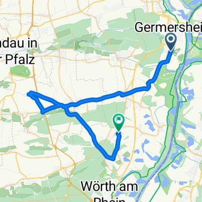
 Germersheim-Kirrlach
- Distance
- 14,1 km
- Montée
- 16 m
- Descente
- 13 m
- Emplacement
- Germersheim, Rhénanie-Palatinat, Allemagne
 Ziegelei
- Distance
- 17,6 km
- Montée
- 33 m
- Descente
- 33 m
- Emplacement
- Germersheim, Rhénanie-Palatinat, Allemagne
 Germersheim-Leimersheim und zurück CLONED FROM ROUTE 67944
- Distance
- 34,7 km
- Montée
- 76 m
- Descente
- 77 m
- Emplacement
- Germersheim, Rhénanie-Palatinat, Allemagne
 Von Germersheim bis Rastatt
- Distance
- 61,1 km
- Montée
- 168 m
- Descente
- 159 m
- Emplacement
- Germersheim, Rhénanie-Palatinat, Allemagne
 France Louterbourg
- Distance
- 49 km
- Montée
- 223 m
- Descente
- 202 m
- Emplacement
- Germersheim, Rhénanie-Palatinat, Allemagne
 inselgrün
- Distance
- 17,9 km
- Montée
- 31 m
- Descente
- 31 m
- Emplacement
- Germersheim, Rhénanie-Palatinat, Allemagne
 von Germesheim nach Rülzheim,Herxheim,Insheim,Hatzenbühl,Jockgrim und Schluss in Rheinzabern
- Distance
- 40,6 km
- Montée
- 80 m
- Descente
- 74 m
- Emplacement
- Germersheim, Rhénanie-Palatinat, Allemagne
 Germesheim Rundweg 1 50/80
- Distance
- 50 km
- Montée
- 186 m
- Descente
- 182 m
- Emplacement
- Germersheim, Rhénanie-Palatinat, Allemagne
Ouvre-la dans l’app