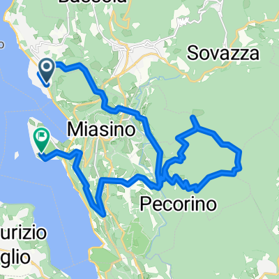
Pettenasco - Caprezzo (via Alpe Pala) - Pettenasco
Un itinéraire vélo au départ de Pettenasco, Piémont, Italie.
Vue d'ensemble
À propos du circuit
A beautiful ride of about 80 km. Mostly we drove over paved roads, where possibile small and quiet ones.
Start in Pratolungo, go to Agrano and then down in the direction of Omegna. Leave this on your left and follow the signs to Granerolo. It is a climb but worth the trip as you go down over a beautiful, small road until you reach the mainstreet. Take a right, in the direction of Verbania/Stresa. Just before you go under the highway, take the road on the lef t(going to camping Piano Grande). Follow this until you end up on another high way and go to the left. On the roundabout you go to the right and immediately after that to the left goin to Bieno. Before the centre of Cambiasca take a left and then follow the road all the way up, passing Cossogno, Ungiasca and Miazzina until you arrive at Alpe Pale. Take the road directly on the left of the restaurant, which is unpaved. The first few kms of this road where fine, but the last half our/45 minutes we had to walk because it was all grown with grass.... You can have a good picnic the chapel you arrive. Then head down towards Caprezzo, Ramello and Cambiasca. From there you can take the same road back (we followed the water and skipped the trip to Granerolo)- -:--
- Durée
- 79,9 km
- Distance
- 1 523 m
- Montée
- 1 523 m
- Descente
- ---
- Vit. moyenne
- ---
- Altitude max.
Continuer avec Bikemap
Utilise, modifie ou télécharge cet itinéraire vélo
Tu veux parcourir Pettenasco - Caprezzo (via Alpe Pala) - Pettenasco ou l’adapter à ton propre voyage ? Voici ce que tu peux faire avec cet itinéraire Bikemap :
Fonctionnalités gratuites
- Enregistre cet itinéraire comme favori ou dans une collection
- Copie et planifie ta propre version de cet itinéraire
- Synchronise ton itinéraire avec Garmin ou Wahoo
Fonctionnalités Premium
Essai gratuit de 3 jours, ou paiement unique. En savoir plus sur Bikemap Premium.
- Navigue sur cet itinéraire sur iOS et Android
- Exporter un fichier GPX / KML de cet itinéraire
- Crée ton impression personnalisée (essaie-la gratuitement)
- Télécharge cet itinéraire pour la navigation hors ligne
Découvre plus de fonctionnalités Premium.
Obtiens Bikemap PremiumDe notre communauté
Pettenasco : Autres itinéraires populaires qui commencent ici
- OrtaseeStresaFlachFlachLang
- Distance
- 66,5 km
- Montée
- 334 m
- Descente
- 331 m
- Emplacement
- Pettenasco, Piémont, Italie
- MB Mountainbiketour auf den Monte Mottarone vom Lago d´Orta
- Distance
- 31,9 km
- Montée
- 1 616 m
- Descente
- 1 613 m
- Emplacement
- Pettenasco, Piémont, Italie
- Pratolungo - Mottarone - Pratolungo (in mountainbike)
- Distance
- 52,7 km
- Montée
- 1 288 m
- Descente
- 1 288 m
- Emplacement
- Pettenasco, Piémont, Italie
- Da Via Giovanni Curioni 8, Pettenasco a Via Vittorio Veneto 1, Pettenasco
- Distance
- 19,3 km
- Montée
- 596 m
- Descente
- 581 m
- Emplacement
- Pettenasco, Piémont, Italie
- Percorco bike 70.3 Pettenasco
- Distance
- 36,3 km
- Montée
- 294 m
- Descente
- 292 m
- Emplacement
- Pettenasco, Piémont, Italie
- CPR Lac d'Orta 2020
- Distance
- 65,2 km
- Montée
- 1 288 m
- Descente
- 1 286 m
- Emplacement
- Pettenasco, Piémont, Italie
- Girolago Anello Azzurro
- Distance
- 39,4 km
- Montée
- 1 705 m
- Descente
- 1 705 m
- Emplacement
- Pettenasco, Piémont, Italie
- Lago d'Orta 2016: Bielmonte - Bocch. Boscarola - Valsesia
- Distance
- 138,5 km
- Montée
- 2 190 m
- Descente
- 2 192 m
- Emplacement
- Pettenasco, Piémont, Italie
Ouvre-la dans l’app