

3.Route des Grandes Alpes - Day Three
Un itinéraire vélo au départ de Tignes, Auvergne-Rhône-Alpes, France.
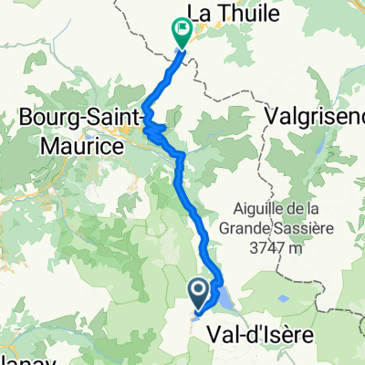
Vue d'ensemble
À propos du circuit
<span style="margin: 0px; padding: 0px; border: 0px; outline: 0px; font-size: medium; vertical-align: baseline; background-color: transparent; color: rgb(0, 0, 0); font-family: Tahoma, Geneva, Kalimati, sans-serif; background-position: initial initial; background-repeat: initial initial;">105km 1950m gain, 2 cat. 1 cols</span>
<span style="margin: 0px; padding: 0px; border: 0px; outline: 0px; font-size: small; vertical-align: baseline; background-color: transparent; color: rgb(0, 0, 0); font-family: Tahoma, Geneva, Kalimati, sans-serif; background-position: initial initial; background-repeat: initial initial;">From Val d’Isere it is straight up to the Iseran, an exposed and tough start to the morning but well worth it for the view from the top. The descent seems endless at 73km but well deserved and very beautiful, it brings us down to St Michel-de-Maurienne where with rested legs we tackle the Col du Telegraphe which at 830m height gain is a tough but good end to the day as it winds up through the trees which offer good shade on a hot day. A short descent takes us to Valloire and the hotel.</span> <span style="margin: 0px; padding: 0px; border: 0px; outline: 0px; font-size: small; vertical-align: baseline; background-color: transparent; color: rgb(0, 0, 0); font-family: Tahoma, Geneva, Kalimati, sans-serif; background-position: initial initial; background-repeat: initial initial;">Accommodation: </span><span style="color: rgb(34, 34, 34); font-family: Arial, Verdana, sans-serif;">Hôtel Patchwork, </span><span style="color: rgb(34, 34, 34); font-family: Arial, Verdana, sans-serif;">Route des Grandes Alpes, </span><span style="color: rgb(34, 34, 34); font-family: Arial, Verdana, sans-serif;">73450 Valloire, </span><span style="color: rgb(34, 34, 34); font-family: Arial, Verdana, sans-serif;">04.79.59.00.99</span>- -:--
- Durée
- 109,8 km
- Distance
- 1 851 m
- Montée
- 2 250 m
- Descente
- ---
- Vit. moyenne
- ---
- Altitude max.

Continuer avec Bikemap
Utilise, modifie ou télécharge cet itinéraire vélo
Tu veux parcourir 3.Route des Grandes Alpes - Day Three ou l’adapter à ton propre voyage ? Voici ce que tu peux faire avec cet itinéraire Bikemap :
Fonctionnalités gratuites
- Enregistre cet itinéraire comme favori ou dans une collection
- Copie et planifie ta propre version de cet itinéraire
- Divise-le en étapes pour créer un tour sur plusieurs jours
- Synchronise ton itinéraire avec Garmin ou Wahoo
Fonctionnalités Premium
Essai gratuit de 3 jours, ou paiement unique. En savoir plus sur Bikemap Premium.
- Navigue sur cet itinéraire sur iOS et Android
- Exporter un fichier GPX / KML de cet itinéraire
- Crée ton impression personnalisée (essaie-la gratuitement)
- Télécharge cet itinéraire pour la navigation hors ligne
Découvre plus de fonctionnalités Premium.
Obtiens Bikemap PremiumDe notre communauté
Tignes : Autres itinéraires populaires qui commencent ici
 TDLA etp 5B Tignes - colle di somelier
- Distance
- 148,9 km
- Montée
- 3 989 m
- Descente
- 3 109 m
- Emplacement
- Tignes, Auvergne-Rhône-Alpes, France
 Tour de France 2019 3. Etappe
- Distance
- 216,3 km
- Montée
- 1 040 m
- Descente
- 2 435 m
- Emplacement
- Tignes, Auvergne-Rhône-Alpes, France
 Tignes - Col D´Iseran
- Distance
- 30,6 km
- Montée
- 1 209 m
- Descente
- 583 m
- Emplacement
- Tignes, Auvergne-Rhône-Alpes, France
 TIGNES - COL DE L'ISERAN
- Distance
- 28,6 km
- Montée
- 1 267 m
- Descente
- 595 m
- Emplacement
- Tignes, Auvergne-Rhône-Alpes, France
 Col de l'Iseran and Mont Cenis
- Distance
- 72 km
- Montée
- 1 711 m
- Descente
- 1 739 m
- Emplacement
- Tignes, Auvergne-Rhône-Alpes, France
 to furnicular
- Distance
- 0,6 km
- Montée
- 12 m
- Descente
- 32 m
- Emplacement
- Tignes, Auvergne-Rhône-Alpes, France
 Tignes - Col de Petit st. Bernard
- Distance
- 39,8 km
- Montée
- 1 121 m
- Descente
- 1 057 m
- Emplacement
- Tignes, Auvergne-Rhône-Alpes, France
 Guillestre - Tignes
- Distance
- 231,2 km
- Montée
- 4 232 m
- Descente
- 5 325 m
- Emplacement
- Tignes, Auvergne-Rhône-Alpes, France
Ouvre-la dans l’app