

St Margaret's Elbow- via Crail and Fife Ness to St Andrews
Un itinéraire vélo au départ de Saint Monans, Ecosse, Royaume-Uni.
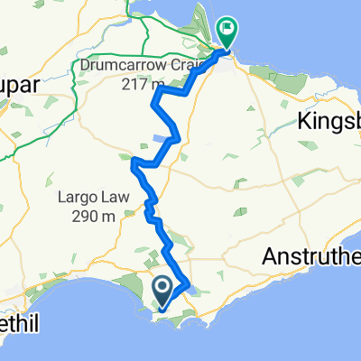
Vue d'ensemble
À propos du circuit
Cette extension du Chemin de St Margaret continue le long du sentier côtier de Fife à travers des villages de pêcheurs anciens, le long des plages et sur des rochers jusqu'à ce que les flèches de St Andrews apparaissent à la vue sur des kilomètres de fairways vallonnés. Le chemin continue par le port dans les abords de la cathédrale en ruine. Des pubs, etc. le long du chemin vers Crail et de grandes opportunités de camping sauvage. Les cyclistes peuvent devoir descendre de leur vélo à certains moments.
- -:--
- Durée
- 37,4 km
- Distance
- 174 m
- Montée
- 159 m
- Descente
- ---
- Vit. moyenne
- ---
- Altitude max.

Points forts de l’itinéraire
Points d’intérêt le long de l’itinéraire
Point d'intérêt après 10,6 km
The Dreel Burn. King James IV (1473-1513) disguised as a piper was carried over this burn by a "stout gaberlunzie" woman and rewarded with his purse. "Gaberlunzie" is a medieval Scots word for licensed beggar.

Point d'intérêt après 25,8 km
As glaciers advanced during the last ice age over 10,000 years ago they chipped off boulders and carried them along sometimes hundreds of miles. When the ice melted the boulders, like these ones here, were simply dumped. Thanks to geoHeritage Fife for advice and image.

Point d'intérêt après 28,2 km
Here the sandstone contains many little pits which form parallel rows about 20 cm apart. Some rows cross over each other .These pits represent the footprints of a millipede-type animal, about 1.5 m long, which lived about 330 million years ago. At that time it was probably the largest land animal. Thanks to geoHeritage Fife for advice and image.
Point d'intérêt après 30,7 km
Peekie Bridge over Kenly Burn, with panel showing arms of Prior Hepburn, in office around 1500.
Continuer avec Bikemap
Utilise, modifie ou télécharge cet itinéraire vélo
Tu veux parcourir St Margaret's Elbow- via Crail and Fife Ness to St Andrews ou l’adapter à ton propre voyage ? Voici ce que tu peux faire avec cet itinéraire Bikemap :
Fonctionnalités gratuites
- Enregistre cet itinéraire comme favori ou dans une collection
- Copie et planifie ta propre version de cet itinéraire
- Synchronise ton itinéraire avec Garmin ou Wahoo
Fonctionnalités Premium
Essai gratuit de 3 jours, ou paiement unique. En savoir plus sur Bikemap Premium.
- Navigue sur cet itinéraire sur iOS et Android
- Exporter un fichier GPX / KML de cet itinéraire
- Crée ton impression personnalisée (essaie-la gratuitement)
- Télécharge cet itinéraire pour la navigation hors ligne
Découvre plus de fonctionnalités Premium.
Obtiens Bikemap PremiumDe notre communauté
Saint Monans : Autres itinéraires populaires qui commencent ici
 14, Marine Park, Leven to A917, Broomlees, Kilconquhar, Leven
- Distance
- 2,7 km
- Montée
- 22 m
- Descente
- 8 m
- Emplacement
- Saint Monans, Ecosse, Royaume-Uni
 Kellie Castle - St Andrews - Crail - Pittenweem
- Distance
- 51,6 km
- Montée
- 316 m
- Descente
- 305 m
- Emplacement
- Saint Monans, Ecosse, Royaume-Uni
 St Margaret's Elbow- via Crail and Fife Ness to St Andrews
- Distance
- 37,4 km
- Montée
- 174 m
- Descente
- 159 m
- Emplacement
- Saint Monans, Ecosse, Royaume-Uni
 Route from Woodland Way, Kilconquhar, Leven
- Distance
- 4,6 km
- Montée
- 20 m
- Descente
- 42 m
- Emplacement
- Saint Monans, Ecosse, Royaume-Uni
 Route from 25 Station Road, Anstruther
- Distance
- 13,6 km
- Montée
- 298 m
- Descente
- 46 m
- Emplacement
- Saint Monans, Ecosse, Royaume-Uni
 Coastal Path - never again
- Distance
- 9,7 km
- Montée
- 67 m
- Descente
- 67 m
- Emplacement
- Saint Monans, Ecosse, Royaume-Uni
 Woodland Way, Kilconquhar, Leven to Woodland Way, Kilconquhar, Leven
- Distance
- 14,6 km
- Montée
- 96 m
- Descente
- 92 m
- Emplacement
- Saint Monans, Ecosse, Royaume-Uni
 Saint Monans - St Andrews
- Distance
- 25,3 km
- Montée
- 197 m
- Descente
- 190 m
- Emplacement
- Saint Monans, Ecosse, Royaume-Uni
Ouvre-la dans l’app