ITU Kitzbuhel 2012
Un itinéraire vélo au départ de 
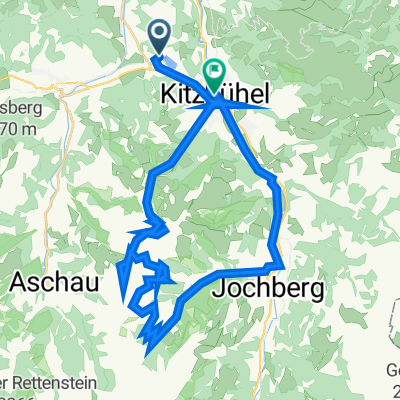
Reith bei Kitzbühel, Tyrol, Autriche.
Vue d'ensemble
Ă€ propos du circuit
Bike Course of the ITU Kitzbuhel Race in 2012
- -:--
- Durée
- 12,3 km
- Distance
- 992 m
- Montée
- 91 m
- Descente
- ---
- Vit. moyenne
- ---
- Altitude max.
Qualité de l’itinéraire
Types de voies et surfaces le long de l’itinéraire
Types de routes
Route tranquille
9,8 km
(80 %)
Route fréquentée
1,6 km
(13 %)
surfaces
Pavé
9,6 km
(78 %)
Asphalte
9,4 km
(77 %)
Pavé (non défini)
0,2 km
(2 %)
Indéfini
2,6 km
(22 %)
Continuer avec Bikemap
Utilise, modifie ou télécharge cet itinéraire vélo
Tu veux parcourir ITU Kitzbuhel 2012 ou l’adapter à ton propre voyage ? Voici ce que tu peux faire avec cet itinéraire Bikemap :
Fonctionnalités gratuites
- Enregistre cet itinéraire comme favori ou dans une collection
- Copie et planifie ta propre version de cet itinéraire
- Synchronise ton itinéraire avec Garmin ou Wahoo
Fonctionnalités Premium
Essai gratuit de 3 jours, ou paiement unique. En savoir plus sur Bikemap Premium.
- Navigue sur cet itinéraire sur iOS et Android
- Exporter un fichier GPX / KML de cet itinéraire
- Crée ton impression personnalisée (essaie-la gratuitement)
- Télécharge cet itinéraire pour la navigation hors ligne
Découvre plus de fonctionnalités Premium.
Obtiens Bikemap PremiumDe notre communauté
Reith bei Kitzbühel : Autres itinéraires populaires qui commencent ici
- KitzbĂĽhel
- Distance
- 9,4 km
- Montée
- 125 m
- Descente
- 124 m
- Emplacement
- Reith bei KitzbĂĽhel, Tyrol, Autriche
- Reith um den Hartkaser
- Distance
- 50,5 km
- Montée
- 438 m
- Descente
- 438 m
- Emplacement
- Reith bei KitzbĂĽhel, Tyrol, Autriche
- Schwarzee ĂĽber St.Johann auf den Harschbichl
- Distance
- 31,2 km
- Montée
- 1 042 m
- Descente
- 1 036 m
- Emplacement
- Reith bei KitzbĂĽhel, Tyrol, Autriche
- ITU Kitzbuhel 2012
- Distance
- 12,3 km
- Montée
- 992 m
- Descente
- 91 m
- Emplacement
- Reith bei KitzbĂĽhel, Tyrol, Autriche
- Reith -Kitz - Oberndorf - Reith
- Distance
- 20,7 km
- Montée
- 278 m
- Descente
- 277 m
- Emplacement
- Reith bei KitzbĂĽhel, Tyrol, Autriche
- Der Weg zum Ochsen
- Distance
- 22,5 km
- Montée
- 755 m
- Descente
- 667 m
- Emplacement
- Reith bei KitzbĂĽhel, Tyrol, Autriche
- reith bei kitzbĂĽhel waidring steinplatte winklmoosalm reith im winkl reith bei kitzbĂĽhel
- Distance
- 86,4 km
- Montée
- 1 531 m
- Descente
- 1 527 m
- Emplacement
- Reith bei KitzbĂĽhel, Tyrol, Autriche
- KB-Runde von MegO, bearbeitet
- Distance
- 13,5 km
- Montée
- 335 m
- Descente
- 335 m
- Emplacement
- Reith bei KitzbĂĽhel, Tyrol, Autriche
Ouvre-la dans l’app