

Sunnehörnli
Un itinéraire vélo au départ de Schwanden, Canton de Glaris, Suisse.
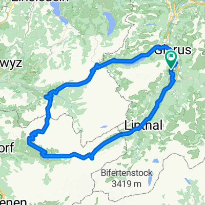
Vue d'ensemble
À propos du circuit
Sortie de ski de randonnée facile avec une très belle expérience de la nature. Le téléphérique vous emmène de 840 à 1230 m d'altitude. De là, jusqu'au Hörnli (2230 m), environ 1000 mètres d'ascension tranquille. Descente par la vallée de Mühlebach, très agréable car ombragée.
- -:--
- Durée
- 11,4 km
- Distance
- 1 372 m
- Montée
- 1 408 m
- Descente
- ---
- Vit. moyenne
- ---
- Altitude max.

Continuer avec Bikemap
Utilise, modifie ou télécharge cet itinéraire vélo
Tu veux parcourir Sunnehörnli ou l’adapter à ton propre voyage ? Voici ce que tu peux faire avec cet itinéraire Bikemap :
Fonctionnalités gratuites
- Enregistre cet itinéraire comme favori ou dans une collection
- Copie et planifie ta propre version de cet itinéraire
- Synchronise ton itinéraire avec Garmin ou Wahoo
Fonctionnalités Premium
Essai gratuit de 3 jours, ou paiement unique. En savoir plus sur Bikemap Premium.
- Navigue sur cet itinéraire sur iOS et Android
- Exporter un fichier GPX / KML de cet itinéraire
- Crée ton impression personnalisée (essaie-la gratuitement)
- Télécharge cet itinéraire pour la navigation hors ligne
Découvre plus de fonctionnalités Premium.
Obtiens Bikemap PremiumDe notre communauté
Schwanden : Autres itinéraires populaires qui commencent ici
 Engi - Skihuette - Lueser - Muelibach Oberstaffel - Engi - Elm - Schiessplatz - Engi @ 19.07.2020
- Distance
- 50,1 km
- Montée
- 2 131 m
- Descente
- 2 130 m
- Emplacement
- Schwanden, Canton de Glaris, Suisse
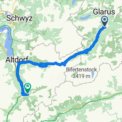
 Klausenpass
- Distance
- 98,3 km
- Montée
- 3 324 m
- Descente
- 3 322 m
- Emplacement
- Schwanden, Canton de Glaris, Suisse
 Matt Riseten Alp
- Distance
- 9,5 km
- Montée
- 1 093 m
- Descente
- 26 m
- Emplacement
- Schwanden, Canton de Glaris, Suisse
 Bikeroute 2 Schwanden - Achseli
- Distance
- 6 km
- Montée
- 991 m
- Descente
- 131 m
- Emplacement
- Schwanden, Canton de Glaris, Suisse
 Fleggen 109, Glarus Süd nach Obbortstrasse 18, Linthal
- Distance
- 18 km
- Montée
- 540 m
- Descente
- 210 m
- Emplacement
- Schwanden, Canton de Glaris, Suisse
 Klausenpass
- Distance
- 59,7 km
- Montée
- 1 694 m
- Descente
- 2 248 m
- Emplacement
- Schwanden, Canton de Glaris, Suisse
 Schwanden-Elm
- Distance
- 18,6 km
- Montée
- 657 m
- Descente
- 255 m
- Emplacement
- Schwanden, Canton de Glaris, Suisse
 1. Alpentour/1. Etappe: Klausen-Pass
- Distance
- 73,6 km
- Montée
- 1 773 m
- Descente
- 1 551 m
- Emplacement
- Schwanden, Canton de Glaris, Suisse
Ouvre-la dans l’app