
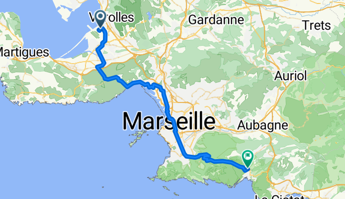
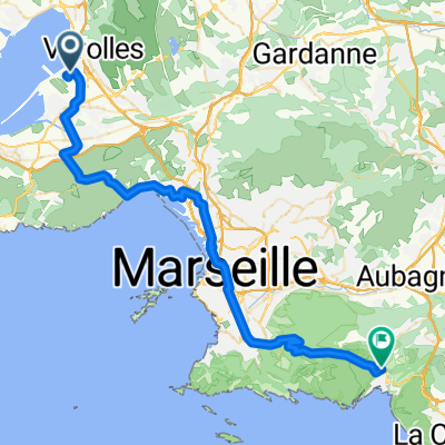
Flughafen Marseille - Cassis
Un itinéraire vélo au départ de Vitrolles, Provence-Alpes-Côte d'Azur, France.
Vue d'ensemble
À propos du circuit
- Etappe meiner Frankreich-Reise '08 <table style="border-collapse: collapse; width: 98pt;" border="0" cellspacing="0" cellpadding="0" width="131"> <tbody> <tr style="height: 12.75pt;" height="17"> <td class="xl22" style="height: 12.75pt; width: 98pt;" width="131" height="17">
Flughafen
</td> </tr> </tbody> </table> <table style="border-collapse: collapse; width: 98pt;" border="0" cellspacing="0" cellpadding="0" width="131"> <tbody> <tr style="height: 12.75pt;" height="17"> <td class="xl22" style="height: 12.75pt;" height="17">
St. Victoret
</td> </tr> </tbody> </table> <table style="border-collapse: collapse; width: 98pt;" border="0" cellspacing="0" cellpadding="0" width="131"> <tbody> <tr style="height: 12.75pt;" height="17"> <td class="xl22" style="height: 12.75pt;" height="17">
Lauret
</td> </tr> </tbody> </table>
<table style="border-collapse: collapse; width: 98pt;" border="0" cellspacing="0" cellpadding="0" width="131"> <tbody> <tr style="height: 12.75pt;" height="17"> <td class="xl22" style="height: 12.75pt;" height="17">
Le Rove
</td> </tr> </tbody> </table>
<table style="border-collapse: collapse; width: 98pt;" border="0" cellspacing="0" cellpadding="0" width="131"> <tbody> <tr style="height: 12.75pt;" height="17"> <td class="xl22" style="height: 12.75pt;" height="17">
L'Estaque
</td> </tr> </tbody> </table>
<table style="border-collapse: collapse; width: 98pt;" border="0" cellspacing="0" cellpadding="0" width="131"> <tbody> <tr style="height: 12.75pt;" height="17"> <td class="xl22" style="height: 12.75pt;" height="17">
Marseille
</td> </tr> </tbody> </table> <table style="border-collapse: collapse; width: 98pt;" border="0" cellspacing="0" cellpadding="0" width="131"> <tbody> <tr style="height: 12.75pt;" height="17"> <td class="xl22" style="height: 12.75pt;" height="17">
Valmante
</td> </tr> </tbody> </table>
<table style="border-collapse: collapse; width: 98pt;" border="0" cellspacing="0" cellpadding="0" width="131"> <tbody> <tr style="height: 12.75pt;" height="17"> <td class="xl23" style="height: 12.75pt;" height="17">
Col de la Gineste
</td> </tr> </tbody> </table>
<table style="border-collapse: collapse; width: 98pt;" border="0" cellspacing="0" cellpadding="0" width="131"> <tbody> <tr style="height: 12.75pt;" height="17"> <td class="xl22" style="height: 12.75pt;" height="17">
Cassis
</td> </tr> </tbody> </table>
<table style="border-collapse: collapse; width: 98pt;" border="0" cellspacing="0" cellpadding="0" width="131"> <tbody> </tbody> </table>
- -:--
- Durée
- 53 km
- Distance
- 616 m
- Montée
- 522 m
- Descente
- ---
- Vit. moyenne
- ---
- Altitude max.

Continuer avec Bikemap
Utilise, modifie ou télécharge cet itinéraire vélo
Tu veux parcourir Flughafen Marseille - Cassis ou l’adapter à ton propre voyage ? Voici ce que tu peux faire avec cet itinéraire Bikemap :
Fonctionnalités gratuites
- Enregistre cet itinéraire comme favori ou dans une collection
- Copie et planifie ta propre version de cet itinéraire
- Synchronise ton itinéraire avec Garmin ou Wahoo
Fonctionnalités Premium
Essai gratuit de 3 jours, ou paiement unique. En savoir plus sur Bikemap Premium.
- Navigue sur cet itinéraire sur iOS et Android
- Exporter un fichier GPX / KML de cet itinéraire
- Crée ton impression personnalisée (essaie-la gratuitement)
- Télécharge cet itinéraire pour la navigation hors ligne
Découvre plus de fonctionnalités Premium.
Obtiens Bikemap PremiumDe notre communauté
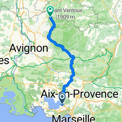
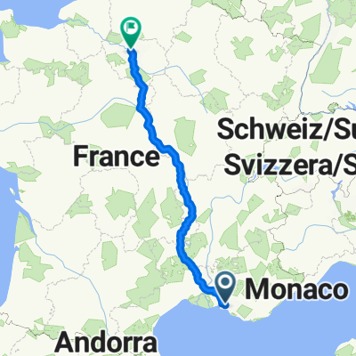
Vitrolles : Autres itinéraires populaires qui commencent ici
 Marseille to Romain
- Distance
- 138,3 km
- Montée
- 1 481 m
- Descente
- 1 267 m
- Emplacement
- Vitrolles, Provence-Alpes-Côte d'Azur, France
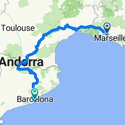
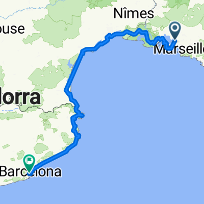 Marseille - Barclona (exact)
- Distance
- 653,9 km
- Montée
- 686 m
- Descente
- 663 m
- Emplacement
- Vitrolles, Provence-Alpes-Côte d'Azur, France
 Mariagne-Niolon
- Distance
- 57 km
- Montée
- 502 m
- Descente
- 488 m
- Emplacement
- Vitrolles, Provence-Alpes-Côte d'Azur, France
 sommer 2017
- Distance
- 871,5 km
- Montée
- 1 896 m
- Descente
- 1 980 m
- Emplacement
- Vitrolles, Provence-Alpes-Côte d'Azur, France
 Etappe 27 Vitrolles - Giens
- Distance
- 128,6 km
- Montée
- 1 100 m
- Descente
- 1 105 m
- Emplacement
- Vitrolles, Provence-Alpes-Côte d'Azur, France
 Marseille to Romain Easy
- Distance
- 111,4 km
- Montée
- 609 m
- Descente
- 399 m
- Emplacement
- Vitrolles, Provence-Alpes-Côte d'Azur, France
 Flughafen Marseille - Cassis
- Distance
- 53 km
- Montée
- 616 m
- Descente
- 522 m
- Emplacement
- Vitrolles, Provence-Alpes-Côte d'Azur, France
 Marseille-Barcelona
- Distance
- 809,4 km
- Montée
- 5 469 m
- Descente
- 5 437 m
- Emplacement
- Vitrolles, Provence-Alpes-Côte d'Azur, France
Ouvre-la dans l’app