

NL Rhine Cycle Route
Un itinéraire vélo au départ de Andermatt, Canton d’Uri, Suisse.
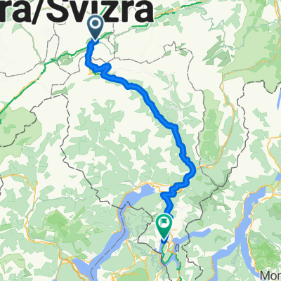
Vue d'ensemble
À propos du circuit
La véloroute du Rhin mesure environ 1 360 kilomètres et traverse cinq pays. Le parcours commence dans les Alpes suisses, la région source du Rhin. Ensuite, il passe par l'Autriche, la France et l'Allemagne. La route se termine à Rotterdam aux Pays-Bas, où le Rhin se jette dans la mer du Nord.
- -:--
- Durée
- 1 365,4 km
- Distance
- 12 m
- Montée
- 1 447 m
- Descente
- ---
- Vit. moyenne
- ---
- Altitude max.

Qualité de l’itinéraire
Types de voies et surfaces le long de l’itinéraire
Types de routes
Route forestière
368,7 km
(27 %)
Route tranquille
286,7 km
(21 %)
surfaces
Pavé
887,5 km
(65 %)
Non pavé
286,7 km
(21 %)
Asphalte
860,2 km
(63 %)
Gravier
177,5 km
(13 %)
Points forts de l’itinéraire
Points d’intérêt le long de l’itinéraire

Point d'intérêt après 299,4 km
The Rhine Falls (Rheinfall in German) is the largest plain waterfall in Europe. They are 150 m wide and 23 m high.

Point d'intérêt après 675,2 km
Speyer is one of the oldest cities in Germany and is therefore historically and culturally important. Most famous is the Imperial Cathedral of Speyer.

Point d'intérêt après 839,2 km
The Lorelei is a rock on the eastern bank of the Rhine which soars some 120 metres above the waterline. It marks the narrowest part of the river between Switzerland and the North Sea, and is the most famous feature of the Rhine Gorge, a 65 km section of the river between Koblenz and Bingen that was added to the UNESCO World Heritage Sites in June 2002. A very strong current and rocks below the waterline have caused many boat accidents there. Lorelei is also the name of a feminine water spirit, similar to mermaids or Rhine maidens, associated with this rock in popular folklore and in works of music, art and literature.

Point d'intérêt après 903,5 km
One of Andernach's natural attractions is the world's highest (max. 64 m) cold-water geyser, driven by carbon dioxide with force generated in a fashion similar to that in a shaken bottle of table water.
Continuer avec Bikemap
Utilise, modifie ou télécharge cet itinéraire vélo
Tu veux parcourir NL Rhine Cycle Route ou l’adapter à ton propre voyage ? Voici ce que tu peux faire avec cet itinéraire Bikemap :
Fonctionnalités gratuites
- Enregistre cet itinéraire comme favori ou dans une collection
- Copie et planifie ta propre version de cet itinéraire
- Divise-le en étapes pour créer un tour sur plusieurs jours
- Synchronise ton itinéraire avec Garmin ou Wahoo
Fonctionnalités Premium
Essai gratuit de 3 jours, ou paiement unique. En savoir plus sur Bikemap Premium.
- Navigue sur cet itinéraire sur iOS et Android
- Exporter un fichier GPX / KML de cet itinéraire
- Crée ton impression personnalisée (essaie-la gratuitement)
- Télécharge cet itinéraire pour la navigation hors ligne
Découvre plus de fonctionnalités Premium.
Obtiens Bikemap PremiumDe notre communauté
Andermatt : Autres itinéraires populaires qui commencent ici
![[DAY 19] Göschenen - Ilanz](https://media.bikemap.net/routes/8561780/gallery/thumbs/af10c4bc-a85d-4013-8c11-c6c25ccc528a.jpeg.208x208_q80_crop.jpg) [DAY 19] Göschenen - Ilanz
[DAY 19] Göschenen - Ilanz- Distance
- 68,1 km
- Montée
- 984 m
- Descente
- 1 380 m
- Emplacement
- Andermatt, Canton d’Uri, Suisse
 Furka-Nufenen-Gotthard-Oberalp
- Distance
- 135,9 km
- Montée
- 4 637 m
- Descente
- 4 527 m
- Emplacement
- Andermatt, Canton d’Uri, Suisse
 Andermatt 3
- Distance
- 158,9 km
- Montée
- 3 905 m
- Descente
- 3 702 m
- Emplacement
- Andermatt, Canton d’Uri, Suisse
 VR01 Furkapass Belvedere-Brig.kml - VR01 Furkapass Belvedere-Brig.kml_VR01 Furkapass Belvedere-Brig
- Distance
- 60,1 km
- Montée
- 852 m
- Descente
- 2 409 m
- Emplacement
- Andermatt, Canton d’Uri, Suisse
 Transalpine (7) Andermatt - Visp
- Distance
- 89,5 km
- Montée
- 1 685 m
- Descente
- 2 290 m
- Emplacement
- Andermatt, Canton d’Uri, Suisse
 Bellinzona - Vizzola Ticino
- Distance
- 130,7 km
- Montée
- 2 639 m
- Descente
- 3 799 m
- Emplacement
- Andermatt, Canton d’Uri, Suisse
 Witenwasseren Bike
- Distance
- 17,3 km
- Montée
- 808 m
- Descente
- 26 m
- Emplacement
- Andermatt, Canton d’Uri, Suisse
 20.09.2010 Furka, Nufenen, Gotthard
- Distance
- 98,5 km
- Montée
- 2 959 m
- Descente
- 2 959 m
- Emplacement
- Andermatt, Canton d’Uri, Suisse
Ouvre-la dans l’app