

River Ping Southern Route
Un itinéraire vélo au départ de Chiang Mai, Chiang Mai, Thaïlande.
Vue d'ensemble
À propos du circuit
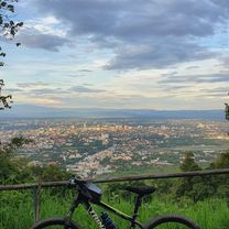
This trip begins in the southern city district of Chang Khlan and runs along the banks of river Ping to the border of Lamphun and back. First follow the road on the western bank leading south (downstream). The tarmac road is not very wide, but in good condition. From Saraphi on, there is considerably less traffic. If you go all the way down to the Lamphun border, the scenery becomes quite rural and you will pass through Longan orchards, fields, and villages. Turn around at Lamphun and follow the eastern bank north (upstream) back to Chiang Mai.<br /> <br /> There are several interesting spots for sight-seeing that potentially turn this into a full-day trip: 1. an optional detour to the city of Lamphun at the southernmost point (+1-2 hours), 2. an optional detour to the beautiful park of the century-old McKean rehabilitation centre (+0.5 hours), and 3. exploration of the ancient ruins and tempels of Wiang Kum Kam between the two outer ring roads (+1 hour).
(cloned from route 2325497)- -:--
- Durée
- 44,7 km
- Distance
- 24 m
- Montée
- 25 m
- Descente
- ---
- Vit. moyenne
- ---
- Altitude max.
Qualité de l’itinéraire
Types de voies et surfaces le long de l’itinéraire
Types de routes
Route
33,9 km
(76 %)
Route tranquille
9,7 km
(22 %)
surfaces
Pavé
44,3 km
(99 %)
Asphalte
32,4 km
(73 %)
Béton
6,9 km
(15 %)
Points forts de l’itinéraire
Points d’intérêt le long de l’itinéraire
Point d'intérêt après 19,6 km
Lamphun city
Point d'intérêt après 34,8 km
McKean Rehabilitation Centre
Continuer avec Bikemap
Utilise, modifie ou télécharge cet itinéraire vélo
Tu veux parcourir River Ping Southern Route ou l’adapter à ton propre voyage ? Voici ce que tu peux faire avec cet itinéraire Bikemap :
Fonctionnalités gratuites
- Enregistre cet itinéraire comme favori ou dans une collection
- Copie et planifie ta propre version de cet itinéraire
- Synchronise ton itinéraire avec Garmin ou Wahoo
Fonctionnalités Premium
Essai gratuit de 3 jours, ou paiement unique. En savoir plus sur Bikemap Premium.
- Navigue sur cet itinéraire sur iOS et Android
- Exporter un fichier GPX / KML de cet itinéraire
- Crée ton impression personnalisée (essaie-la gratuitement)
- Télécharge cet itinéraire pour la navigation hors ligne
Découvre plus de fonctionnalités Premium.
Obtiens Bikemap PremiumDe notre communauté
Chiang Mai : Autres itinéraires populaires qui commencent ici
 Reverse Samoeng Loop back via Bhubbing Palace
- Distance
- 116,8 km
- Montée
- 2 847 m
- Descente
- 2 847 m
- Emplacement
- Chiang Mai, Chiang Mai, Thaïlande
 Moderate Route in Chiang Mai
- Distance
- 7,4 km
- Montée
- 21 m
- Descente
- 18 m
- Emplacement
- Chiang Mai, Chiang Mai, Thaïlande
 Chiang Mai - Rim Ping
- Distance
- 65 km
- Montée
- 30 m
- Descente
- 29 m
- Emplacement
- Chiang Mai, Chiang Mai, Thaïlande
 CPB small circle
- Distance
- 13,7 km
- Montée
- 73 m
- Descente
- 71 m
- Emplacement
- Chiang Mai, Chiang Mai, Thaïlande
 Chiangmai U to Doi Su Thep view point
- Distance
- 18,1 km
- Montée
- 404 m
- Descente
- 403 m
- Emplacement
- Chiang Mai, Chiang Mai, Thaïlande
 Phuping Palace
- Distance
- 52,2 km
- Montée
- 1 083 m
- Descente
- 1 098 m
- Emplacement
- Chiang Mai, Chiang Mai, Thaïlande
 straight to samoeng
- Distance
- 41,2 km
- Montée
- 1 028 m
- Descente
- 849 m
- Emplacement
- Chiang Mai, Chiang Mai, Thaïlande
 Chiang Mai
- Distance
- 669,4 km
- Montée
- 1 461 m
- Descente
- 1 461 m
- Emplacement
- Chiang Mai, Chiang Mai, Thaïlande
Ouvre-la dans l’app