

sdf dffff
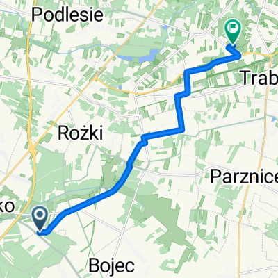
Un itinéraire vélo au départ de Orońsko, Masovian Voivodeship, Poland.
Vue d'ensemble
À propos du circuit
adas
- -:--
- Durée
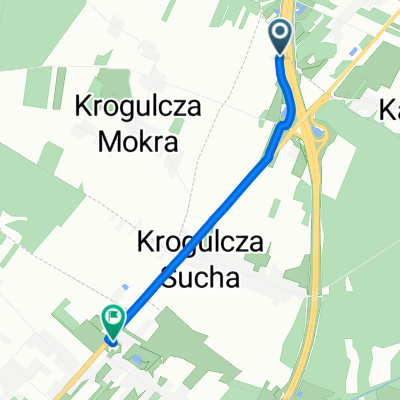
- 22,2 km
- Distance
- 94 m
- Montée
- 95 m
- Descente
- ---
- Vit. moyenne
- ---
- Altitude max.
Qualité de l’itinéraire
Types de voies et surfaces le long de l’itinéraire
Types de routes
Route tranquille
15,3 km
(69 %)
Route
2,8 km
(13 %)
surfaces
Pavé
7,4 km
(33 %)
Non pavé
0,8 km
(4 %)
Asphalte
6,8 km
(30 %)
Non pavé (non défini)
0,8 km
(4 %)
Points forts de l’itinéraire
Points d’intérêt le long de l’itinéraire

Point d'intérêt après 11,1 km
Szydlowiecki parish church of St. Nicholas. Sigismund, erected on January 1, 1401, the university students we offer the brothers Jacob and Sławosz Odrowąż who adopted the name of the property later Szydłowieccy name is a monument worthy of attention. The original church was wooden. In 1493, James Szydlowiecki (margrave of Cracow and treasurer of the Crown) began the construction of a brick church. The work ended with his brother Nicholas Szydlowiecki (Castellan Radom and treasurer of the Crown) about 1525 The late-Gothic church oriented (located on the east-west axis) built of local sandstone. The church is an example of the use of sandstone blocks Szydłowiec a monumental religious building. The walls are tight-fitting buttresses, the church orbit profiled cornices. Temple consists of a rectangular nave and chancel. The nave is not vaulted, has a ceiling (currently comes from the first half of the eighteenth century, the original was below). The sanctuary adjacent to the north Gothic sacristy and the treasury. On the south side of the nave is adjacent to the chapel of the Blessed Virgin Mary, built originally as a necropolis Szydłowieccy, and from the north - Chapel St. Stanislaus and porch. In times Radziwill from the west, on the axis of the church, was added to the main aisle of the new porch. Turret with a turret from the mid-seventeenth century The interior is dominated by the Renaissance style. In the corner of the nave, next to the entrance to the chapel of the Blessed Virgin Mary, is a late Gothic font of local sandstone, founded by Nicholas Szydłowiecki. In the chancel on the north wall is placed a beautiful late Gothic polyptych, depicting the Assumption of the Blessed Virgin Mary and the Gospel scene, made in 1509 in the workshop of Krakow. For poliptych envisioned were also members of the family Szydłowieccy who were its founders.
Continuer avec Bikemap
Utilise, modifie ou télécharge cet itinéraire vélo
Tu veux parcourir sdf dffff ou l’adapter à ton propre voyage ? Voici ce que tu peux faire avec cet itinéraire Bikemap :
Fonctionnalités gratuites
- Enregistre cet itinéraire comme favori ou dans une collection
- Copie et planifie ta propre version de cet itinéraire
- Synchronise ton itinéraire avec Garmin ou Wahoo
Fonctionnalités Premium
Essai gratuit de 3 jours, ou paiement unique. En savoir plus sur Bikemap Premium.
- Navigue sur cet itinéraire sur iOS et Android
- Exporter un fichier GPX / KML de cet itinéraire
- Crée ton impression personnalisée (essaie-la gratuitement)
- Télécharge cet itinéraire pour la navigation hors ligne
Découvre plus de fonctionnalités Premium.
Obtiens Bikemap PremiumDe notre communauté
Orońsko : Autres itinéraires populaires qui commencent ici
 Helenów do Okrężna 6c
- Distance
- 11,4 km
- Montée
- 58 m
- Descente
- 69 m
- Emplacement
- Orońsko, Masovian Voivodeship, Poland
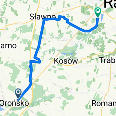
 Młodocin Mniejszy do św. Rocha 24, Wąchock
- Distance
- 37,3 km
- Montée
- 259 m
- Descente
- 244 m
- Emplacement
- Orońsko, Masovian Voivodeship, Poland
 Waliny 52, Wolanów do Kolejowa 3, Wolanów
- Distance
- 5 km
- Montée
- 20 m
- Descente
- 31 m
- Emplacement
- Orońsko, Masovian Voivodeship, Poland
 orońsko
- Distance
- 17,4 km
- Montée
- 65 m
- Descente
- 97 m
- Emplacement
- Orońsko, Masovian Voivodeship, Poland
 Co Za Jazda 2020 Szydłowiec - końcówka
- Distance
- 17 km
- Montée
- 65 m
- Descente
- 76 m
- Emplacement
- Orońsko, Masovian Voivodeship, Poland
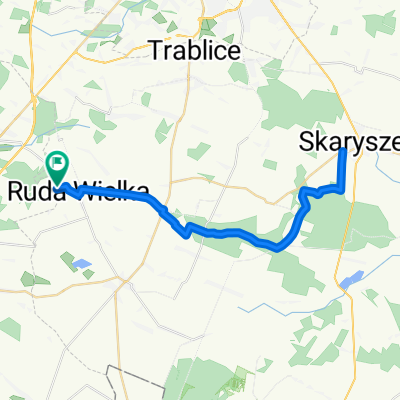 Do Skaryszewa i z powrotem z Tomaszowa
- Distance
- 40,8 km
- Montée
- 142 m
- Descente
- 142 m
- Emplacement
- Orońsko, Masovian Voivodeship, Poland
 S7, Orońsko do Radomska 1B, Orońsko
- Distance
- 2,4 km
- Montée
- 15 m
- Descente
- 30 m
- Emplacement
- Orońsko, Masovian Voivodeship, Poland
 sdf dffff
- Distance
- 22,2 km
- Montée
- 94 m
- Descente
- 95 m
- Emplacement
- Orońsko, Masovian Voivodeship, Poland
Ouvre-la dans l’app