

Day2:新竹→台中
Un itinéraire vélo au départ de Hsinchu, Taiwan, Taïwan.
Vue d'ensemble
À propos du circuit
<span style="margin: 0px; padding: 0px; font-family: 'Times New Roman'; color: #000000; font-size: small;">★距離:112KM</span>
<span style="margin: 0px; padding: 0px; font-family: 'Times New Roman'; color: #000000; font-size: small;">★難度:★★</span><span style="color: #000000; font-family: 'Times New Roman'; font-size: small;">★(里程較長)</span>
<span style="margin: 0px; padding: 0px; font-family: 'Times New Roman'; color: #000000; font-size: small;">★路線:新竹→香山右轉台13線→竹南右轉台13甲→右轉台1己→左轉台61西濱→白沙屯台1線→社口左轉台10線</span><span style="color: #000000; font-family: 'Times New Roman'; font-size: small;">→大雅台1乙</span><span style="color: #000000; font-family: 'Times New Roman'; font-size: small;">→台中市<br /><br /></span>
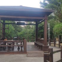
<span style="margin: 0px; padding: 0px; font-family: 'Times New Roman'; color: #000000; font-size: small;">★ 景點:白沙屯、東海大學、中興大學、逢甲夜市</span>
<span style="color: #000000; font-family: 'Times New Roman'; font-size: small;">★或住大甲、或往山線苗栗三義(多一天在台中玩)</span>
(cloned from route 1678255)
- -:--
- Durée
- 112,4 km
- Distance
- 404 m
- Montée
- 355 m
- Descente
- ---
- Vit. moyenne
- ---
- Altitude max.
Points forts de l’itinéraire
Points d’intérêt le long de l’itinéraire
Point d'intérêt après 112,3 km
西螺大橋
Continuer avec Bikemap
Utilise, modifie ou télécharge cet itinéraire vélo
Tu veux parcourir Day2:新竹→台中 ou l’adapter à ton propre voyage ? Voici ce que tu peux faire avec cet itinéraire Bikemap :
Fonctionnalités gratuites
- Enregistre cet itinéraire comme favori ou dans une collection
- Copie et planifie ta propre version de cet itinéraire
- Divise-le en étapes pour créer un tour sur plusieurs jours
- Synchronise ton itinéraire avec Garmin ou Wahoo
Fonctionnalités Premium
Essai gratuit de 3 jours, ou paiement unique. En savoir plus sur Bikemap Premium.
- Navigue sur cet itinéraire sur iOS et Android
- Exporter un fichier GPX / KML de cet itinéraire
- Crée ton impression personnalisée (essaie-la gratuitement)
- Télécharge cet itinéraire pour la navigation hors ligne
Découvre plus de fonctionnalités Premium.
Obtiens Bikemap PremiumDe notre communauté
Hsinchu : Autres itinéraires populaires qui commencent ici
 新竹雙北
新竹雙北- Distance
- 298,3 km
- Montée
- 2 518 m
- Descente
- 2 518 m
- Emplacement
- Hsinchu, Taiwan, Taïwan
 20200822父子倆騎行17公里中段
- Distance
- 5,5 km
- Montée
- 0 m
- Descente
- 3 m
- Emplacement
- Hsinchu, Taiwan, Taïwan
 園區練騎路線 (青草湖、古奇峰) 25K_324m
- Distance
- 15,7 km
- Montée
- 272 m
- Descente
- 270 m
- Emplacement
- Hsinchu, Taiwan, Taïwan
 Day 02
- Distance
- 124 km
- Montée
- 204 m
- Descente
- 192 m
- Emplacement
- Hsinchu, Taiwan, Taïwan
 Part1 Day2 (4/4)新竹市~台中市
- Distance
- 107,6 km
- Montée
- 399 m
- Descente
- 335 m
- Emplacement
- Hsinchu, Taiwan, Taïwan
 風城-北埔-風嶺--雙胎胞井-台積電-風城
- Distance
- 37,1 km
- Montée
- 400 m
- Descente
- 401 m
- Emplacement
- Hsinchu, Taiwan, Taïwan
 老爺酒店-青草湖-古奇峄-清大土地公-交大土地公之-老爺酒店
- Distance
- 23,6 km
- Montée
- 314 m
- Descente
- 319 m
- Emplacement
- Hsinchu, Taiwan, Taïwan
 Nanliao, North District to E-W Expressway Nanliao-Zhudong Line, North District
- Distance
- 6,4 km
- Montée
- 40 m
- Descente
- 34 m
- Emplacement
- Hsinchu, Taiwan, Taïwan
Ouvre-la dans l’app