CoN Delhi
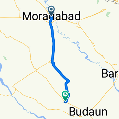
Un itinéraire vélo au départ de Morādābād, Uttar Pradesh, Inde.
Vue d'ensemble
À propos du circuit
Le Clash of Nations amène la World Tour en Inde pour une course difficile qui se termine dans l'Himalaya méridional. Cependant, avant que le peloton ne rejoigne la plus haute chaîne de montagnes du monde, il devra traverser une partie importante du nord de l'Inde. La bataille éclate à Moradabad, une ville de près d'un million d'habitants, responsable de 85 % des exportations de métal du pays.
Au nord-est, en passant par Tanda, Bazpur, jusqu'à Kaladhungi, la route commence lentement mais sûrement à monter alors que les puissants sommets de l'Himalaya apparaissent au loin. Au musée Jim Corbett, le peloton prend un virage serré à gauche et entame l'ascension absolument brutale vers Nainital. Cette route ondulée n'atteint jamais une pente très raide, mais 30 kilomètres et un gain d'altitude de près de 1500 mètres feront que le peloton espérera une section de descente.
À Nainital, construite autour du célèbre lac Nainital, les coureurs tournent à gauche pour la boucle locale de 37 kilomètres qu'ils devront effectuer trois fois. Bien que la section de descente soit relativement facile, la montée de la boucle ne l'est pas. En particulier les 500 mètres dans la section Devidhura, avec des pentes maximales pouvant atteindre 22 %, garantissent que seuls les meilleurs grimpeurs auront une chance de victoire. La ligne d'arrivée est tracée sur Mall Road, surplombant le lac Nainital. Un spectacle pour les spectateurs, mais probablement pas dans la tête des cyclistes qui franchissent la ligne d'arrivée.
- -:--
- Durée
- 229 km
- Distance
- 3 538 m
- Montée
- 1 781 m
- Descente
- ---
- Vit. moyenne
- ---
- Altitude max.
Continuer avec Bikemap
Utilise, modifie ou télécharge cet itinéraire vélo
Tu veux parcourir CoN Delhi ou l’adapter à ton propre voyage ? Voici ce que tu peux faire avec cet itinéraire Bikemap :
Fonctionnalités gratuites
- Enregistre cet itinéraire comme favori ou dans une collection
- Copie et planifie ta propre version de cet itinéraire
- Divise-le en étapes pour créer un tour sur plusieurs jours
- Synchronise ton itinéraire avec Garmin ou Wahoo
Fonctionnalités Premium
Essai gratuit de 3 jours, ou paiement unique. En savoir plus sur Bikemap Premium.
- Navigue sur cet itinéraire sur iOS et Android
- Exporter un fichier GPX / KML de cet itinéraire
- Crée ton impression personnalisée (essaie-la gratuitement)
- Télécharge cet itinéraire pour la navigation hors ligne
Découvre plus de fonctionnalités Premium.
Obtiens Bikemap PremiumDe notre communauté
Morādābād : Autres itinéraires populaires qui commencent ici
 Ram Ganga Vihar, Moradabad to Moradabad, Moradabad
- Distance
- 5,8 km
- Montée
- 20 m
- Descente
- 22 m
- Emplacement
- Morādābād, Uttar Pradesh, Inde
 CoN Delhi
- Distance
- 229 km
- Montée
- 3 538 m
- Descente
- 1 781 m
- Emplacement
- Morādābād, Uttar Pradesh, Inde
 milanvihar
- Distance
- 2 km
- Montée
- 47 m
- Descente
- 16 m
- Emplacement
- Morādābād, Uttar Pradesh, Inde
 ateev to vivekanad to Anandam
- Distance
- 5,7 km
- Montée
- 20 m
- Descente
- 17 m
- Emplacement
- Morādābād, Uttar Pradesh, Inde
 Moradabad to Bilsi
- Distance
- 89,9 km
- Montée
- 99 m
- Descente
- 125 m
- Emplacement
- Morādābād, Uttar Pradesh, Inde
 Moradabad, Moradabad to SH 49, Moradabad
- Distance
- 4,5 km
- Montée
- 18 m
- Descente
- 20 m
- Emplacement
- Morādābād, Uttar Pradesh, Inde
 Kanth Road 49, Moradabad to HIG A 39, Moradabad
- Distance
- 11,9 km
- Montée
- 9 m
- Descente
- 5 m
- Emplacement
- Morādābād, Uttar Pradesh, Inde
 Moradabad, Moradabad to SH 49, Moradabad
- Distance
- 5,4 km
- Montée
- 16 m
- Descente
- 16 m
- Emplacement
- Morādābād, Uttar Pradesh, Inde
Ouvre-la dans l’app


