

Montargis nach Fontainebleau
Un itinéraire vélo au départ de Villemandeur, Centre-Val de Loire, France.
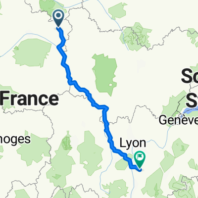
Vue d'ensemble
À propos du circuit
<table border="0" cellpadding="0" cellspacing="0" style="width:290px;" width="291"> <colgroup> <col /> <col /> <col span="3" /> </colgroup> <tbody> <tr height="20"> <td height="20" style="height:20px;width:50px;"> 0,0</td> <td style="width:48px;"> 0,0</td> <td colspan="2" style="width:128px;"> Montargis</td> <td style="width:64px;"> </td> </tr> <tr height="20"> <td height="20" style="height:20px;width:50px;"> 7,0</td> <td style="width:48px;"> 7,0</td> <td> Cepoy</td> <td> </td> <td> </td> </tr> <tr height="20"> <td height="20" style="height:20px;width:50px;"> 14,0</td> <td style="width:48px;"> 7,0</td> <td> Nargis</td> <td> </td> <td> </td> </tr> <tr height="20"> <td height="20" style="height:20px;width:50px;"> 16,5</td> <td style="width:48px;"> 2,5</td> <td colspan="3"> Moulin de Nancais</td> </tr> <tr height="20"> <td height="20" style="height:20px;width:50px;"> 18,0</td> <td style="width:48px;"> 1,5</td> <td colspan="2"> Pont de Dordives</td> <td> </td> </tr> <tr height="20"> <td height="20" style="height:20px;width:50px;"> 20,5</td> <td style="width:48px;"> 2,5</td> <td colspan="2"> Moulin Foulon</td> <td> </td> </tr> <tr height="20"> <td height="20" style="height:20px;width:50px;"> 26,5</td> <td style="width:48px;"> 6,0</td> <td colspan="3"> La Madeleine sur Loing</td> </tr> <tr height="20"> <td height="20" style="height:20px;width:50px;"> 34,0</td> <td style="width:48px;"> 7,5</td> <td colspan="2"> Nemours</td> <td> </td> </tr> <tr height="20"> <td height="20" style="height:20px;width:50px;"> 43,0</td> <td style="width:48px;"> 9,0</td> <td colspan="2"> La Genevraye</td> <td> </td> </tr> <tr height="20"> <td height="20" style="height:20px;width:50px;"> 46,0</td> <td style="width:48px;"> 3,0</td> <td> Épisy</td> <td> </td> <td> </td> </tr> <tr height="20"> <td height="20" style="height:20px;width:50px;"> 49,0</td> <td style="width:48px;"> 3,0</td> <td> Écuelles</td> <td> </td> <td> </td> </tr> <tr height="20"> <td height="20" style="height:20px;width:50px;"> 54,5</td> <td style="width:48px;"> 5,5</td> <td colspan="2"> Saint-Mammès</td> <td> </td> </tr> <tr height="20"> <td height="20" style="height:20px;width:50px;"> 58,0</td> <td style="width:48px;"> 3,5</td> <td colspan="2"> Thomery</td> <td> </td> </tr> <tr height="20"> <td height="20" style="height:20px;width:50px;"> 63,0</td> <td style="width:48px;"> 5,0</td> <td colspan="2"> Fontainebleau</td> <td> </td> </tr> </tbody> </table> <table border="0" cellpadding="0" cellspacing="0" style="width:450px;" width="451"> <tbody> <tr height="37"> <td colspan="5" height="37" style="height:37px;width:450px;"> La Carpe d'Or Boutique-Hotel <br /> 7 Rue d'Avon, 77300 Fontainebleau<br /> Telefon:+33 1 64 22 28 64</td> </tr> </tbody> </table>
- -:--
- Durée
- 65,6 km
- Distance
- 188 m
- Montée
- 203 m
- Descente
- ---
- Vit. moyenne
- ---
- Altitude max.

Qualité de l’itinéraire
Types de voies et surfaces le long de l’itinéraire
Types de routes
Sentier
14,9 km
(23 %)
Route
11,5 km
(17 %)
surfaces
Pavé
25,4 km
(39 %)
Non pavé
9,6 km
(15 %)
Asphalte
23,2 km
(35 %)
Gravier
8,9 km
(14 %)
Continuer avec Bikemap
Utilise, modifie ou télécharge cet itinéraire vélo
Tu veux parcourir Montargis nach Fontainebleau ou l’adapter à ton propre voyage ? Voici ce que tu peux faire avec cet itinéraire Bikemap :
Fonctionnalités gratuites
- Enregistre cet itinéraire comme favori ou dans une collection
- Copie et planifie ta propre version de cet itinéraire
- Synchronise ton itinéraire avec Garmin ou Wahoo
Fonctionnalités Premium
Essai gratuit de 3 jours, ou paiement unique. En savoir plus sur Bikemap Premium.
- Navigue sur cet itinéraire sur iOS et Android
- Exporter un fichier GPX / KML de cet itinéraire
- Crée ton impression personnalisée (essaie-la gratuitement)
- Télécharge cet itinéraire pour la navigation hors ligne
Découvre plus de fonctionnalités Premium.
Obtiens Bikemap PremiumDe notre communauté
Villemandeur : Autres itinéraires populaires qui commencent ici
 2009 Euro Tour -- Ride Day 18 — 13 July 2009 — 45200 Montargis to 28000 Chartres
- Distance
- 120,5 km
- Montée
- 118 m
- Descente
- 58 m
- Emplacement
- Villemandeur, Centre-Val de Loire, France
 Recovered Route
- Distance
- 14,1 km
- Montée
- 95 m
- Descente
- 99 m
- Emplacement
- Villemandeur, Centre-Val de Loire, France
 Montargis nach Fontainebleau
- Distance
- 65,6 km
- Montée
- 188 m
- Descente
- 203 m
- Emplacement
- Villemandeur, Centre-Val de Loire, France
 Montargis - Combreux
- Distance
- 44,3 km
- Montée
- 137 m
- Descente
- 97 m
- Emplacement
- Villemandeur, Centre-Val de Loire, France
 De Montargis à Hauterives
- Distance
- 509,2 km
- Montée
- 3 982 m
- Descente
- 3 769 m
- Emplacement
- Villemandeur, Centre-Val de Loire, France
 6 ème étape : Montargis - Gueugnon : 227,5 km
- Distance
- 231,6 km
- Montée
- 906 m
- Descente
- 757 m
- Emplacement
- Villemandeur, Centre-Val de Loire, France
 MONTARGIS-MONTARGIS, par Orleans
- Distance
- 260,8 km
- Montée
- 224 m
- Descente
- 227 m
- Emplacement
- Villemandeur, Centre-Val de Loire, France
 Montargis-Nevers
- Distance
- 144,4 km
- Montée
- 450 m
- Descente
- 344 m
- Emplacement
- Villemandeur, Centre-Val de Loire, France
Ouvre-la dans l’app