Digne la fameuse D 17
- 87,4 km
- 1 269 m
- 1 273 m
- Digne-les-Bains, Provence-Alpes-Côte d'Azur, France
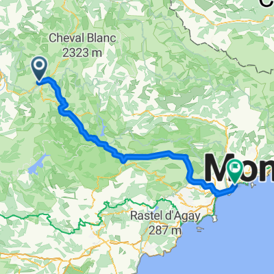
Un itinéraire vélo au départ de Digne-les-Bains, Provence-Alpes-Côte d'Azur, France.
Vue d'ensemble
Digne les Bains
</td> </tr> </tbody> </table> <table style="border-collapse: collapse; width: 98pt;" border="0" cellspacing="0" cellpadding="0" width="131"> <tbody> <tr style="height: 12.75pt;" height="17"> <td style="height: 12.75pt;" height="17">
Les Hostelleries
</td> </tr> </tbody> </table> <table style="border-collapse: collapse; width: 98pt;" border="0" cellspacing="0" cellpadding="0" width="131"> <tbody> <tr style="height: 12.75pt;" height="17"> <td style="height: 12.75pt;" height="17">
Châteauredon
</td> </tr> </tbody> </table> <table style="border-collapse: collapse; width: 98pt;" border="0" cellspacing="0" cellpadding="0" width="131"> <tbody> <tr style="height: 12.75pt;" height="17"> <td style="height: 12.75pt;" height="17">
Mézel
</td> </tr> </tbody> </table> <table style="border-collapse: collapse; width: 98pt;" border="0" cellspacing="0" cellpadding="0" width="131"> <tbody> <tr style="height: 12.75pt;" height="17"> <td style="height: 12.75pt;" height="17">
Estoublon
</td> </tr> </tbody> </table> <table style="border-collapse: collapse; width: 98pt;" border="0" cellspacing="0" cellpadding="0" width="131"> <tbody> <tr style="height: 12.75pt;" height="17"> <td style="height: 12.75pt;" height="17">
La Bégude Blanche
</td> </tr> </tbody> </table> <table style="border-collapse: collapse; width: 98pt;" border="0" cellspacing="0" cellpadding="0" width="131"> <tbody> <tr style="height: 12.75pt;" height="17"> <td style="height: 12.75pt;" height="17">
Puimoisson
</td> </tr> </tbody> </table> <table style="border-collapse: collapse; width: 98pt;" border="0" cellspacing="0" cellpadding="0" width="131"> <tbody> <tr style="height: 12.75pt;" height="17"> <td style="height: 12.75pt;" height="17">
Roumoules
</td> </tr> </tbody> </table> <table style="border-collapse: collapse; width: 98pt;" border="0" cellspacing="0" cellpadding="0" width="131"> <tbody> <tr style="height: 12.75pt;" height="17"> <td style="height: 12.75pt;" height="17">
Riez
</td> </tr> </tbody> </table> <table style="border-collapse: collapse; width: 98pt;" border="0" cellspacing="0" cellpadding="0" width="131"> <tbody> <tr style="height: 12.75pt;" height="17"> <td style="height: 12.75pt;" height="17">
Saint Croix du Verdon
</td> </tr> </tbody> </table> <table style="border-collapse: collapse; width: 98pt;" border="0" cellspacing="0" cellpadding="0" width="131"> <tbody> <tr style="height: 12.75pt;" height="17"> <td style="height: 12.75pt;" height="17">
Les Roux
</td> </tr> </tbody> </table> <table style="border-collapse: collapse; width: 98pt;" border="0" cellspacing="0" cellpadding="0" width="131"> <tbody> <tr style="height: 12.75pt;" height="17"> <td style="height: 12.75pt;" height="17">
Le Serre
</td> </tr> </tbody> </table> <table style="border-collapse: collapse; width: 98pt;" border="0" cellspacing="0" cellpadding="0" width="131"> <tbody> <tr style="height: 12.75pt;" height="17"> <td style="height: 12.75pt;" height="17">
Moustiers Saint Marie
</td> </tr> </tbody> </table> <table style="border-collapse: collapse; width: 98pt;" border="0" cellspacing="0" cellpadding="0" width="131"> <tbody> <tr style="height: 12.75pt;" height="17"> <td class="xl25" style="height: 12.75pt;" height="17">
Col d'Olivier
</td> </tr> </tbody> </table> <table style="border-collapse: collapse; width: 98pt;" border="0" cellspacing="0" cellpadding="0" width="131"> <tbody> <tr style="height: 12.75pt;" height="17"> <td style="height: 12.75pt;" height="17">
Mayreste
</td> </tr> </tbody> </table> <table style="border-collapse: collapse; width: 98pt;" border="0" cellspacing="0" cellpadding="0" width="131"> <tbody> <tr style="height: 12.75pt;" height="17"> <td style="height: 12.75pt;" height="17">
Graou
</td> </tr> </tbody> </table> <table style="border-collapse: collapse; width: 98pt;" border="0" cellspacing="0" cellpadding="0" width="131"> <tbody> <tr style="height: 13.5pt;" height="18"> <td class="xl24" style="height: 13.5pt;" height="18">
Col d'Ayens
</td> </tr> </tbody> </table> <table style="border-collapse: collapse; width: 98pt;" border="0" cellspacing="0" cellpadding="0" width="131"> <tbody> <tr style="height: 12.75pt;" height="17"> <td style="height: 12.75pt;" height="17">
La Palud sur Verdon
</td> </tr> </tbody> </table>
créé il y a 17 ans
Qualité de l’itinéraire
Route
10,7 km
(11 %)
Route forestière
8,8 km
(9 %)
Pavé
81,9 km
(84 %)
Non pavé
4,9 km
(5 %)
Asphalte
81,9 km
(84 %)
Non pavé (non défini)
2 km
(2 %)
Continuer avec Bikemap
Tu veux parcourir Digne les Bains - Palud sur Verdon ou l’adapter à ton propre voyage ? Voici ce que tu peux faire avec cet itinéraire Bikemap :
Essai gratuit de 3 jours, ou paiement unique. En savoir plus sur Bikemap Premium.
Découvre plus de fonctionnalités Premium.
Obtiens Bikemap PremiumDe notre communauté
Ouvre-la dans l’app