

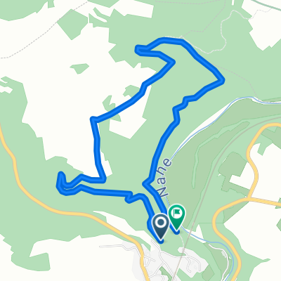
Traumschleife Nohener-Nahe-Schleife
Un itinéraire vélo au départ de Nohen, Rhénanie-Palatinat, Allemagne.
Vue d'ensemble
À propos du circuit
TEASI Track
- -:--
- Durée
- 11,9 km
- Distance
- 400 m
- Montée
- 398 m
- Descente
- ---
- Vit. moyenne
- ---
- Altitude max.
Points forts de l’itinéraire
Points d’intérêt le long de l’itinéraire
Point d'intérêt après 0,2 km
Kriegerdenkmal
Point d'intérêt après 5,7 km
Felsklipp
Point d'intérêt après 5,7 km
Rastplatz Nahe-Insel
Point d'intérêt après 6,8 km
Nahe-Wiesen-Blick
Point d'intérêt après 8,5 km
Panoramablick
Point d'intérêt après 10,7 km
Nahe-Blick
Point d'intérêt après 10,7 km
Schutzhütte
Point d'intérêt après 11,5 km
Bahnhof Nohen
Point d'intérêt après 11,5 km
Restaurant "Am Bahnhof"
Point d'intérêt après 11,7 km
Restaurant Speisekammer
Continuer avec Bikemap
Utilise, modifie ou télécharge cet itinéraire vélo
Tu veux parcourir Traumschleife Nohener-Nahe-Schleife ou l’adapter à ton propre voyage ? Voici ce que tu peux faire avec cet itinéraire Bikemap :
Fonctionnalités gratuites
- Enregistre cet itinéraire comme favori ou dans une collection
- Copie et planifie ta propre version de cet itinéraire
- Synchronise ton itinéraire avec Garmin ou Wahoo
Fonctionnalités Premium
Essai gratuit de 3 jours, ou paiement unique. En savoir plus sur Bikemap Premium.
- Navigue sur cet itinéraire sur iOS et Android
- Exporter un fichier GPX / KML de cet itinéraire
- Crée ton impression personnalisée (essaie-la gratuitement)
- Télécharge cet itinéraire pour la navigation hors ligne
Découvre plus de fonctionnalités Premium.
Obtiens Bikemap PremiumDe notre communauté
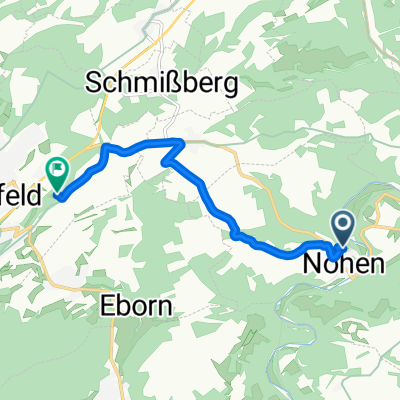
Nohen : Autres itinéraires populaires qui commencent ici
 Kleine Runde (5,1 km)
- Distance
- 5,2 km
- Montée
- 149 m
- Descente
- 189 m
- Emplacement
- Nohen, Rhénanie-Palatinat, Allemagne
 Lange Ausfahrt durch Nohen
- Distance
- 33,1 km
- Montée
- 485 m
- Descente
- 482 m
- Emplacement
- Nohen, Rhénanie-Palatinat, Allemagne
 Traumschleife Nohener-Nahe-Schleife
- Distance
- 11,9 km
- Montée
- 400 m
- Descente
- 398 m
- Emplacement
- Nohen, Rhénanie-Palatinat, Allemagne
 Wandern Ahmed
- Distance
- 9,3 km
- Montée
- 344 m
- Descente
- 308 m
- Emplacement
- Nohen, Rhénanie-Palatinat, Allemagne
 Neuweg nach Rennweg
- Distance
- 7 km
- Montée
- 180 m
- Descente
- 122 m
- Emplacement
- Nohen, Rhénanie-Palatinat, Allemagne
 Aufnahme vom 04.09.2016, 15:14
- Distance
- 25,2 km
- Montée
- 481 m
- Descente
- 480 m
- Emplacement
- Nohen, Rhénanie-Palatinat, Allemagne
 Abendtour
- Distance
- 33,9 km
- Montée
- 608 m
- Descente
- 605 m
- Emplacement
- Nohen, Rhénanie-Palatinat, Allemagne
Ouvre-la dans l’app