Massiv Alp 3: Mittenwald- Anhalter Hütte
Un itinéraire vélo au départ de Mittenwald, Bavière, Allemagne.
Vue d'ensemble
À propos du circuit
<span style="font-size: 11pt; font-weight: normal; font-family: "Calibri","sans-serif";"><<< Transalp von Ost nach West >>></span>
<span style="font-size: 11pt; font-weight: normal; font-family: "Calibri","sans-serif";">Zur<span style="mso-spacerun: yes;"> </span></span><span style="font-size: 11pt; font-weight: normal; font-family: "Calibri","sans-serif";">dritten </span><span style="font-size: 11pt; font-weight: normal; font-family: "Calibri","sans-serif";">Etappe</span> Von Mittenwald geht es am Wettersteinmassiv vorbei, immer an der Leutasch aufwerts, bis es endlich nach Ehrwald bergab geht. Weiter folgt man der Via Claudia über den Fernpass bis zum Fernsteinsee, dort hält man sich rechts und biegt auf eine irrsinnig steile Forstsraße ab, die aber plötzlich abflacht und zur Tarrenton Alm führt. Ab hier beginnt eine 3 Stündige Radwanderung zur Anhalterhütte.(cloned from route 1843475)
- -:--
- Durée
- 73,6 km
- Distance
- 2 180 m
- Montée
- 1 162 m
- Descente
- ---
- Vit. moyenne
- ---
- Altitude max.
Points forts de l’itinéraire
Points d’intérêt le long de l’itinéraire

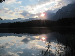
Photo après 0 km
Guten Morgen.

Photo après 53,1 km
Blick vom Fernpass zurück richtung Zugspitze.

Photo après 60,8 km
Mal wieder verdammt steil.

Photo après 65,4 km
So, wo gehts dann weiter? Auf den Sattel links im Bild.

Photo après 67,9 km
Die Tarrentonalm.
Hébergement après 67,9 km
Tarrentonalm Tel.: +43 (664) 6332504

Photo après 71,7 km
Da kam ich her.

Photo après 71,9 km
Da muss ich hien.

Photo après 72,5 km
Weit ists nicht mehr, Hütte in Sicht!
Hébergement après 73,5 km
Anhalter Hütte http://www.anhalterhuette.at Tel: +43 (0)664 / 461 89 93
Continuer avec Bikemap
Utilise, modifie ou télécharge cet itinéraire vélo
Tu veux parcourir Massiv Alp 3: Mittenwald- Anhalter Hütte ou l’adapter à ton propre voyage ? Voici ce que tu peux faire avec cet itinéraire Bikemap :
Fonctionnalités gratuites
- Enregistre cet itinéraire comme favori ou dans une collection
- Copie et planifie ta propre version de cet itinéraire
- Synchronise ton itinéraire avec Garmin ou Wahoo
Fonctionnalités Premium
Essai gratuit de 3 jours, ou paiement unique. En savoir plus sur Bikemap Premium.
- Navigue sur cet itinéraire sur iOS et Android
- Exporter un fichier GPX / KML de cet itinéraire
- Crée ton impression personnalisée (essaie-la gratuitement)
- Télécharge cet itinéraire pour la navigation hors ligne
Découvre plus de fonctionnalités Premium.
Obtiens Bikemap PremiumDe notre communauté
Mittenwald : Autres itinéraires populaires qui commencent ici
 Mittenwald - Riva
- Distance
- 389,2 km
- Montée
- 7 671 m
- Descente
- 8 511 m
- Emplacement
- Mittenwald, Bavière, Allemagne
 Mittenwald-ElmauerAlm-HoherKranzberg-Arnspitzrunde
- Distance
- 70,3 km
- Montée
- 1 142 m
- Descente
- 1 142 m
- Emplacement
- Mittenwald, Bavière, Allemagne
 Mittenwald_München
- Distance
- 115,5 km
- Montée
- 214 m
- Descente
- 603 m
- Emplacement
- Mittenwald, Bavière, Allemagne
 Karwendelrunde light - Mittenwald - Scharnitz - Karwendelhaus - Hinterriss - Vorderriss - Wallgau
- Distance
- 75,5 km
- Montée
- 1 530 m
- Descente
- 1 530 m
- Emplacement
- Mittenwald, Bavière, Allemagne
 Mittenwald - Eppzirlalm - Oberbrunnalm
- Distance
- 37,7 km
- Montée
- 927 m
- Descente
- 926 m
- Emplacement
- Mittenwald, Bavière, Allemagne
 -> Ferein Alm -> Karwendelhaus
- Distance
- 67,7 km
- Montée
- 1 579 m
- Descente
- 1 576 m
- Emplacement
- Mittenwald, Bavière, Allemagne
 Unbenannte Route
- Distance
- 120,7 km
- Montée
- 1 501 m
- Descente
- 1 727 m
- Emplacement
- Mittenwald, Bavière, Allemagne
 Lautersee-wettersteinalm-ellmau-lautersee
- Distance
- 22,9 km
- Montée
- 558 m
- Descente
- 558 m
- Emplacement
- Mittenwald, Bavière, Allemagne
Ouvre-la dans l’app

