

Over the River 'N through the 'Wood 2016
Un itinéraire vélo au départ de Englewood, Ohio, États Unis.
Vue d'ensemble
À propos du circuit
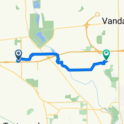
Route begins @Centennial Park, Englewood OH takes the bike route South through residential area to Wenger Road. Riders go West to Crestway, then South to Kimmel. Follow Kimmel West to Wastler crossing Diamond Mill onto East Upper Salem to Wellbaum and North to Wengerlawn. Next Riders go West on Wengerlawn to Brookville-Phillipsburg Road Where they go North To East Main in Phillipsburg. (Note: 1st break area will be at Brookville Community Park just before reaching E. Main) Next riders will go East on Phillipsburg-Union to Pansing, then North to Frederick-Garland, East across SR48 and the Still Water River to Ballinger which becomes Old Springfield West becoming Phillipsburg-Union once crossing SR48. Continue West to Putnam, South to Sweet Potato Ridge, West to Barnes and South to National Road. From here Riders will go East rejoining the bike route at Hoke Rd and returning to Centennial Park.
- -:--
- Durée
- 48,1 km
- Distance
- 137 m
- Montée
- 136 m
- Descente
- ---
- Vit. moyenne
- ---
- Altitude max.
Qualité de l’itinéraire
Types de voies et surfaces le long de l’itinéraire
Types de routes
Route tranquille
18,5 km
(38 %)
Route
18,2 km
(38 %)
surfaces
Pavé
1 km
(2 %)
Asphalte
1 km
(2 %)
Indéfini
47,1 km
(98 %)
Continuer avec Bikemap
Utilise, modifie ou télécharge cet itinéraire vélo
Tu veux parcourir Over the River 'N through the 'Wood 2016 ou l’adapter à ton propre voyage ? Voici ce que tu peux faire avec cet itinéraire Bikemap :
Fonctionnalités gratuites
- Enregistre cet itinéraire comme favori ou dans une collection
- Copie et planifie ta propre version de cet itinéraire
- Synchronise ton itinéraire avec Garmin ou Wahoo
Fonctionnalités Premium
Essai gratuit de 3 jours, ou paiement unique. En savoir plus sur Bikemap Premium.
- Navigue sur cet itinéraire sur iOS et Android
- Exporter un fichier GPX / KML de cet itinéraire
- Crée ton impression personnalisée (essaie-la gratuitement)
- Télécharge cet itinéraire pour la navigation hors ligne
Découvre plus de fonctionnalités Premium.
Obtiens Bikemap PremiumDe notre communauté
Englewood : Autres itinéraires populaires qui commencent ici
 Pattys Road, Vandalia to Pattys Road, Vandalia
- Distance
- 8,9 km
- Montée
- 104 m
- Descente
- 105 m
- Emplacement
- Englewood, Ohio, États Unis
 100 E National Rd, Englewood to 100 E National Rd, Englewood
- Distance
- 4,7 km
- Montée
- 73 m
- Descente
- 81 m
- Emplacement
- Englewood, Ohio, États Unis
 1236 Sunset Dr, Englewood to 3462 Garianne Dr, Dayton
- Distance
- 11,5 km
- Montée
- 100 m
- Descente
- 96 m
- Emplacement
- Englewood, Ohio, États Unis
 549–585 E Wenger Rd, Englewood to 549–585 E Wenger Rd, Englewood
- Distance
- 16,3 km
- Montée
- 238 m
- Descente
- 247 m
- Emplacement
- Englewood, Ohio, États Unis
 Over the River 'N through the 'Wood 2016
- Distance
- 48,1 km
- Montée
- 137 m
- Descente
- 136 m
- Emplacement
- Englewood, Ohio, États Unis
 Kinsey Road 7119, Englewood to Kinsey Road 7119, Englewood
- Distance
- 2,6 km
- Montée
- 22 m
- Descente
- 21 m
- Emplacement
- Englewood, Ohio, États Unis
 good morning
- Distance
- 3,7 km
- Montée
- 12 m
- Descente
- 9 m
- Emplacement
- Englewood, Ohio, États Unis
 1232 Sunset Dr, Englewood to 3462 Garianne Dr, Dayton
- Distance
- 11,5 km
- Montée
- 102 m
- Descente
- 101 m
- Emplacement
- Englewood, Ohio, États Unis
Ouvre-la dans l’app