

D 227: Traunstein - Kufstein
Un itinéraire vélo au départ de Traunstein, Bavière, Allemagne.
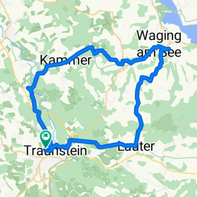
Vue d'ensemble
À propos du circuit
- -:--
- Durée
- 72,1 km
- Distance
- 450 m
- Montée
- 552 m
- Descente
- ---
- Vit. moyenne
- ---
- Altitude max.
Qualité de l’itinéraire
Types de voies et surfaces le long de l’itinéraire
Types de routes
Route tranquille
19,5 km
(27 %)
Route forestière
16,6 km
(23 %)
surfaces
Pavé
52,6 km
(73 %)
Non pavé
15,9 km
(22 %)
Asphalte
52,6 km
(73 %)
Gravier
14,4 km
(20 %)
Points forts de l’itinéraire
Points d’intérêt le long de l’itinéraire
Hébergement après 0 km
Rosenheimer Hof
Eau potable après 2 km
Traun
Eau potable après 10 km
Weiße Traun
Eau potable après 13 km
Weiße Traun
Eau potable après 14,9 km
Weiße Traun
Photo après 18,6 km
Chiemgau Arena
Eau potable après 21,2 km
Förchensee
Eau potable après 24,3 km
Lödensee
Eau potable après 25,1 km
Mittersee
Eau potable après 27,2 km
Weitsee
Eau potable après 35,7 km
Schwarzlofer
Eau potable après 41,4 km
Lofer
Eau potable après 46 km
Großache
Eau potable après 54 km
Walchsee
Photo après 61,6 km
Panoramastrecke (vom Feinsten)
Photo après 62,9 km
Kirche Hl. St. Nikolaus
Eau potable après 66,2 km
Inn
Eau potable après 71,5 km
Inn
Photo après 71,5 km
Batzenhäusl
Photo après 71,5 km
Altstadt
Photo après 71,6 km
Unterer Stadtplatz
Photo après 71,8 km
Oberer Stadtplatz
Photo après 71,8 km
Stadtpfarrkirche St. Vitus
Photo après 71,9 km
Festung Kufstein
Hébergement après 72,1 km
Andreas Hofer
Photo après 72,1 km
Bezirksgericht
Continuer avec Bikemap
Utilise, modifie ou télécharge cet itinéraire vélo
Tu veux parcourir D 227: Traunstein - Kufstein ou l’adapter à ton propre voyage ? Voici ce que tu peux faire avec cet itinéraire Bikemap :
Fonctionnalités gratuites
- Enregistre cet itinéraire comme favori ou dans une collection
- Copie et planifie ta propre version de cet itinéraire
- Synchronise ton itinéraire avec Garmin ou Wahoo
Fonctionnalités Premium
Essai gratuit de 3 jours, ou paiement unique. En savoir plus sur Bikemap Premium.
- Navigue sur cet itinéraire sur iOS et Android
- Exporter un fichier GPX / KML de cet itinéraire
- Crée ton impression personnalisée (essaie-la gratuitement)
- Télécharge cet itinéraire pour la navigation hors ligne
Découvre plus de fonctionnalités Premium.
Obtiens Bikemap PremiumDe notre communauté
Traunstein : Autres itinéraires populaires qui commencent ici
 TS - Stoißer Alm - Bäckeralm - TS
- Distance
- 50,4 km
- Montée
- 931 m
- Descente
- 930 m
- Emplacement
- Traunstein, Bavière, Allemagne
 Brauereitour 2 - Chiemsee und Alz, Hopfen und Malz
- Distance
- 62,7 km
- Montée
- 608 m
- Descente
- 609 m
- Emplacement
- Traunstein, Bavière, Allemagne
 Gut Edermann über Siegsdorf
- Distance
- 43,4 km
- Montée
- 348 m
- Descente
- 348 m
- Emplacement
- Traunstein, Bavière, Allemagne
 Traunstein um Waging am See
- Distance
- 46,6 km
- Montée
- 418 m
- Descente
- 419 m
- Emplacement
- Traunstein, Bavière, Allemagne
 Gut Ising
- Distance
- 16,3 km
- Montée
- 203 m
- Descente
- 259 m
- Emplacement
- Traunstein, Bavière, Allemagne
 Traunstein zum Landhaus Tanner
- Distance
- 34,6 km
- Montée
- 339 m
- Descente
- 339 m
- Emplacement
- Traunstein, Bavière, Allemagne
 Hartseestüberl
- Distance
- 26,3 km
- Montée
- 91 m
- Descente
- 156 m
- Emplacement
- Traunstein, Bavière, Allemagne
 Alte Panzerstraße, Traunstein nach Siegerthöhe 2, Trostberg
- Distance
- 22,4 km
- Montée
- 94 m
- Descente
- 142 m
- Emplacement
- Traunstein, Bavière, Allemagne
Ouvre-la dans l’app