

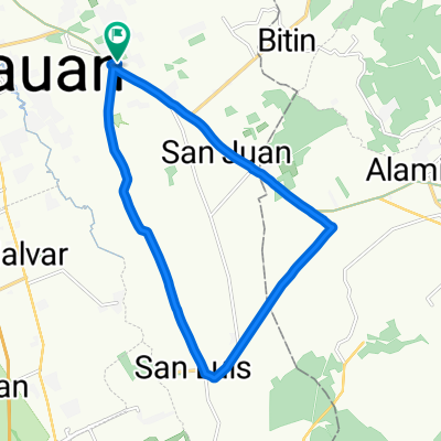
SV to Bitin to UPLB to Bucal to Saimsim to National Road to Sto. Tomas and back to San Vicente
Un itinéraire vélo au départ de Tanauan, Calabarzon, Philippines.
Vue d'ensemble
À propos du circuit
Défi en montée jusqu'à Bitin et au pied du Mt. Bulalo, suivi d'une longue descente jusqu'à Masaya et Pansol. Presque plat jusqu'à Bucal et ensuite à nouveau en montée vers San Rafael.
- -:--
- Durée
- 50,6 km
- Distance
- 362 m
- Montée
- 362 m
- Descente
- ---
- Vit. moyenne
- ---
- Altitude max.
Continuer avec Bikemap
Utilise, modifie ou télécharge cet itinéraire vélo
Tu veux parcourir SV to Bitin to UPLB to Bucal to Saimsim to National Road to Sto. Tomas and back to San Vicente ou l’adapter à ton propre voyage ? Voici ce que tu peux faire avec cet itinéraire Bikemap :
Fonctionnalités gratuites
- Enregistre cet itinéraire comme favori ou dans une collection
- Copie et planifie ta propre version de cet itinéraire
- Synchronise ton itinéraire avec Garmin ou Wahoo
Fonctionnalités Premium
Essai gratuit de 3 jours, ou paiement unique. En savoir plus sur Bikemap Premium.
- Navigue sur cet itinéraire sur iOS et Android
- Exporter un fichier GPX / KML de cet itinéraire
- Crée ton impression personnalisée (essaie-la gratuitement)
- Télécharge cet itinéraire pour la navigation hors ligne
Découvre plus de fonctionnalités Premium.
Obtiens Bikemap PremiumDe notre communauté
Tanauan : Autres itinéraires populaires qui commencent ici
 SV to Bitin to UPLB to Bucal to Saimsim to National Road to Sto. Tomas and back to San Vicente
- Distance
- 50,6 km
- Montée
- 362 m
- Descente
- 362 m
- Emplacement
- Tanauan, Calabarzon, Philippines
 taal loop
- Distance
- 118 km
- Montée
- 1 659 m
- Descente
- 1 660 m
- Emplacement
- Tanauan, Calabarzon, Philippines
 goal to get her
- Distance
- 9,7 km
- Montée
- 127 m
- Descente
- 21 m
- Emplacement
- Tanauan, Calabarzon, Philippines
 Relaxed route in Biñan
- Distance
- 40,7 km
- Montée
- 1 736 m
- Descente
- 1 878 m
- Emplacement
- Tanauan, Calabarzon, Philippines
 Tagaytay-Tanauan Ride
- Distance
- 70 km
- Montée
- 1 393 m
- Descente
- 1 393 m
- Emplacement
- Tanauan, Calabarzon, Philippines
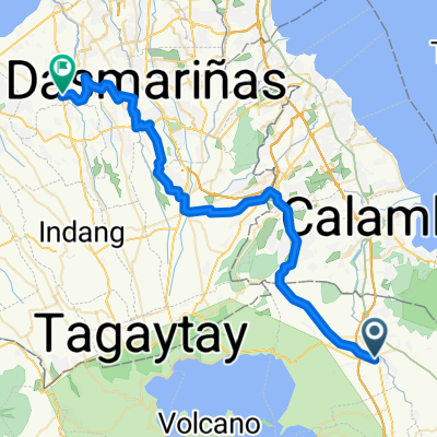 From Tanauan City to Tanza
- Distance
- 64,6 km
- Montée
- 509 m
- Descente
- 597 m
- Emplacement
- Tanauan, Calabarzon, Philippines
 Juan Villegas Street 3050, Santo Tomas to Juan Villegas Street 3050, Santo Tomas
- Distance
- 19,4 km
- Montée
- 132 m
- Descente
- 135 m
- Emplacement
- Tanauan, Calabarzon, Philippines
 4524+3WG, Santo Tomas to 1, Alaminos
- Distance
- 11,7 km
- Montée
- 64 m
- Descente
- 67 m
- Emplacement
- Tanauan, Calabarzon, Philippines
Ouvre-la dans l’app