

A Coffee + Architecture + Platting + Infrastructure + Beer Exploration
Un itinéraire vélo au départ de Portland, Oregon, États Unis.
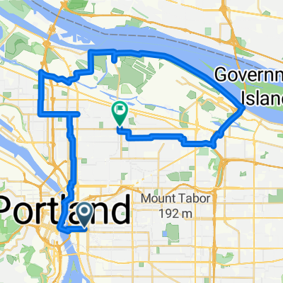
Vue d'ensemble
À propos du circuit
Choses que nous allons voir/faire.
Nous allons passer par le Steel Bridge - un pont vieux de 104 ans qui transporte des tramways légers, des bus, des piétons, des vélos, des trains de fret, des trains de passagers et même des camions de remorque. C'est le cheval de bataille de Portland depuis 1912 !
Cup & Bar - l'un des plus nouveaux torréfacteurs de la ville, livre à vélo-cargo, avec un espace ouvert pour traîner/hacker/faire du vélo, etc. Situé à côté de deux des nouvelles tours résidentielles folles et bizarres en construction.
Ladd's Addition, l'un des premiers quartiers, un quartier planifié pour le tramway, de Portland, planifié et construit entre 1905 et 1930.
Apex Bar/Brasserie. Super bar avec de la musique entraînante, plus de stationnement pour vélos que vous ne pouvez l'imaginer (et nous allons probablement quand même attacher nos vélos à des arbres) et une sélection de bières locales extrêmement impressionnante (des dizaines et des dizaines d'entre elles !).
Le Tillikum Bridge est le nouveau pont de transport, de cyclisme et de piétons de Portland. Nous allons longer quelques-uns des nouveaux MUP (Mixed Use Path) jusqu'au pont, où vous pourrez voir la confluence des tramways, des trains légers et des bus traversant le pont et probablement des cyclistes et des piétons partout. C'est un pont sympa, ouvert l'année dernière en septembre !
Nous retournerons le long de l'extrémité sud du MUP (Mixed Use Path) du front de mer.
- -:--
- Durée
- 9,9 km
- Distance
- 122 m
- Montée
- 121 m
- Descente
- ---
- Vit. moyenne
- ---
- Altitude max.

Qualité de l’itinéraire
Types de voies et surfaces le long de l’itinéraire
Types de routes
Route tranquille
3,6 km
(36 %)
Piste cyclable
2,7 km
(27 %)
surfaces
Pavé
8,6 km
(87 %)
Asphalte
3,9 km
(39 %)
Pavé (non défini)
2,4 km
(24 %)
Continuer avec Bikemap
Utilise, modifie ou télécharge cet itinéraire vélo
Tu veux parcourir A Coffee + Architecture + Platting + Infrastructure + Beer Exploration ou l’adapter à ton propre voyage ? Voici ce que tu peux faire avec cet itinéraire Bikemap :
Fonctionnalités gratuites
- Enregistre cet itinéraire comme favori ou dans une collection
- Copie et planifie ta propre version de cet itinéraire
- Synchronise ton itinéraire avec Garmin ou Wahoo
Fonctionnalités Premium
Essai gratuit de 3 jours, ou paiement unique. En savoir plus sur Bikemap Premium.
- Navigue sur cet itinéraire sur iOS et Android
- Exporter un fichier GPX / KML de cet itinéraire
- Crée ton impression personnalisée (essaie-la gratuitement)
- Télécharge cet itinéraire pour la navigation hors ligne
Découvre plus de fonctionnalités Premium.
Obtiens Bikemap PremiumDe notre communauté
Portland : Autres itinéraires populaires qui commencent ici
 50mi loop to troutdale
- Distance
- 75,9 km
- Montée
- 278 m
- Descente
- 274 m
- Emplacement
- Portland, Oregon, États Unis
 Ride to Rhody
- Distance
- 89 km
- Montée
- 1 095 m
- Descente
- 444 m
- Emplacement
- Portland, Oregon, États Unis
 Wednesday 9/24
- Distance
- 37,7 km
- Montée
- 225 m
- Descente
- 187 m
- Emplacement
- Portland, Oregon, États Unis
 8/2017 Century Plus Route 1
- Distance
- 177,9 km
- Montée
- 995 m
- Descente
- 993 m
- Emplacement
- Portland, Oregon, États Unis
 Distance Training
- Distance
- 46,7 km
- Montée
- 186 m
- Descente
- 218 m
- Emplacement
- Portland, Oregon, États Unis
 Portland to Casc Locks OR via I 84
- Distance
- 71,7 km
- Montée
- 318 m
- Descente
- 316 m
- Emplacement
- Portland, Oregon, États Unis
 I-5 to 205 Loop
- Distance
- 38,7 km
- Montée
- 178 m
- Descente
- 180 m
- Emplacement
- Portland, Oregon, États Unis
 A Coffee + Architecture + Platting + Infrastructure + Beer Exploration
- Distance
- 9,9 km
- Montée
- 122 m
- Descente
- 121 m
- Emplacement
- Portland, Oregon, États Unis
Ouvre-la dans l’app