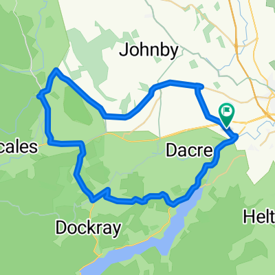
LEJOG Day 10 - Penrith to Lanark
Un itinéraire vélo au départ de Penrith, Angleterre, Royaume-Uni.
Vue d'ensemble
À propos du circuit
Une longue journée difficile - principalement par nécessité, en raison du manque de routes ou d'options d'hébergement dans cette partie de l'Écosse.
L'itinéraire de Penrith à Carlisle est merveilleux - long, droit, plat.
Cependant, je ne recommande pas grand-chose du reste. La route de Gretna Green à Kirtlebridge est correcte, mais la fameuse B-road, qui longe l'autoroute, est mal goudronnée, assez ennuyeuse, et partagée avec des camions de bois. Emportez beaucoup de nourriture ; il y a peu d'occasions d'en acheter.
Après avoir quitté la B7078 à travers Uddington, la A70 est infernale : étroite, sans accotement (encore moins de piste cyclable), et à nouveau partagée avec des poids lourds roulant très vite.
Hébergement au New Lanark YHA.
- -:--
- Durée
- 155,6 km
- Distance
- 590 m
- Montée
- 552 m
- Descente
- ---
- Vit. moyenne
- ---
- Altitude max.
Qualité de l’itinéraire
Types de voies et surfaces le long de l’itinéraire
Types de routes
Route
32,7 km
(21 %)
Piste cyclable
14 km
(9 %)
surfaces
Pavé
43,6 km
(28 %)
Asphalte
43,6 km
(28 %)
Indéfini
112,1 km
(72 %)
Continuer avec Bikemap
Utilise, modifie ou télécharge cet itinéraire vélo
Tu veux parcourir LEJOG Day 10 - Penrith to Lanark ou l’adapter à ton propre voyage ? Voici ce que tu peux faire avec cet itinéraire Bikemap :
Fonctionnalités gratuites
- Enregistre cet itinéraire comme favori ou dans une collection
- Copie et planifie ta propre version de cet itinéraire
- Divise-le en étapes pour créer un tour sur plusieurs jours
- Synchronise ton itinéraire avec Garmin ou Wahoo
Fonctionnalités Premium
Essai gratuit de 3 jours, ou paiement unique. En savoir plus sur Bikemap Premium.
- Navigue sur cet itinéraire sur iOS et Android
- Exporter un fichier GPX / KML de cet itinéraire
- Crée ton impression personnalisée (essaie-la gratuitement)
- Télécharge cet itinéraire pour la navigation hors ligne
Découvre plus de fonctionnalités Premium.
Obtiens Bikemap PremiumDe notre communauté
Penrith : Autres itinéraires populaires qui commencent ici
 C2C Day Three. Little Salkeld to Allenheads.
- Distance
- 41,1 km
- Montée
- 1 053 m
- Descente
- 744 m
- Emplacement
- Penrith, Angleterre, Royaume-Uni
 Route
Route- Distance
- 42,4 km
- Montée
- 510 m
- Descente
- 509 m
- Emplacement
- Penrith, Angleterre, Royaume-Uni
 LEJOG Day 10 - Penrith to Lanark
- Distance
- 155,6 km
- Montée
- 590 m
- Descente
- 552 m
- Emplacement
- Penrith, Angleterre, Royaume-Uni
 SC Melkinthorpe
- Distance
- 37,2 km
- Montée
- 388 m
- Descente
- 388 m
- Emplacement
- Penrith, Angleterre, Royaume-Uni
 Lowther Trails & Withnail's Phone Box
- Distance
- 30 km
- Montée
- 505 m
- Descente
- 507 m
- Emplacement
- Penrith, Angleterre, Royaume-Uni
 Yanwath & Bampton Grange
- Distance
- 24,6 km
- Montée
- 230 m
- Descente
- 229 m
- Emplacement
- Penrith, Angleterre, Royaume-Uni
 cols GB
- Distance
- 170,7 km
- Montée
- 3 125 m
- Descente
- 3 214 m
- Emplacement
- Penrith, Angleterre, Royaume-Uni
 coast to oast day 1 penrith to whitley bay
- Distance
- 141,5 km
- Montée
- 1 453 m
- Descente
- 1 582 m
- Emplacement
- Penrith, Angleterre, Royaume-Uni
Ouvre-la dans l’app

