

ELBE 22 HOHENWARTHE TANGERMUENDE
Un itinéraire vélo au départ de Hohenwarthe, Saxe-Anhalt, Allemagne.
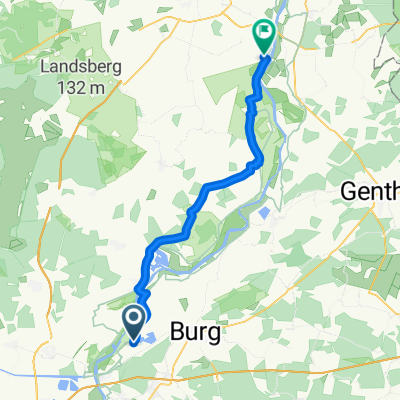
Vue d'ensemble
À propos du circuit
TEASI Track
- -:--
- Durée
- 61,4 km
- Distance
- 75 m
- Montée
- 77 m
- Descente
- ---
- Vit. moyenne
- ---
- Altitude max.

Qualité de l’itinéraire
Types de voies et surfaces le long de l’itinéraire
Types de routes
Route forestière
38,1 km
(62 %)
Route tranquille
8 km
(13 %)
surfaces
Pavé
47,9 km
(78 %)
Non pavé
1,2 km
(2 %)
Asphalte
31,9 km
(52 %)
Béton
12,9 km
(21 %)
Continuer avec Bikemap
Utilise, modifie ou télécharge cet itinéraire vélo
Tu veux parcourir ELBE 22 HOHENWARTHE TANGERMUENDE ou l’adapter à ton propre voyage ? Voici ce que tu peux faire avec cet itinéraire Bikemap :
Fonctionnalités gratuites
- Enregistre cet itinéraire comme favori ou dans une collection
- Copie et planifie ta propre version de cet itinéraire
- Synchronise ton itinéraire avec Garmin ou Wahoo
Fonctionnalités Premium
Essai gratuit de 3 jours, ou paiement unique. En savoir plus sur Bikemap Premium.
- Navigue sur cet itinéraire sur iOS et Android
- Exporter un fichier GPX / KML de cet itinéraire
- Crée ton impression personnalisée (essaie-la gratuitement)
- Télécharge cet itinéraire pour la navigation hors ligne
Découvre plus de fonctionnalités Premium.
Obtiens Bikemap PremiumDe notre communauté
Hohenwarthe : Autres itinéraires populaires qui commencent ici
 Route nach Tangermünde
- Distance
- 43,4 km
- Montée
- 122 m
- Descente
- 120 m
- Emplacement
- Hohenwarthe, Saxe-Anhalt, Allemagne
 Elbstraße 66, Loitsche-Heinrichsberg nach Heideweg 38, Wolmirstedt
- Distance
- 15,2 km
- Montée
- 24 m
- Descente
- 7 m
- Emplacement
- Hohenwarthe, Saxe-Anhalt, Allemagne
 Elbe 12 Hohenwarthe-Tangermünde
- Distance
- 58,6 km
- Montée
- 67 m
- Descente
- 74 m
- Emplacement
- Hohenwarthe, Saxe-Anhalt, Allemagne
 Niegripp - Brandenburg Havel
- Distance
- 63 km
- Montée
- 94 m
- Descente
- 100 m
- Emplacement
- Hohenwarthe, Saxe-Anhalt, Allemagne
 Gildenberg/hohenwarte - Magdeburg Hbf
- Distance
- 17,8 km
- Montée
- 64 m
- Descente
- 48 m
- Emplacement
- Hohenwarthe, Saxe-Anhalt, Allemagne
 Rund um Hohenwarthe
- Distance
- 66,8 km
- Montée
- 122 m
- Descente
- 116 m
- Emplacement
- Hohenwarthe, Saxe-Anhalt, Allemagne
 ELBE 22 HOHENWARTHE TANGERMUENDE
- Distance
- 61,4 km
- Montée
- 75 m
- Descente
- 77 m
- Emplacement
- Hohenwarthe, Saxe-Anhalt, Allemagne
 Sommertour - Tag 4
- Distance
- 28,5 km
- Montée
- 71 m
- Descente
- 78 m
- Emplacement
- Hohenwarthe, Saxe-Anhalt, Allemagne
Ouvre-la dans l’app