

St Ninian's Way - Newtown Stewart to Wigtown
Un itinéraire vélo au départ de Newton Stewart, Ecosse, Royaume-Uni.
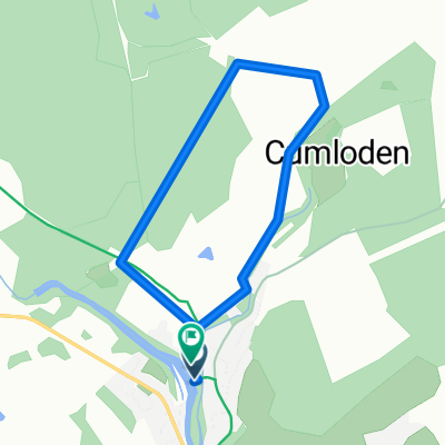
Vue d'ensemble
À propos du circuit
The 10th section of St Ninian’s Way takes Bike Route 73 (On A714 and accompanying core path) south out of Newton Stewart past the Y junction by St Ninian's Well (3 km) and then, turning left, down to Wigtown, with the Cree and Wigtown Bay to the east.
Flat after a short descent into farmland bordering the Cree.
For a map overview of Part 1 and Part 2 of St Ninian’s Way please go to https://www.bikemap.net/en/route/3548129-st-ninians-way-carlisle-to-st-andrews-part-1-carlisle-to-whithorn/
St Ninian’s Way is one of the great pilgrim routes in Scotland to St Andrews - The Way of St Andrews - For other routes see http://www.thewayofstandrews.com
- -:--
- Durée
- 13,1 km
- Distance
- 56 m
- Montée
- 25 m
- Descente
- ---
- Vit. moyenne
- ---
- Altitude max.

Qualité de l’itinéraire
Types de voies et surfaces le long de l’itinéraire
Types de routes
Route tranquille
10,1 km
(77 %)
Sentier
1,2 km
(9 %)
Indéfini
1,8 km
(14 %)
surfaces
Pavé
1,2 km
(9 %)
Asphalte
1,2 km
(9 %)
Indéfini
11,9 km
(91 %)
Points forts de l’itinéraire
Points d’intérêt le long de l’itinéraire
Point d'intérêt après 3,2 km
St Ninian's Well
Continuer avec Bikemap
Utilise, modifie ou télécharge cet itinéraire vélo
Tu veux parcourir St Ninian's Way - Newtown Stewart to Wigtown ou l’adapter à ton propre voyage ? Voici ce que tu peux faire avec cet itinéraire Bikemap :
Fonctionnalités gratuites
- Enregistre cet itinéraire comme favori ou dans une collection
- Copie et planifie ta propre version de cet itinéraire
- Synchronise ton itinéraire avec Garmin ou Wahoo
Fonctionnalités Premium
Essai gratuit de 3 jours, ou paiement unique. En savoir plus sur Bikemap Premium.
- Navigue sur cet itinéraire sur iOS et Android
- Exporter un fichier GPX / KML de cet itinéraire
- Crée ton impression personnalisée (essaie-la gratuitement)
- Télécharge cet itinéraire pour la navigation hors ligne
Découvre plus de fonctionnalités Premium.
Obtiens Bikemap PremiumDe notre communauté
Newton Stewart : Autres itinéraires populaires qui commencent ici
 Loch Trool Loop.
- Distance
- 10,5 km
- Montée
- 225 m
- Descente
- 227 m
- Emplacement
- Newton Stewart, Ecosse, Royaume-Uni
 Glen Troll V1
- Distance
- 23,5 km
- Montée
- 421 m
- Descente
- 421 m
- Emplacement
- Newton Stewart, Ecosse, Royaume-Uni
 Newton Stewart Glentrool Village circular
- Distance
- 42 km
- Montée
- 383 m
- Descente
- 384 m
- Emplacement
- Newton Stewart, Ecosse, Royaume-Uni
 Glentrool Blue
- Distance
- 9,5 km
- Montée
- 173 m
- Descente
- 174 m
- Emplacement
- Newton Stewart, Ecosse, Royaume-Uni
 Newton Stewart to Wigtown Circular 2
- Distance
- 47,3 km
- Montée
- 272 m
- Descente
- 274 m
- Emplacement
- Newton Stewart, Ecosse, Royaume-Uni
 Newton Stewart-Whauphill-Wigton Circular
- Distance
- 46,4 km
- Montée
- 178 m
- Descente
- 182 m
- Emplacement
- Newton Stewart, Ecosse, Royaume-Uni
 From Creetown to the viaduct
- Distance
- 21,7 km
- Montée
- 313 m
- Descente
- 312 m
- Emplacement
- Newton Stewart, Ecosse, Royaume-Uni
 Route in Newton Stewart
- Distance
- 4,8 km
- Montée
- 42 m
- Descente
- 42 m
- Emplacement
- Newton Stewart, Ecosse, Royaume-Uni
Ouvre-la dans l’app