

St Ninian's Way - Wigtown to Garlieston
Un itinéraire vélo au départ de Newton Stewart, Scotland, United Kingdom.
Vue d'ensemble
À propos du circuit
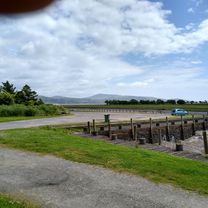
The 11th section of St Ninian’s Way takes Bike Route 73 from Wigtown, crosses the bridge at Bladnoch, and then another 300m to Y junction. Here the Way goes left and south (BR 73 goes west) along minor road ( A746) to T junction (1 km). Turn left onto minor road and track, pass Mains of Baldoon (1 km) and continue to junction before wood overlooking Baldoon Sands (1 km). Turn right (south) along track to South Balfern ((2 km) and continue to junction on B7004 (1 km). Turn left along B7004 to junction with track (3 km) Turn left onto track to Culscadden (1 km) and branch onto minor road to coast (1 km). Continue along coastal track to Garlieston (6 km).
Mainly flatish and great views across Wigtown Bay and beyond to Cumbria and the Lake District.
For a map overview of Part 1 and Part 2 of St Ninian’s Way please go to https://www.bikemap.net/en/route/3548129-st-ninians-way-carlisle-to-st-andrews-part-1-carlisle-to-whithorn/
St Ninian’s Way is one of the great pilgrim routes in Scotland to St Andrews - The Way of St Andrews - For other routes see http://www.thewayofstandrews.com
- -:--
- Durée
- 20,4 km
- Distance
- 94 m
- Montée
- 126 m
- Descente
- ---
- Vit. moyenne
- ---
- Altitude max.

Qualité de l’itinéraire
Types de voies et surfaces le long de l’itinéraire
Types de routes
Sentier
14,7 km
(72 %)
Route fréquentée
2,7 km
(13 %)
surfaces
Pavé
0,6 km
(3 %)
Non pavé
0,1 km
(<1 %)
Asphalte
0,6 km
(3 %)
Gravier
0,1 km
(<1 %)
Indéfini
19,8 km
(97 %)
Continuer avec Bikemap
Utilise, modifie ou télécharge cet itinéraire vélo
Tu veux parcourir St Ninian's Way - Wigtown to Garlieston ou l’adapter à ton propre voyage ? Voici ce que tu peux faire avec cet itinéraire Bikemap :
Fonctionnalités gratuites
- Enregistre cet itinéraire comme favori ou dans une collection
- Copie et planifie ta propre version de cet itinéraire
- Synchronise ton itinéraire avec Garmin ou Wahoo
Fonctionnalités Premium
Essai gratuit de 3 jours, ou paiement unique. En savoir plus sur Bikemap Premium.
- Navigue sur cet itinéraire sur iOS et Android
- Exporter un fichier GPX / KML de cet itinéraire
- Crée ton impression personnalisée (essaie-la gratuitement)
- Télécharge cet itinéraire pour la navigation hors ligne
Découvre plus de fonctionnalités Premium.
Obtiens Bikemap PremiumDe notre communauté
Newton Stewart : Autres itinéraires populaires qui commencent ici
 Loch Trool Loop.
- Distance
- 10,5 km
- Montée
- 225 m
- Descente
- 227 m
- Emplacement
- Newton Stewart, Scotland, United Kingdom
 1.4 Southern Upland Way
- Distance
- 7,9 km
- Montée
- 103 m
- Descente
- 138 m
- Emplacement
- Newton Stewart, Scotland, United Kingdom
 From Creetown to the viaduct
- Distance
- 21,7 km
- Montée
- 313 m
- Descente
- 312 m
- Emplacement
- Newton Stewart, Scotland, United Kingdom
 Newton Stewart to Wigtown Circular 2
- Distance
- 47,3 km
- Montée
- 272 m
- Descente
- 274 m
- Emplacement
- Newton Stewart, Scotland, United Kingdom
 Home to Wigtown return
- Distance
- 32,2 km
- Montée
- 289 m
- Descente
- 287 m
- Emplacement
- Newton Stewart, Scotland, United Kingdom
 loch chatteringshaw
- Distance
- 23,1 km
- Montée
- 264 m
- Descente
- 259 m
- Emplacement
- Newton Stewart, Scotland, United Kingdom
 Newton Stewart Glentrool Village circular
- Distance
- 42 km
- Montée
- 383 m
- Descente
- 384 m
- Emplacement
- Newton Stewart, Scotland, United Kingdom
 Newton Stewart-Whauphill-Wigton Circular
- Distance
- 46,4 km
- Montée
- 178 m
- Descente
- 182 m
- Emplacement
- Newton Stewart, Scotland, United Kingdom
Ouvre-la dans l’app