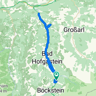
Biciklitúra 2016. 3. nap. (Bad Gastein - Mallnitz-Spittal. d. Drau)
Un itinéraire vélo au départ de Bad Gastein, Salzbourg, Autriche.
Vue d'ensemble
À propos du circuit
Résumé
Cette étape commence dans la vallée de Gastein ou à Mallnitz (selon le moment où vous préférez utiliser le service de motorail Tauernschleuse). Après la Tauernschleuse, nous nous retrouvons en Carinthie, l'une des régions touristiques les plus importantes d'Autriche, située du côté sud des Alpes. Lors de cette étape, le Tour à vélo Alpe-Adria nous emmène généralement à travers la vallée du Mölltal inférieur, nichée entre les montagnes d'environ 3 000 mètres du groupe Reisseck au nord et du groupe Kreuzeck au sud de la vallée. Les attractions touristiques exceptionnelles et les points d'arrêt gratifiants incluent le centre-ville d'Obervellach, le château de Falkenstein, la cascade de Bernitz, les remontées mécaniques Reisseck et Kreuzeck, le canyon de Barbarossa, une aire de repos sur les rives du Möllstausee à Mühldorf et le musée romain Teurinia à l'extérieur de Spittal. Dans le chef-lieu du comté de Spittal lui-même, nous trouvons le magnifique château Renaissance de Porcia, le musée de la culture populaire et le parc de la ville toujours aussi populaire.
- -:--
- Durée
- 58,9 km
- Distance
- 1 572 m
- Montée
- 2 103 m
- Descente
- ---
- Vit. moyenne
- ---
- Altitude max.
Continuer avec Bikemap
Utilise, modifie ou télécharge cet itinéraire vélo
Tu veux parcourir Biciklitúra 2016. 3. nap. (Bad Gastein - Mallnitz-Spittal. d. Drau) ou l’adapter à ton propre voyage ? Voici ce que tu peux faire avec cet itinéraire Bikemap :
Fonctionnalités gratuites
- Enregistre cet itinéraire comme favori ou dans une collection
- Copie et planifie ta propre version de cet itinéraire
- Synchronise ton itinéraire avec Garmin ou Wahoo
Fonctionnalités Premium
Essai gratuit de 3 jours, ou paiement unique. En savoir plus sur Bikemap Premium.
- Navigue sur cet itinéraire sur iOS et Android
- Exporter un fichier GPX / KML de cet itinéraire
- Crée ton impression personnalisée (essaie-la gratuitement)
- Télécharge cet itinéraire pour la navigation hors ligne
Découvre plus de fonctionnalités Premium.
Obtiens Bikemap PremiumDe notre communauté
Bad Gastein : Autres itinéraires populaires qui commencent ici
 Bad Gastein - Runde
- Distance
- 54,8 km
- Montée
- 774 m
- Descente
- 773 m
- Emplacement
- Bad Gastein, Salzbourg, Autriche
 Badgastein - Dorfgastein
- Distance
- 51,7 km
- Montée
- 518 m
- Descente
- 518 m
- Emplacement
- Bad Gastein, Salzbourg, Autriche
 Bad Gastein 2024
- Distance
- 7,8 km
- Montée
- 201 m
- Descente
- 199 m
- Emplacement
- Bad Gastein, Salzbourg, Autriche
 Stubnerkogel
- Distance
- 17,8 km
- Montée
- 1 288 m
- Descente
- 138 m
- Emplacement
- Bad Gastein, Salzbourg, Autriche
 Karl-Heinrich-Waggerl-Straße 12, Bad Gastein to Kaiser-Franz-Josef-Straße 41, Bad Gastein
- Distance
- 23 km
- Montée
- 1 149 m
- Descente
- 1 148 m
- Emplacement
- Bad Gastein, Salzbourg, Autriche
 AAR-5.1 Bad Gastein nach Böckstein
- Distance
- 4,1 km
- Montée
- 94 m
- Descente
- 9 m
- Emplacement
- Bad Gastein, Salzbourg, Autriche
 Bad Gastein - Villach
- Distance
- 102,3 km
- Montée
- 873 m
- Descente
- 1 443 m
- Emplacement
- Bad Gastein, Salzbourg, Autriche
 03 Bad Gastein - Spittal an. d. Drau
- Distance
- 63 km
- Montée
- 922 m
- Descente
- 1 334 m
- Emplacement
- Bad Gastein, Salzbourg, Autriche
Ouvre-la dans l’app

