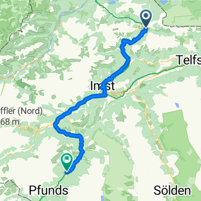
Blidsee Trail and Barabara Steig Trail
Un itinéraire vélo au départ de Biberwier, Tyrol, Autriche.
Vue d'ensemble
À propos du circuit
Vraiment belle randonnée à vélo utilisant les remontées mécaniques. Donc, très peu de pédalage en montée.
Les sentiers ne sont pas faciles mais faisables avec un peu d'expérience. De très belles vues!
Tout d'abord, vous prenez la section 1 et 2 de la Grubigstein Bahn. Ensuite, vous descendez vers le Blidsee. Puis vous traversez les vallées. Et ensuite, vous prenez 2 autres télécabines. Et vous entrez dans le sentier final. Voici le parcours complet incluant les remontées mécaniques.
La tournée commence à Biberwier. Là, vous garez la voiture sur le parking de l'église.
- -:--
- Durée
- 27,5 km
- Distance
- 1 711 m
- Montée
- 1 711 m
- Descente
- ---
- Vit. moyenne
- ---
- Altitude max.
Continuer avec Bikemap
Utilise, modifie ou télécharge cet itinéraire vélo
Tu veux parcourir Blidsee Trail and Barabara Steig Trail ou l’adapter à ton propre voyage ? Voici ce que tu peux faire avec cet itinéraire Bikemap :
Fonctionnalités gratuites
- Enregistre cet itinéraire comme favori ou dans une collection
- Copie et planifie ta propre version de cet itinéraire
- Synchronise ton itinéraire avec Garmin ou Wahoo
Fonctionnalités Premium
Essai gratuit de 3 jours, ou paiement unique. En savoir plus sur Bikemap Premium.
- Navigue sur cet itinéraire sur iOS et Android
- Exporter un fichier GPX / KML de cet itinéraire
- Crée ton impression personnalisée (essaie-la gratuitement)
- Télécharge cet itinéraire pour la navigation hors ligne
Découvre plus de fonctionnalités Premium.
Obtiens Bikemap PremiumDe notre communauté
Biberwier : Autres itinéraires populaires qui commencent ici
 Blidsee Trail and Barabara Steig Trail
- Distance
- 27,5 km
- Montée
- 1 711 m
- Descente
- 1 711 m
- Emplacement
- Biberwier, Tyrol, Autriche
 Gipfeltour Sonnenspitze
- Distance
- 4 km
- Montée
- 606 m
- Descente
- 614 m
- Emplacement
- Biberwier, Tyrol, Autriche
 E2: Biberwier - Zernez
- Distance
- 138,7 km
- Montée
- 2 893 m
- Descente
- 2 461 m
- Emplacement
- Biberwier, Tyrol, Autriche
 Biberwier - Serfaus
- Distance
- 76,6 km
- Montée
- 1 703 m
- Descente
- 1 739 m
- Emplacement
- Biberwier, Tyrol, Autriche
 L71 64, Biberwier nach Malserstraße 31, Landeck
- Distance
- 54,4 km
- Montée
- 651 m
- Descente
- 852 m
- Emplacement
- Biberwier, Tyrol, Autriche
 z-B31EHR-Biberwier-3 Seen Runde
- Distance
- 11,2 km
- Montée
- 357 m
- Descente
- 357 m
- Emplacement
- Biberwier, Tyrol, Autriche
 8. Etappe: Biberwier - Zams
- Distance
- 59,3 km
- Montée
- 1 220 m
- Descente
- 1 452 m
- Emplacement
- Biberwier, Tyrol, Autriche
 Biberwier "Otto"-Fernsteinsee
- Distance
- 11,7 km
- Montée
- 361 m
- Descente
- 414 m
- Emplacement
- Biberwier, Tyrol, Autriche
Ouvre-la dans l’app


