

St Ninian's Way- Troon to Kilwinning
Un itinéraire vélo au départ de Troon, Ecosse, Royaume-Uni.
Vue d'ensemble
À propos du circuit
Troon to Kilwinning
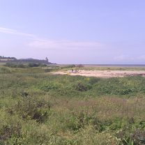
This 22nd section of St Ninian’s way starts at Troon Old Parish Church . Go South along West Portland Street to the coast and pick up the Ayrshire Coastal Path (ACP) after 100 m. Proceed west to the point (2km) and then back East along the marina to Barassie Sands (4 km) . Turn East off ACP onto marked track . Pass under two railway bridges (400m), then under A68 (1.3km). Rejoin ACP and proceed to bridge back over the A78 (2.5km). Follow ACP past the Gailes Marsh Nature Reserve (1km) towards Irvine and track junction (2km) , veer right (North along track until it rejoins ACP (1 km) . Continue through Irvine past the Scottish Maritime Museum and underneath the railway(1km)) and across footbridge over the River Irvine (500 m). Then proceed North along ACP and cross the river Garnock (3 km) and through the tunnel under the A78 . Continue along ACP path beside the Garnock into Kilwinning and arrive at the ruins of the old abbey (2 km). A detailed route description with grid references is available on the Whithorn website below.
Flattish but with great variation.
Also part of the Whithorn Way - http://www.whithornway.org . courtesy of the WWSG where a detailed route description with grid references is available.
For a map overview of Part 1 and Part 2 of St Ninian’s Way please go to https://www.bikemap.net/en/route/3548129-st-ninians-way-carlisle-to-st-andrews-part-1-carlisle-to-whithorn/
St Ninian’s Way is one of the great pilgrim routes in Scotland to St Andrews - The Way of St Andrews - For other routes see http://www.thewayofstandrews.com
- -:--
- Durée
- 20,1 km
- Distance
- 40 m
- Montée
- 25 m
- Descente
- ---
- Vit. moyenne
- ---
- Altitude max.

Qualité de l’itinéraire
Types de voies et surfaces le long de l’itinéraire
Types de routes
Piste cyclable
15,6 km
(77 %)
Route tranquille
3,3 km
(16 %)
surfaces
Pavé
15,2 km
(75 %)
Asphalte
15,2 km
(75 %)
Indéfini
5 km
(25 %)
Points forts de l’itinéraire
Points d’intérêt le long de l’itinéraire
Point d'intérêt après 10,2 km
Gailes Marsh Nature Reserve
Point d'intérêt après 13,6 km
Scottish Maritime Museum
Continuer avec Bikemap
Utilise, modifie ou télécharge cet itinéraire vélo
Tu veux parcourir St Ninian's Way- Troon to Kilwinning ou l’adapter à ton propre voyage ? Voici ce que tu peux faire avec cet itinéraire Bikemap :
Fonctionnalités gratuites
- Enregistre cet itinéraire comme favori ou dans une collection
- Copie et planifie ta propre version de cet itinéraire
- Synchronise ton itinéraire avec Garmin ou Wahoo
Fonctionnalités Premium
Essai gratuit de 3 jours, ou paiement unique. En savoir plus sur Bikemap Premium.
- Navigue sur cet itinéraire sur iOS et Android
- Exporter un fichier GPX / KML de cet itinéraire
- Crée ton impression personnalisée (essaie-la gratuitement)
- Télécharge cet itinéraire pour la navigation hors ligne
Découvre plus de fonctionnalités Premium.
Obtiens Bikemap PremiumDe notre communauté
Troon : Autres itinéraires populaires qui commencent ici
 Troon - Ayr
- Distance
- 13,8 km
- Montée
- 31 m
- Descente
- 26 m
- Emplacement
- Troon, Ecosse, Royaume-Uni
 4 Bowman Warren Wynd, Troon to 4 Bowman Warren Wynd, Troon
- Distance
- 22,5 km
- Montée
- 3 m
- Descente
- 14 m
- Emplacement
- Troon, Ecosse, Royaume-Uni
 26 Hillhouse Road, Troon to 6 Bowman Warren Wynd, Troon
- Distance
- 11,5 km
- Montée
- 0 m
- Descente
- 7 m
- Emplacement
- Troon, Ecosse, Royaume-Uni
 17A Harbour Road, Troon to Esplanade, Ayr
- Distance
- 19,9 km
- Montée
- 0 m
- Descente
- 4 m
- Emplacement
- Troon, Ecosse, Royaume-Uni
 33 Gailes Road, Troon to 27 Gailes Road, Troon
- Distance
- 42 km
- Montée
- 238 m
- Descente
- 238 m
- Emplacement
- Troon, Ecosse, Royaume-Uni
 From Troon to Culzean Castle and Home
- Distance
- 113,2 km
- Montée
- 2 287 m
- Descente
- 2 347 m
- Emplacement
- Troon, Ecosse, Royaume-Uni
 South Beach 3 to Wardneuk Court 2, Girdle Toll
- Distance
- 19,3 km
- Montée
- 47 m
- Descente
- 82 m
- Emplacement
- Troon, Ecosse, Royaume-Uni
 2 Boyd Place, Troon to 4 Bowman Warren Wynd, Troon
- Distance
- 21,5 km
- Montée
- 76 m
- Descente
- 85 m
- Emplacement
- Troon, Ecosse, Royaume-Uni
Ouvre-la dans l’app