Serena
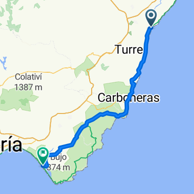
Un itinéraire vélo au départ de Vera, Andalousie, Espagne.
Vue d'ensemble
À propos du circuit
Starting at Vera, the route heads out towards Los Gallardos and at Perulaca it joins the route of the old silvermines train route which used to transport silver ore from the mines above Bedar down to the sea at Garrucha. There is a broken bridge which you have to go around. On the approach to Serena there is a 300metre tunnel which you can cycle through. At Serena there is a spring to top up your water bottle, and then its on to Bedar. The return route passes near to the extinct volcano, Cabezo de Maria.
- -:--
- Durée
- 42,2 km
- Distance
- 517 m
- Montée
- 499 m
- Descente
- ---
- Vit. moyenne
- ---
- Altitude max.
Points forts de l’itinéraire
Points d’intérêt le long de l’itinéraire
Point d'intérêt après 11,1 km
Join the old train route here
Point d'intérêt après 15,1 km
Broken bridge
Point d'intérêt après 19,2 km
Serena tunnel (about 300m)
Point d'intérêt après 19,2 km
Serena tunnel (about 300m)
Point d'intérêt après 21,2 km
Spring at Serena
Point d'intérêt après 21,2 km
Spring at Serena
Point d'intérêt après 24,3 km
Viewpoint at Bedar
Point d'intérêt après 24,3 km
Viewpoint at Bedar
Point d'intérêt après 29,6 km
Enter the rambla here
Point d'intérêt après 29,6 km
Enter the rambla here
Point d'intérêt après 32,4 km
Volcano of Cabezo de Maria
Point d'intérêt après 32,5 km
Volcano of Cabezo de Maria
Continuer avec Bikemap
Utilise, modifie ou télécharge cet itinéraire vélo
Tu veux parcourir Serena ou l’adapter à ton propre voyage ? Voici ce que tu peux faire avec cet itinéraire Bikemap :
Fonctionnalités gratuites
- Enregistre cet itinéraire comme favori ou dans une collection
- Copie et planifie ta propre version de cet itinéraire
- Synchronise ton itinéraire avec Garmin ou Wahoo
Fonctionnalités Premium
Essai gratuit de 3 jours, ou paiement unique. En savoir plus sur Bikemap Premium.
- Navigue sur cet itinéraire sur iOS et Android
- Exporter un fichier GPX / KML de cet itinéraire
- Crée ton impression personnalisée (essaie-la gratuitement)
- Télécharge cet itinéraire pour la navigation hors ligne
Découvre plus de fonctionnalités Premium.
Obtiens Bikemap PremiumDe notre communauté
Vera : Autres itinéraires populaires qui commencent ici
 Pozo del Esparto
- Distance
- 30,7 km
- Montée
- 318 m
- Descente
- 342 m
- Emplacement
- Vera, Andalousie, Espagne
 VERA-Las Cunas-PALOMARES-VILLARICOS-El Salar-VERA
- Distance
- 28,4 km
- Montée
- 199 m
- Descente
- 199 m
- Emplacement
- Vera, Andalousie, Espagne
 Serena
- Distance
- 42,2 km
- Montée
- 517 m
- Descente
- 499 m
- Emplacement
- Vera, Andalousie, Espagne
 Cucharon
- Distance
- 44,7 km
- Montée
- 659 m
- Descente
- 683 m
- Emplacement
- Vera, Andalousie, Espagne
 I Desafío Baria Cross-Runing 2017
- Distance
- 23,1 km
- Montée
- 229 m
- Descente
- 229 m
- Emplacement
- Vera, Andalousie, Espagne
 VERA-GARRUCHA- TURRE-La Carrasca-TURRE-Las Alparatas- VERA
- Distance
- 57 km
- Montée
- 850 m
- Descente
- 850 m
- Emplacement
- Vera, Andalousie, Espagne
 Vera - Cabo de Gata 82km
- Distance
- 81,9 km
- Montée
- 568 m
- Descente
- 563 m
- Emplacement
- Vera, Andalousie, Espagne
 Sendas de Grima
- Distance
- 42,8 km
- Montée
- 354 m
- Descente
- 352 m
- Emplacement
- Vera, Andalousie, Espagne
Ouvre-la dans l’app


