

Etape du Tour 2017?
Un itinéraire vélo au départ de Briançon, Provence-Alpes-Côte d'Azur, France.
Vue d'ensemble
À propos du circuit
This is more or less the most direct route that connects the points that are expected to feature in the stage. There are a number of 'detours' available to ASO that would add extra climbing in the first 80kms if that's what they want. Col de Pontis starting at around 60km would be a possibility as well as going west around the lake after Embrun and then back over the bridge to Savine.. Early in the ride there would also be scope to use the 'back' road south of Briançon that runs on the west of the Durance river passing through Les Vigneaux, also adding a bit of climbing.
- -:--
- Durée
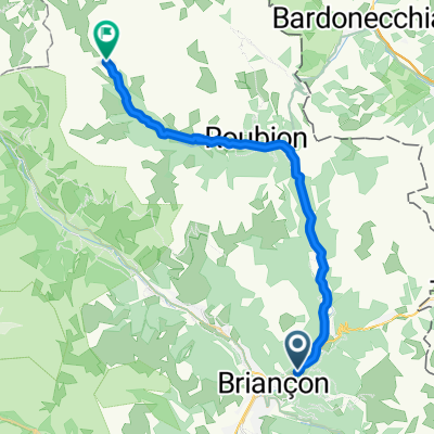
- 184,2 km
- Distance
- 2 946 m
- Montée
- 1 812 m
- Descente
- ---
- Vit. moyenne
- ---
- Altitude max.
Qualité de l’itinéraire
Types de voies et surfaces le long de l’itinéraire
Types de routes
Route tranquille
12,9 km
(7 %)
Route
7,4 km
(4 %)
surfaces
Pavé
130,8 km
(71 %)
Asphalte
130,8 km
(71 %)
Indéfini
53,4 km
(29 %)
Continuer avec Bikemap
Utilise, modifie ou télécharge cet itinéraire vélo
Tu veux parcourir Etape du Tour 2017? ou l’adapter à ton propre voyage ? Voici ce que tu peux faire avec cet itinéraire Bikemap :
Fonctionnalités gratuites
- Enregistre cet itinéraire comme favori ou dans une collection
- Copie et planifie ta propre version de cet itinéraire
- Divise-le en étapes pour créer un tour sur plusieurs jours
- Synchronise ton itinéraire avec Garmin ou Wahoo
Fonctionnalités Premium
Essai gratuit de 3 jours, ou paiement unique. En savoir plus sur Bikemap Premium.
- Navigue sur cet itinéraire sur iOS et Android
- Exporter un fichier GPX / KML de cet itinéraire
- Crée ton impression personnalisée (essaie-la gratuitement)
- Télécharge cet itinéraire pour la navigation hors ligne
Découvre plus de fonctionnalités Premium.
Obtiens Bikemap PremiumDe notre communauté
Briançon : Autres itinéraires populaires qui commencent ici
 2013-07-20: Briançon - St-Michel-de-Maurienne
- Distance
- 77,2 km
- Montée
- 1 464 m
- Descente
- 2 104 m
- Emplacement
- Briançon, Provence-Alpes-Côte d'Azur, France
 briancon-izoard
- Distance
- 20,4 km
- Montée
- 1 201 m
- Descente
- 155 m
- Emplacement
- Briançon, Provence-Alpes-Côte d'Azur, France
 Col de l'Echelle
- Distance
- 20,5 km
- Montée
- 546 m
- Descente
- 69 m
- Emplacement
- Briançon, Provence-Alpes-Côte d'Azur, France
 Izoard - Agnel + Izoard
- Distance
- 140 km
- Montée
- 2 927 m
- Descente
- 2 931 m
- Emplacement
- Briançon, Provence-Alpes-Côte d'Azur, France
 Col du Galibier via the old road
- Distance
- 52 km
- Montée
- 1 387 m
- Descente
- 1 239 m
- Emplacement
- Briançon, Provence-Alpes-Côte d'Azur, France
 Francia Alpok negyedik nap vándor nehéz
- Distance
- 112,4 km
- Montée
- 2 451 m
- Descente
- 2 851 m
- Emplacement
- Briançon, Provence-Alpes-Côte d'Azur, France
 01_Val-des-Prés bis Névache 30/900
- Distance
- 28 km
- Montée
- 889 m
- Descente
- 141 m
- Emplacement
- Briançon, Provence-Alpes-Côte d'Azur, France
 Col du Granon, Five Gravel Cols, Two Perched Forts
- Distance
- 72,6 km
- Montée
- 1 887 m
- Descente
- 1 892 m
- Emplacement
- Briançon, Provence-Alpes-Côte d'Azur, France
Ouvre-la dans l’app