

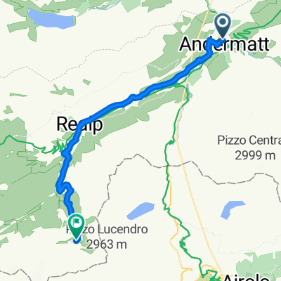
Gotthard Challenge
Un itinéraire vélo au départ de Andermatt, Canton d’Uri, Suisse.
Vue d'ensemble
À propos du circuit
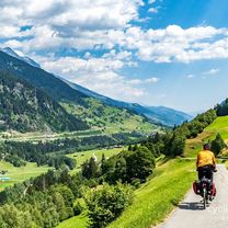
With three legendary passes that regularly feature in the Tour de Suisse, this loop ranks among the great alpine classics. Although just 106km in length, it should not be underestimated: with almost 40km of climbing, it presents a major challenge.
Starting in Andermatt in Canton Uri, the first pass is the Furka: 11km of climbing to reach the summit at alt. 2436m. You then enter Canton Valais for the long descent to Gletsch followed by Ulrichen in the Upper Rhone valley, known locally as the Goms. Time to think of taking food and drink on board, since you are about to make the ascent to the Nufenen pass (alt. 2478m) after 13km of climbing punctuated by long straights over 10% in gradient. Featuring Switzerland’s second-highest metalled pass road (only the Umbrail is higher), the Nufenen is a challenge in itself. The summit marks the gateway to another of Switzerland’s cantons: Ticino. There now follows a marvellous, extended descent towards Italian-speaking Airolo, where the day’s third and final ascent starts to the Gotthard at alt. 2091m. The world’s fourth-longest road tunnel swallows most of the north-south traffic; what is left takes the main pass road. Cyclists climb the ancient road, call the Tremola. Uniquely for the Alps, its 24 upper hairpin bends feature cobblestones. Enough to make you forget the 3000m-plus of difference in altitude you have been climbing today. Once at the top, Andermatt is no more than a few kilometres further on (and down!). Time for a well-earned rest in this quintessential village in the heart of the Swiss Alps.
- -:--
- Durée
- 105,9 km
- Distance
- 3 023 m
- Montée
- 3 021 m
- Descente
- ---
- Vit. moyenne
- ---
- Altitude max.

Qualité de l’itinéraire
Types de voies et surfaces le long de l’itinéraire
Types de routes
Route fréquentée
95,8 km
(90 %)
Route tranquille
5,5 km
(5 %)
surfaces
Pavé
93,6 km
(88 %)
Non pavé
0,9 km
(<1 %)
Asphalte
91,5 km
(86 %)
Béton
1,3 km
(1 %)
Continuer avec Bikemap
Utilise, modifie ou télécharge cet itinéraire vélo
Tu veux parcourir Gotthard Challenge ou l’adapter à ton propre voyage ? Voici ce que tu peux faire avec cet itinéraire Bikemap :
Fonctionnalités gratuites
- Enregistre cet itinéraire comme favori ou dans une collection
- Copie et planifie ta propre version de cet itinéraire
- Divise-le en étapes pour créer un tour sur plusieurs jours
- Synchronise ton itinéraire avec Garmin ou Wahoo
Fonctionnalités Premium
Essai gratuit de 3 jours, ou paiement unique. En savoir plus sur Bikemap Premium.
- Navigue sur cet itinéraire sur iOS et Android
- Exporter un fichier GPX / KML de cet itinéraire
- Crée ton impression personnalisée (essaie-la gratuitement)
- Télécharge cet itinéraire pour la navigation hors ligne
Découvre plus de fonctionnalités Premium.
Obtiens Bikemap PremiumDe notre communauté
Andermatt : Autres itinéraires populaires qui commencent ici
 VR01 Furkapass Belvedere-Brig.kml - VR01 Furkapass Belvedere-Brig.kml_VR01 Furkapass Belvedere-Brig
- Distance
- 60,1 km
- Montée
- 852 m
- Descente
- 2 409 m
- Emplacement
- Andermatt, Canton d’Uri, Suisse
 giro dei tre passi susten grimsel furka
- Distance
- 132,9 km
- Montée
- 3 457 m
- Descente
- 3 601 m
- Emplacement
- Andermatt, Canton d’Uri, Suisse
 Transalpine (7) Andermatt - Visp
- Distance
- 89,5 km
- Montée
- 1 685 m
- Descente
- 2 290 m
- Emplacement
- Andermatt, Canton d’Uri, Suisse
 Witenwasseren Bike
- Distance
- 17,3 km
- Montée
- 808 m
- Descente
- 26 m
- Emplacement
- Andermatt, Canton d’Uri, Suisse
 Furka-Nufenen-Gotthard-Oberalp
- Distance
- 135,9 km
- Montée
- 4 637 m
- Descente
- 4 527 m
- Emplacement
- Andermatt, Canton d’Uri, Suisse
 20.09.2010 Furka, Nufenen, Gotthard
- Distance
- 98,5 km
- Montée
- 2 959 m
- Descente
- 2 959 m
- Emplacement
- Andermatt, Canton d’Uri, Suisse
 Rhine Cycle Route, EuroVelo 15 - Andermatt to Basel
- Distance
- 492,2 km
- Montée
- 6 424 m
- Descente
- 7 590 m
- Emplacement
- Andermatt, Canton d’Uri, Suisse
 NL The Rhine Cycle Route
- Distance
- 1 352,1 km
- Montée
- 88 m
- Descente
- 1 523 m
- Emplacement
- Andermatt, Canton d’Uri, Suisse
Ouvre-la dans l’app