

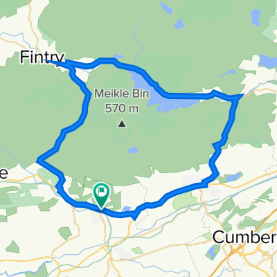
Dumgoyne Loop from Lennoxtown
Un itinéraire vélo au départ de Lennoxtown, Scotland, United Kingdom.
Vue d'ensemble
À propos du circuit
Route involving tarmac paths, offroad trails, fireroads and roads. Numerous options to explore and add offroad trails on the way. Stop in at the Beech Tree Inn for a drink and something to eat along the way
- -:--
- Durée
- 31,3 km
- Distance
- 245 m
- Montée
- 245 m
- Descente
- ---
- Vit. moyenne
- ---
- Altitude max.

Qualité de l’itinéraire
Types de voies et surfaces le long de l’itinéraire
Types de routes
Piste cyclable
12,1 km
(39 %)
Route forestière
8,9 km
(28 %)
surfaces
Pavé
16,3 km
(52 %)
Non pavé
13,7 km
(44 %)
Asphalte
16,3 km
(52 %)
Sol
6,5 km
(21 %)
Continuer avec Bikemap
Utilise, modifie ou télécharge cet itinéraire vélo
Tu veux parcourir Dumgoyne Loop from Lennoxtown ou l’adapter à ton propre voyage ? Voici ce que tu peux faire avec cet itinéraire Bikemap :
Fonctionnalités gratuites
- Enregistre cet itinéraire comme favori ou dans une collection
- Copie et planifie ta propre version de cet itinéraire
- Synchronise ton itinéraire avec Garmin ou Wahoo
Fonctionnalités Premium
Essai gratuit de 3 jours, ou paiement unique. En savoir plus sur Bikemap Premium.
- Navigue sur cet itinéraire sur iOS et Android
- Exporter un fichier GPX / KML de cet itinéraire
- Crée ton impression personnalisée (essaie-la gratuitement)
- Télécharge cet itinéraire pour la navigation hors ligne
Découvre plus de fonctionnalités Premium.
Obtiens Bikemap PremiumDe notre communauté
Lennoxtown : Autres itinéraires populaires qui commencent ici
 John Muir Way Part 2
- Distance
- 49,9 km
- Montée
- 200 m
- Descente
- 148 m
- Emplacement
- Lennoxtown, Scotland, United Kingdom
 Main Street 224, Lennoxtown to Main Street 226, Lennoxtown
- Distance
- 18,9 km
- Montée
- 94 m
- Descente
- 81 m
- Emplacement
- Lennoxtown, Scotland, United Kingdom
 Ferguson Park to Top of Campsies
- Distance
- 7 km
- Montée
- 10 m
- Descente
- 404 m
- Emplacement
- Lennoxtown, Scotland, United Kingdom
 Campsie Glen returning via public right of way through fields
- Distance
- 7,6 km
- Montée
- 45 m
- Descente
- 43 m
- Emplacement
- Lennoxtown, Scotland, United Kingdom
 Main Street 216, Lennoxtown to Crow Road
- Distance
- 3,7 km
- Montée
- 146 m
- Descente
- 1 m
- Emplacement
- Lennoxtown, Scotland, United Kingdom
 Lennox Forest, Balmore Quarry and Trig Point
- Distance
- 11,8 km
- Montée
- 222 m
- Descente
- 221 m
- Emplacement
- Lennoxtown, Scotland, United Kingdom
 Family Celtic Route
- Distance
- 5,2 km
- Montée
- 69 m
- Descente
- 69 m
- Emplacement
- Lennoxtown, Scotland, United Kingdom
 Crow road and Tak Ma Doon circular
- Distance
- 42,5 km
- Montée
- 597 m
- Descente
- 594 m
- Emplacement
- Lennoxtown, Scotland, United Kingdom
Ouvre-la dans l’app