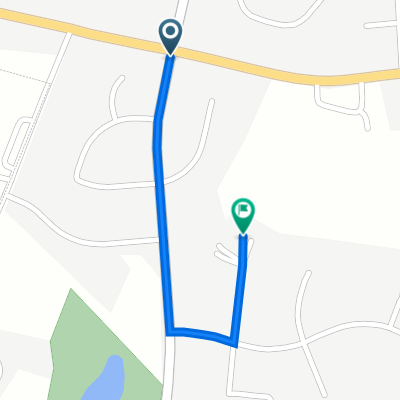
Woodsboro Black Ankle Loop
Un itinéraire vélo au départ de Westminster, Maryland, États Unis.
Vue d'ensemble
À propos du circuit
However you decide to do this loop, we think you will enjoy it! It takes you down around some small rivers and creeks and forested areas in the ‘Black Ankle’ section of this loop and then heads into more open areas with big open fields where you can catch a wind on your back to enjoy the views of the foothills of the Blue Ridge in the distant west. Woodsboro could be a lunch stop. There is a nice park just out of town on the 550 (south east). You can also extend your loop by heading north-west to a covered bridge and park area, another possibility of the lunch spot.
CumKm
Delta
Turn
Road
0
0
Right
Start at Best Western Parking lot (south into WMC Rd becomes Main)
0.10
0.10
Q-Right
New Windsor Rd
0.59
0.49
Q-Right
Uniontown Rd
6.08
5.49
Left
Springdale Rd (becomes Main St in New Windsor Mills)
12.86
6.78
Left
Old New Windsor Rd
17.00
4.14
Right
Hwy 31 (Also might be called New Windsor Rd)
17.24
0.24
Left
Sams Creek Rd
20.00
2.76
Right
Buffalo Road
25.26
5.26
Straight
Cross Hwy 26 onto Buffalo Road
29.52
4.26
Right
Harrisville Rd
30.68
1.16
V-Right
Talbot Run Rd
33.69
3.01
Right
Black Ankle Rd (BUT not a hard right, go onto paved road)
35.00
1.31
Left
Unionville Rd
37.50
2.50
Right
Clemsonville Road
38.00
0.50
Straight
Cross Hwy 26
40.25
2.25
Straight
Cross Hwy 31
43.45
3.20
Right
Fountain School Rd (map shows Clemsonville becomes Fountain School)
47.00
3.55
Right
Coppermine Rd
56.31
9.31
Straight
Cross 194 (Woodsboro Pike)
56.41
0.10
Right
Main St (could also be Old Woodsboro Pike)
56.71
0.30
Left
Woodsboro Creagerstown Rd (55)
66.42
9.71
Right
Jimtown Rd
68.44
2.02
Right
Rocky Ridge Rd
80.13
11.70
Straight
Detour Rd (Rocky Ridge Rd becomes Middleburg Rd as this point)
94.29
14.20
Straight
Uniontown Rd (Middleburg Rd becomes Uniontown Rd after Hwy 84)
104.14
9.85
Left
New Windsor Rd
113.99
0.50
Q-Left
Wmc Drive
- -:--
- Durée
- 105,6 km
- Distance
- 1 051 m
- Montée
- 1 074 m
- Descente
- ---
- Vit. moyenne
- 268 m
- Altitude max.
Qualité de l’itinéraire
Types de voies et surfaces le long de l’itinéraire
Types de routes
Route
44,4 km
(42 %)
Route tranquille
8,4 km
(8 %)
surfaces
Pavé
48,6 km
(46 %)
Asphalte
48,6 km
(46 %)
Indéfini
57 km
(54 %)
Continuer avec Bikemap
Utilise, modifie ou télécharge cet itinéraire vélo
Tu veux parcourir Woodsboro Black Ankle Loop ou l’adapter à ton propre voyage ? Voici ce que tu peux faire avec cet itinéraire Bikemap :
Fonctionnalités gratuites
- Enregistre cet itinéraire comme favori ou dans une collection
- Copie et planifie ta propre version de cet itinéraire
- Divise-le en étapes pour créer un tour sur plusieurs jours
- Synchronise ton itinéraire avec Garmin ou Wahoo
Fonctionnalités Premium
Essai gratuit de 3 jours, ou paiement unique. En savoir plus sur Bikemap Premium.
- Navigue sur cet itinéraire sur iOS et Android
- Exporter un fichier GPX / KML de cet itinéraire
- Crée ton impression personnalisée (essaie-la gratuitement)
- Télécharge cet itinéraire pour la navigation hors ligne
Découvre plus de fonctionnalités Premium.
Obtiens Bikemap PremiumDe notre communauté
Westminster : Autres itinéraires populaires qui commencent ici
 20-mile Peach route
- Distance
- 35 km
- Montée
- 356 m
- Descente
- 354 m
- Emplacement
- Westminster, Maryland, États Unis
 tanneytown
- Distance
- 22,9 km
- Montée
- 223 m
- Descente
- 224 m
- Emplacement
- Westminster, Maryland, États Unis
 Tour De Finksburg
- Distance
- 9,1 km
- Montée
- 171 m
- Descente
- 193 m
- Emplacement
- Westminster, Maryland, États Unis
 Dash to Harney
- Distance
- 56,6 km
- Montée
- 479 m
- Descente
- 505 m
- Emplacement
- Westminster, Maryland, États Unis
 404 Lucabaugh Mill Rd, Westminster to 124 Market Space Alley, Frederick
- Distance
- 54,6 km
- Montée
- 641 m
- Descente
- 754 m
- Emplacement
- Westminster, Maryland, États Unis
 454 W M C Dr, Westminster to 265 Baltimore Blvd, Westminster
- Distance
- 3,8 km
- Montée
- 78 m
- Descente
- 79 m
- Emplacement
- Westminster, Maryland, États Unis
 Woodsboro Black Ankle Loop
- Distance
- 105,6 km
- Montée
- 1 051 m
- Descente
- 1 074 m
- Emplacement
- Westminster, Maryland, États Unis
 Wakefield
- Distance
- 0,7 km
- Montée
- 8 m
- Descente
- 18 m
- Emplacement
- Westminster, Maryland, États Unis
Ouvre-la dans l’app

