Val Taleggio in trio
- 79,9 km
- 889 m
- 886 m
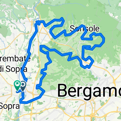
- Ponte San Pietro, Lombardie, Italie
Un itinéraire vélo au départ de Ponte San Pietro, Lombardie, Italie.
Vue d'ensemble
Itinéraire de connexion vers Lecco ou Trezzo sul Adda (en évitant les grandes routes) Commencez à la gare de Ponte.S.Pietro, descendez jusqu'au rond-point et tournez à gauche dans la via Marconi, suivez jusqu'à la fin, tournez à droite sur la SS342 et au feu de circulation après 200 m tournez à gauche --> Ambivere/Mapello, suivez la rue et tournez à droite vers le Centro Papa Giovanni23, tournez à droite dans la Via Dante Alghieri, à gauche dans la Via Alessandro Manzoni, à droite dans la Via Alcide de Gasperi, à droite dans la Via Kennedy, à gauche dans la Via Sanzio, derrière à droite, tournez à gauche à la via Madonna del Carmine (ici commence l'ascension raide sur chemin/rue non pavée), après l'ascension, court descent et court montée, tournez à droite sur le petit chemin, à la fin du chemin tournez à droite sur la route non pavée (restez parallèle à la SS342 dans la vallée), derrière le cimetière tournez à gauche, tournez à gauche dans la Via Gandorla vers Odiago (100 m derrière Odiago, à droite, prenez le chemin à gauche vers le bas avant le virage à droite - uniquement VTT !) À la fin de la route, tournez à droite --> Brivio/Lecco À la fin de la route, tournez à gauche sur la SS342, traversez le pont, directement après le pont descendez vers les rives de l'Adda par une petite route, si vous le manquez, à 100 m plus loin, tournez à droite
créé il y a 18 ans
Qualité de l’itinéraire
Route tranquille
9 km
(60 %)
Route forestière
2 km
(13 %)
Pavé
11,5 km
(76 %)
Non pavé
3,3 km
(22 %)
Asphalte
11,5 km
(76 %)
Sol
2,6 km
(17 %)
Continuer avec Bikemap
Tu veux parcourir Ponte S.Pietro to Brivio (Adda) ou l’adapter à ton propre voyage ? Voici ce que tu peux faire avec cet itinéraire Bikemap :
Essai gratuit de 3 jours, ou paiement unique. En savoir plus sur Bikemap Premium.
Découvre plus de fonctionnalités Premium.
Obtiens Bikemap PremiumDe notre communauté
Ouvre-la dans l’app