חצב 60, כפר ורדים to הדס 15, כפר ורדים
- 4,4 km
- 46 m
- 63 m
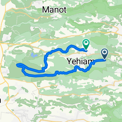
- maalot Tarshīhā, District nord, Israël
Un itinéraire vélo au départ de maalot Tarshīhā, District nord, Israël.
Vue d'ensemble
אורך:43 ק"מ
גובה: 830 מטר
תאור: אחוזת אסיינדה, אגם מונפורט, חזרה לכביש 89, צפונה, תרשיחא, כביש 8833, עין יעקב, געתון, שמאלה בכביש 89, צומת כברי, כביש 70, שמאלה 8721, ג'את, ינוח, כפר ורדים, שמאלה ב- 89
créé il y a 8 ans
Continuer avec Bikemap
Tu veux parcourir מעלות תרשיחא-מונפורט-עין יעקב-כברי-כפר ורדים ou l’adapter à ton propre voyage ? Voici ce que tu peux faire avec cet itinéraire Bikemap :
Essai gratuit de 3 jours, ou paiement unique. En savoir plus sur Bikemap Premium.
Découvre plus de fonctionnalités Premium.
Obtiens Bikemap PremiumDe notre communauté
Ouvre-la dans l’app