

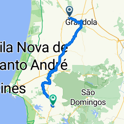
Rota Vicentina MTB - Grandola / Santiago do Cacém
Un itinéraire vélo au départ de Grândola, Setúbal, Portugal.
Vue d'ensemble
À propos du circuit
Grandola is a small town in the Alentejo region. With remains from the Roman times this village is nowadays known as the city of the revolution! This is because it was from Grandôla that the Revolution from April 25th 1974 started towards the capital Lisbon.
From Grandola you will ride through Grandola sierra, along a beautifull forest. Corktree is the most common tree as this region is the portuguese capital of the cork.
Santa Margarida da Serra is the first village yu will meet. This is a characteristic village from the traditional Alentejo region. Here you can stop for a drink or snack or relax at the park just in front from a 16th century church and the observatorium of the Grandola's sierra.
From this point you will enjoy from a rollercoster trail along a river untill you meet the second village, São Bartolomeu da Serra. After a fast descent you will then face a gentle climb up to the entrance of Santiago do Cacém. The panoramic viwe over the city will welcome you to this historic place.
- -:--
- Durée
- 47,2 km
- Distance
- ---
- Montée
- ---
- Descente
- ---
- Vit. moyenne
- ---
- Altitude max.

Photos de l’itinéraire


Qualité de l’itinéraire
Types de voies et surfaces le long de l’itinéraire
Types de routes
Route forestière
31,2 km
(66 %)
Route tranquille
6,6 km
(14 %)
surfaces
Pavé
6,1 km
(13 %)
Non pavé
9,9 km
(21 %)
Non pavé (non défini)
6,1 km
(13 %)
Pavé (non défini)
4,2 km
(9 %)
Points forts de l’itinéraire
Points d’intérêt le long de l’itinéraire

Point d'intérêt après 10,6 km
Caffe for drinks or snacks

Point d'intérêt après 34,7 km
Caffe for a drink or snack
Continuer avec Bikemap
Utilise, modifie ou télécharge cet itinéraire vélo
Tu veux parcourir Rota Vicentina MTB - Grandola / Santiago do Cacém ou l’adapter à ton propre voyage ? Voici ce que tu peux faire avec cet itinéraire Bikemap :
Fonctionnalités gratuites
- Enregistre cet itinéraire comme favori ou dans une collection
- Copie et planifie ta propre version de cet itinéraire
- Synchronise ton itinéraire avec Garmin ou Wahoo
Fonctionnalités Premium
Essai gratuit de 3 jours, ou paiement unique. En savoir plus sur Bikemap Premium.
- Navigue sur cet itinéraire sur iOS et Android
- Exporter un fichier GPX / KML de cet itinéraire
- Crée ton impression personnalisée (essaie-la gratuitement)
- Télécharge cet itinéraire pour la navigation hors ligne
Découvre plus de fonctionnalités Premium.
Obtiens Bikemap PremiumDe notre communauté
Grândola : Autres itinéraires populaires qui commencent ici
 União das freguesias de Grândola e Santa Margarida da Serra, Grândola to Loteamento Vila Amoreira 17, Grândola
- Distance
- 5 km
- Montée
- 7 m
- Descente
- 20 m
- Emplacement
- Grândola, Setúbal, Portugal
 Rua Principal 105, Grândola to Alameda José Amaro, Grândola
- Distance
- 3,6 km
- Montée
- 26 m
- Descente
- 10 m
- Emplacement
- Grândola, Setúbal, Portugal
 Rota D2_2020
- Distance
- 53,9 km
- Montée
- 739 m
- Descente
- 683 m
- Emplacement
- Grândola, Setúbal, Portugal
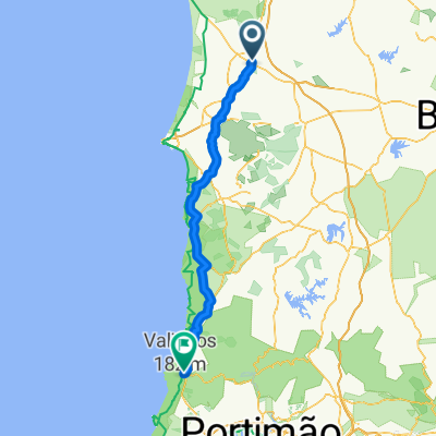 Restful ride in Aljezur
- Distance
- 120,9 km
- Montée
- 1 169 m
- Descente
- 1 234 m
- Emplacement
- Grândola, Setúbal, Portugal
 Évora - Tameira - Dia 4 (possibilidade 3)
- Distance
- 107,6 km
- Montée
- 743 m
- Descente
- 687 m
- Emplacement
- Grândola, Setúbal, Portugal
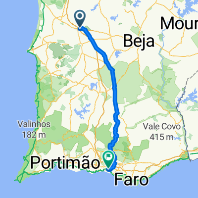 Grandola - Vilamoura 146km
- Distance
- 146,3 km
- Montée
- 934 m
- Descente
- 977 m
- Emplacement
- Grândola, Setúbal, Portugal
 Deutschland - Portugal (Berlin - Faro) PT 18 Grândola - Santiago do Cacém
- Distance
- 28,1 km
- Montée
- 413 m
- Descente
- 313 m
- Emplacement
- Grândola, Setúbal, Portugal
 Grândola as Silveiras e volta
- Distance
- 19,1 km
- Montée
- 238 m
- Descente
- 236 m
- Emplacement
- Grândola, Setúbal, Portugal
Ouvre-la dans l’app