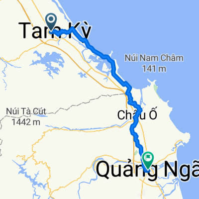

Tam Kỳ - Quảng Ngãi
- 83,2 km
- 320 m
- 320 m
- Tam Kỳ, Quảng Nam, Viêt Nam
Un itinéraire vélo au départ de Tam Kỳ, Quảng Nam, Viêt Nam.
Vue d'ensemble
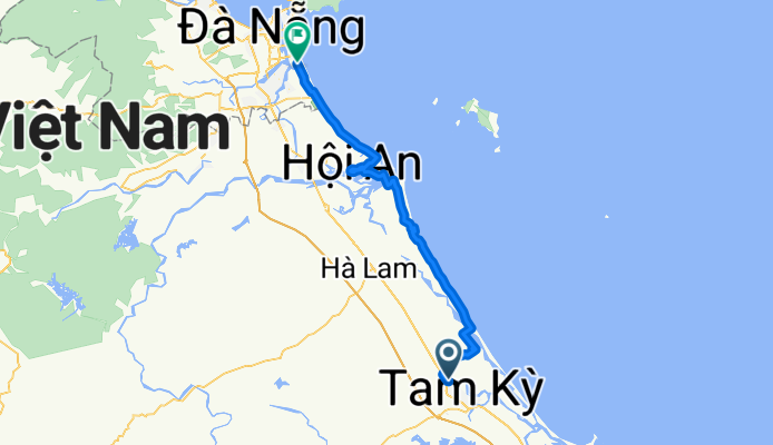
J25 - Lundi 29 janvier 2018 – Tam Ky – Da Nang
Distance parcourue : 79,61 Km - Moyenne : 11,3 Km/h
Dénivelé montant : 65 m - Pente montante Maxi : 3 %
Dénivelé descendant : 60 m - Pente descendante maxi : 3 %
Altitude départ : 3 m - Altitude arrivée : 8 m - Altitude Maxi : 18 m
créé il y a 8 ans
Continuer avec Bikemap
Tu veux parcourir J25 - Lundi 29 janvier 2018 – Tam Ky – Da Nang ou l’adapter à ton propre voyage ? Voici ce que tu peux faire avec cet itinéraire Bikemap :
Essai gratuit de 3 jours, ou paiement unique. En savoir plus sur Bikemap Premium.
Découvre plus de fonctionnalités Premium.
Obtiens Bikemap PremiumDe notre communauté
Ouvre-la dans l’app