

PASSO DELLO STELVIO - Umbrail Pass
Un itinéraire vélo au départ de Glorenza, Trentin-Haut-Adige, Italie.
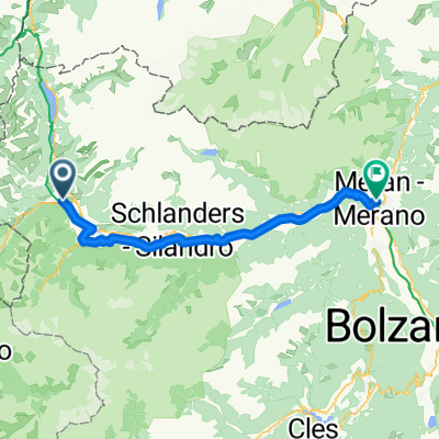
Vue d'ensemble
À propos du circuit
We’ll set out from Bormio to climb the legendary Stelvio, turning off at Umbrail pass to then make the beautiful descent into Switzerland. We circle back into Italy to make our second ascent of Stelvio on the classic side, which was the route of one of Coppi’s most famous victories – Stage 20 of the 1953 Giro. Coppi beat his Swiss rival Hugo Koblet over the Stelvio, sprinted to the finish to win the stage, taking the pink jersey from Koblet to win his record 5th Giro. Today - 15 September - is the 99th anniversary of his birth, so we’ll celebrate his birthday on the top of Stelvio. What better way to pay tribute to Coppi than by ascending epic Stelvio, the 2nd highest paved pass in Europe … twice!
- -:--
- Durée
- 63,2 km
- Distance
- 1 853 m
- Montée
- 1 853 m
- Descente
- ---
- Vit. moyenne
- ---
- Altitude max.

Qualité de l’itinéraire
Types de voies et surfaces le long de l’itinéraire
Types de routes
Route fréquentée
37,9 km
(60 %)
Piste cyclable
8,2 km
(13 %)
surfaces
Pavé
51,9 km
(82 %)
Non pavé
5,5 km
(9 %)
Asphalte
50,7 km
(80 %)
Gravier
3,3 km
(5 %)
Continuer avec Bikemap
Utilise, modifie ou télécharge cet itinéraire vélo
Tu veux parcourir PASSO DELLO STELVIO - Umbrail Pass ou l’adapter à ton propre voyage ? Voici ce que tu peux faire avec cet itinéraire Bikemap :
Fonctionnalités gratuites
- Enregistre cet itinéraire comme favori ou dans une collection
- Copie et planifie ta propre version de cet itinéraire
- Synchronise ton itinéraire avec Garmin ou Wahoo
Fonctionnalités Premium
Essai gratuit de 3 jours, ou paiement unique. En savoir plus sur Bikemap Premium.
- Navigue sur cet itinéraire sur iOS et Android
- Exporter un fichier GPX / KML de cet itinéraire
- Crée ton impression personnalisée (essaie-la gratuitement)
- Télécharge cet itinéraire pour la navigation hors ligne
Découvre plus de fonctionnalités Premium.
Obtiens Bikemap PremiumDe notre communauté
Glorenza : Autres itinéraires populaires qui commencent ici
 Wiesenweg nach Glurns
- Distance
- 12,5 km
- Montée
- 1 244 m
- Descente
- 172 m
- Emplacement
- Glorenza, Trentin-Haut-Adige, Italie
 Dol Stilfser Joch
- Distance
- 62 km
- Montée
- 1 836 m
- Descente
- 1 836 m
- Emplacement
- Glorenza, Trentin-Haut-Adige, Italie
 Preko tri drzave s autom
- Distance
- 133,4 km
- Montée
- 1 813 m
- Descente
- 1 808 m
- Emplacement
- Glorenza, Trentin-Haut-Adige, Italie
 Stelvio - Gavia
- Distance
- 96,1 km
- Montée
- 3 200 m
- Descente
- 2 862 m
- Emplacement
- Glorenza, Trentin-Haut-Adige, Italie
 🚴♀️E*Bike🇮🇩 MALS-GLURNS- MERAN
- Distance
- 61 km
- Montée
- 62 m
- Descente
- 682 m
- Emplacement
- Glorenza, Trentin-Haut-Adige, Italie
 20140617_095125.gpx
- Distance
- 61,1 km
- Montée
- 50 m
- Descente
- 659 m
- Emplacement
- Glorenza, Trentin-Haut-Adige, Italie
 Stilfserjoch
- Distance
- 65 km
- Montée
- 1 856 m
- Descente
- 1 856 m
- Emplacement
- Glorenza, Trentin-Haut-Adige, Italie
 Glurns nach Melag (Südtirol)
- Distance
- 28,7 km
- Montée
- 952 m
- Descente
- 47 m
- Emplacement
- Glorenza, Trentin-Haut-Adige, Italie
Ouvre-la dans l’app