

Loop around Bradford
Un itinéraire vélo au départ de Shipley, Angleterre, Royaume-Uni.
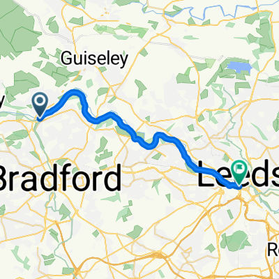
Vue d'ensemble
À propos du circuit
version 1.1
Presque tout sur routes. J'ai essayé d'utiliser des pistes cyclables et des routes plus calmes à travers les quartiers lorsque c'était possible, mais cela inclut inévitablement beaucoup de grands axes également.
(Le canal peut être utilisé pour un itinéraire plus calme [et plus plat] entre Bingley et Shipley, ou même jusqu'à Apperley Bridge pour rejoindre la route à Greengates.)
Il y a environ 100 m de forêt difficile à Fagley - quelques marches puis un chemin difficile. Cela peut être évité en montant un peu ou tout le long de la Harrogate Rd, puis Leeds Rd->Gain Lane; ou en passant par Calverley et Woodhall Hill, mais techniquement c'est Leeds! ;)
Il y a aussi un petit tronçon difficile qui descend vers le gué sur Harden Beck à Bingley. Le gué est probablement trop profond pour un vélo, mais il y a un pont piéton - accessible par deux étroites barrières. Si vous ne pouvez pas soulever votre vélo, restez sur la route principale vers Bingley puis sortez à nouveau sur Bradford Rd.
C'est prévu dans le sens des aiguilles d'une montre, mais dans le sens inverse, cela offre des montées plus courtes.
- -:--
- Durée
- 48,3 km
- Distance
- 541 m
- Montée
- 541 m
- Descente
- ---
- Vit. moyenne
- ---
- Altitude max.

Qualité de l’itinéraire
Types de voies et surfaces le long de l’itinéraire
Types de routes
Route tranquille
16 km
(33 %)
Route
12,6 km
(26 %)
surfaces
Pavé
9,7 km
(20 %)
Non pavé
1,5 km
(3 %)
Asphalte
9,7 km
(20 %)
Sol
1,5 km
(3 %)
Indéfini
37,2 km
(77 %)
Points forts de l’itinéraire
Points d’intérêt le long de l’itinéraire
Point d'intérêt après 8,2 km
Some steps then a rough woodland path for about 50m. If that's a problem, stay on Oakdale, then there is a footpath through to Wharncliffe, up Harrogate Road, then join Leeds Rd/Gain Lane at Undercliffe.
Point d'intérêt après 42,5 km
Ford. Footpath over via 2 squeeze stiles. Avoidable by going into Bingley town centre and out along Bradford Rd.
Continuer avec Bikemap
Utilise, modifie ou télécharge cet itinéraire vélo
Tu veux parcourir Loop around Bradford ou l’adapter à ton propre voyage ? Voici ce que tu peux faire avec cet itinéraire Bikemap :
Fonctionnalités gratuites
- Enregistre cet itinéraire comme favori ou dans une collection
- Copie et planifie ta propre version de cet itinéraire
- Synchronise ton itinéraire avec Garmin ou Wahoo
Fonctionnalités Premium
Essai gratuit de 3 jours, ou paiement unique. En savoir plus sur Bikemap Premium.
- Navigue sur cet itinéraire sur iOS et Android
- Exporter un fichier GPX / KML de cet itinéraire
- Crée ton impression personnalisée (essaie-la gratuitement)
- Télécharge cet itinéraire pour la navigation hors ligne
Découvre plus de fonctionnalités Premium.
Obtiens Bikemap PremiumDe notre communauté
Shipley : Autres itinéraires populaires qui commencent ici
 Canal and moors
- Distance
- 33,5 km
- Montée
- 329 m
- Descente
- 329 m
- Emplacement
- Shipley, Angleterre, Royaume-Uni
 Bumpy Wharfedale route
- Distance
- 54,3 km
- Montée
- 612 m
- Descente
- 612 m
- Emplacement
- Shipley, Angleterre, Royaume-Uni
 Loop around Bradford
- Distance
- 48,3 km
- Montée
- 541 m
- Descente
- 541 m
- Emplacement
- Shipley, Angleterre, Royaume-Uni
 Greengates to Manjit's loop
- Distance
- 28,3 km
- Montée
- 404 m
- Descente
- 398 m
- Emplacement
- Shipley, Angleterre, Royaume-Uni
 The Moo-ers
- Distance
- 31,8 km
- Montée
- 400 m
- Descente
- 401 m
- Emplacement
- Shipley, Angleterre, Royaume-Uni
 East Morton & East Bradford
- Distance
- 44,5 km
- Montée
- 451 m
- Descente
- 449 m
- Emplacement
- Shipley, Angleterre, Royaume-Uni
 Greengates/Skipton/Eccup loop
- Distance
- 104,9 km
- Montée
- 718 m
- Descente
- 720 m
- Emplacement
- Shipley, Angleterre, Royaume-Uni
 Shipley - Leeds
- Distance
- 20,2 km
- Montée
- 150 m
- Descente
- 190 m
- Emplacement
- Shipley, Angleterre, Royaume-Uni
Ouvre-la dans l’app