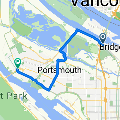
Portland to Seattle - 2018
Un itinéraire vélo au départ de Vancouver, Washington, États Unis.
Vue d'ensemble
À propos du circuit
Retour à Seattle
Après notre trajet de Seattle à Portland (Oregon) lors du STP du Cascade Bicycle Club en 2018, nous avons roulé de nouveau vers Seattle après quelques jours de repos.
Nous avons pris un itinéraire légèrement différent en allant vers le nord à travers Vancouver, Washington, qui évitait le long tronçon de la Highway 30 qui faisait partie de l'itinéraire du STP vers Portland. Dans l'ensemble, c'était un meilleur itinéraire. Nous avons également utilisé le Inter-Urban Trail à mesure que nous nous approchions de Seattle.
Une montée, qui se trouvait le long de Green Mountain Road, était très raide et un véritable défi, surtout avec des sacoches. Dieu merci pour un rapport de "grand-mère" à l'avant. Préparez-vous à envisager de pousser, si nécessaire. J'ai fait un calcul très approximatif en utilisant la carte de relief de BikeMap et j'ai trouvé que la pente sur un tronçon de quelques centaines de mètres de la montée dépassait les 20 %.
Nous avons effectué cette balade en deux jours, passant la nuit à Centralia, Washington.
À l'exception d'un très court tronçon, tout le trajet s'est fait sur des routes assez bien pavées. La plupart des routes étaient soit à faible circulation, soit à circulation plus importante avec un peu de bande d'arrêt d'urgence.
- -:--
- Durée
- 304,5 km
- Distance
- 896 m
- Montée
- 800 m
- Descente
- ---
- Vit. moyenne
- ---
- Altitude max.
Photos de l’itinéraire
Qualité de l’itinéraire
Types de voies et surfaces le long de l’itinéraire
Types de routes
Route
112,7 km
(37 %)
Piste cyclable
45,7 km
(15 %)
surfaces
Pavé
124,8 km
(41 %)
Asphalte
106,6 km
(35 %)
Pavé (non défini)
15,2 km
(5 %)
Continuer avec Bikemap
Utilise, modifie ou télécharge cet itinéraire vélo
Tu veux parcourir Portland to Seattle - 2018 ou l’adapter à ton propre voyage ? Voici ce que tu peux faire avec cet itinéraire Bikemap :
Fonctionnalités gratuites
- Enregistre cet itinéraire comme favori ou dans une collection
- Copie et planifie ta propre version de cet itinéraire
- Divise-le en étapes pour créer un tour sur plusieurs jours
- Synchronise ton itinéraire avec Garmin ou Wahoo
Fonctionnalités Premium
Essai gratuit de 3 jours, ou paiement unique. En savoir plus sur Bikemap Premium.
- Navigue sur cet itinéraire sur iOS et Android
- Exporter un fichier GPX / KML de cet itinéraire
- Crée ton impression personnalisée (essaie-la gratuitement)
- Télécharge cet itinéraire pour la navigation hors ligne
Découvre plus de fonctionnalités Premium.
Obtiens Bikemap PremiumDe notre communauté
Vancouver : Autres itinéraires populaires qui commencent ici
 Two bridge loop
- Distance
- 48,9 km
- Montée
- 123 m
- Descente
- 124 m
- Emplacement
- Vancouver, Washington, États Unis
 W-B17_RooseveltHS-h1
- Distance
- 4,9 km
- Montée
- 0 m
- Descente
- 0 m
- Emplacement
- Vancouver, Washington, États Unis
 North Portland Trails
- Distance
- 36,8 km
- Montée
- 156 m
- Descente
- 155 m
- Emplacement
- Vancouver, Washington, États Unis
 Kelley Point
- Distance
- 26,5 km
- Montée
- 83 m
- Descente
- 87 m
- Emplacement
- Vancouver, Washington, États Unis
 Steady ride in Portland
- Distance
- 16,9 km
- Montée
- 10 m
- Descente
- 16 m
- Emplacement
- Vancouver, Washington, États Unis
 North Portland Trails
- Distance
- 55 km
- Montée
- 368 m
- Descente
- 394 m
- Emplacement
- Vancouver, Washington, États Unis
 Slow ride in Portland
- Distance
- 11 km
- Montée
- 4 m
- Descente
- 8 m
- Emplacement
- Vancouver, Washington, États Unis
 Two Bridge Loop
- Distance
- 29,5 km
- Montée
- 136 m
- Descente
- 138 m
- Emplacement
- Vancouver, Washington, États Unis
Ouvre-la dans l’app


