

Taiwan Round Island Day 1 (台湾自行车环岛): Taipei - Hsinchu (台北 - 新竹)
Un itinéraire vélo au départ de Taipei, Taipei, Taïwan.
Vue d'ensemble
À propos du circuit
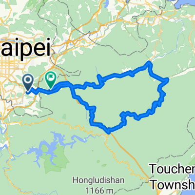
This route is filled with twists and turns among rolling hills; for riders who are comfortable with climbing then this route, with its total ascent of 300 meters in elevation, will be an easy ride.
Today’s journey is a great one, with numerous places to stop along the way to grab a tasty snack. The longest old street in Taiwan, which dates to Japanese colonial times, is found in Sanxia, along this route.
After leaving Sanxia, the route heads to Shimen Reservoir where you can stop for a rest and a bowl of herbal-jelly shaved ice in Guanxi. After riding for 80 km, you arrive in Miaokou, Hsinchu, which is known at the Windy City.
The City God Temple, grade-three national historic site, welcomes you. Renowned snack stands await you and your tired legs near this famous monument.
Source: Taiwan Tourism
- -:--
- Durée
- 86,3 km
- Distance
- 396 m
- Montée
- 388 m
- Descente
- ---
- Vit. moyenne
- ---
- Altitude max.

Continuer avec Bikemap
Utilise, modifie ou télécharge cet itinéraire vélo
Tu veux parcourir Taiwan Round Island Day 1 (台湾自行车环岛): Taipei - Hsinchu (台北 - 新竹) ou l’adapter à ton propre voyage ? Voici ce que tu peux faire avec cet itinéraire Bikemap :
Fonctionnalités gratuites
- Enregistre cet itinéraire comme favori ou dans une collection
- Copie et planifie ta propre version de cet itinéraire
- Divise-le en étapes pour créer un tour sur plusieurs jours
- Synchronise ton itinéraire avec Garmin ou Wahoo
Fonctionnalités Premium
Essai gratuit de 3 jours, ou paiement unique. En savoir plus sur Bikemap Premium.
- Navigue sur cet itinéraire sur iOS et Android
- Exporter un fichier GPX / KML de cet itinéraire
- Crée ton impression personnalisée (essaie-la gratuitement)
- Télécharge cet itinéraire pour la navigation hors ligne
Découvre plus de fonctionnalités Premium.
Obtiens Bikemap PremiumDe notre communauté
Taipei : Autres itinéraires populaires qui commencent ici
 阿柔洋-政大道南橋
- Distance
- 13 km
- Montée
- 688 m
- Descente
- 698 m
- Emplacement
- Taipei, Taipei, Taïwan
 大稻埕→西濱→竹圍漁港→永安漁港
- Distance
- 67,8 km
- Montée
- 95 m
- Descente
- 89 m
- Emplacement
- Taipei, Taipei, Taïwan
 台北←→桃園三坑老街
- Distance
- 111 km
- Montée
- 321 m
- Descente
- 315 m
- Emplacement
- Taipei, Taipei, Taïwan
 秘境之旅-南港,汐止,平溪,石碇
- Distance
- 66,8 km
- Montée
- 1 419 m
- Descente
- 1 418 m
- Emplacement
- Taipei, Taipei, Taïwan
 陽明山第五條:天元宮→巴拉卡公路→大屯山助航站
- Distance
- 15,9 km
- Montée
- 952 m
- Descente
- 37 m
- Emplacement
- Taipei, Taipei, Taïwan
 系列七 海王星-闊瀨尋奇
- Distance
- 82,8 km
- Montée
- 1 299 m
- Descente
- 1 281 m
- Emplacement
- Taipei, Taipei, Taïwan
 陽金P字山道
- Distance
- 74,9 km
- Montée
- 1 995 m
- Descente
- 1 604 m
- Emplacement
- Taipei, Taipei, Taïwan
 Short bike tour through Taipei City
- Distance
- 3,2 km
- Montée
- 295 m
- Descente
- 295 m
- Emplacement
- Taipei, Taipei, Taïwan
Ouvre-la dans l’app