

salita da Marradi al passo carnevale
Un itinéraire vélo au départ de Marradi, Toscane, Italie.
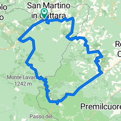
Vue d'ensemble
À propos du circuit
An entire stage into the magical florests of the Casentino. From the second day we start to get serious With an altitude increase worthy of a half-mountain stage there will be little time to rest. The first climb of 7-8 km that takes us to Passo Carnevale will be among the sweetest of the whole day. From Marradi, taking to San Benedetto in Alpe the road returns to tighten and creeps into the equally narrow valley of the Rio Salto. From there Eremo and Peschiera with the Casentino forests as background. Arrival at the Acquacheta, now a place and destination of tourism, both for its literary value and for its naturalistic value. From here, a fast succession that runs along the Montone river up to Portico di Romagna to begin the ascent to Valico di Monte Sacco and Busca pass, relatively easy pass, 7.2 km at a 5.0% gradient, then, 6.5 km downhill to Tredozio where you will return to Tuscany passing through the small fraction of Lutirano. This is an insidious part with steep slopes, therefore arriving at Sant Adriano where turning left along the road 302 for 5 km you will arrive at Marradi. We are almost at the end of the day, the first 4 very long kilometers develop at the edge of the narrow valley of the Collecchio ditch, an endless series of curves and counter-curves with a slope that oscillates continuously between 8 and 10%. Now, 6km all downhill to reach Palazzuolo.
- 47 min
- Durée
- 6,6 km
- Distance
- 583 m
- Montée
- 217 m
- Descente
- 8,4 km/h
- Vit. moyenne
- 695 m
- Altitude max.

Qualité de l’itinéraire
Types de voies et surfaces le long de l’itinéraire
Types de routes
Route fréquentée
6,6 km
(100 %)
surfaces
Pavé
6,6 km
(100 %)
Asphalte
6,6 km
(100 %)
Continuer avec Bikemap
Utilise, modifie ou télécharge cet itinéraire vélo
Tu veux parcourir salita da Marradi al passo carnevale ou l’adapter à ton propre voyage ? Voici ce que tu peux faire avec cet itinéraire Bikemap :
Fonctionnalités gratuites
- Enregistre cet itinéraire comme favori ou dans une collection
- Copie et planifie ta propre version de cet itinéraire
- Synchronise ton itinéraire avec Garmin ou Wahoo
Fonctionnalités Premium
Essai gratuit de 3 jours, ou paiement unique. En savoir plus sur Bikemap Premium.
- Navigue sur cet itinéraire sur iOS et Android
- Exporter un fichier GPX / KML de cet itinéraire
- Crée ton impression personnalisée (essaie-la gratuitement)
- Télécharge cet itinéraire pour la navigation hors ligne
Découvre plus de fonctionnalités Premium.
Obtiens Bikemap PremiumDe notre communauté
Marradi : Autres itinéraires populaires qui commencent ici
 Crespino del Lamone - Montepiano
- Distance
- 59,5 km
- Montée
- 1 300 m
- Descente
- 1 144 m
- Emplacement
- Marradi, Toscane, Italie
 Marradi-Poppi
- Distance
- 97,7 km
- Montée
- 1 536 m
- Descente
- 1 430 m
- Emplacement
- Marradi, Toscane, Italie
 salita da Marradi al passo carnevale
- Distance
- 6,6 km
- Montée
- 583 m
- Descente
- 217 m
- Emplacement
- Marradi, Toscane, Italie
 Marradi-San Benedetto in Alpe-Corniolo
- Distance
- 53,1 km
- Montée
- 1 697 m
- Descente
- 1 441 m
- Emplacement
- Marradi, Toscane, Italie
 S.Adriano-Lutirano-Tredozio-S.Benedetto-Marradi
- Distance
- 66,8 km
- Montée
- 1 467 m
- Descente
- 1 469 m
- Emplacement
- Marradi, Toscane, Italie
 4 tappa da Marradi – a Spinello
- Distance
- 74,5 km
- Montée
- 1 779 m
- Descente
- 1 303 m
- Emplacement
- Marradi, Toscane, Italie
 Via Fabroni 58, Marradi nach Castello di Valenzano 97, Subbiano
- Distance
- 109,6 km
- Montée
- 3 084 m
- Descente
- 2 878 m
- Emplacement
- Marradi, Toscane, Italie
 S.Andrea-Tredozio-Portico-S.Benedetto in Alpe-Marradi06/ago/2015
- Distance
- 66,9 km
- Montée
- 1 498 m
- Descente
- 1 501 m
- Emplacement
- Marradi, Toscane, Italie
Ouvre-la dans l’app