Climb challenge
Un itinéraire vélo au départ de Trimsaran, Wales, United Kingdom.
Vue d'ensemble
À propos du circuit
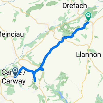
Thiis is a serious challenge which involves some main roads, country roads and cycle paths. There are steep climbs here with Herberdeg Road being the most challenging, in my opinion. The main roads arnen't overly busy but some of the country roads are narrow with rough surfaces in places, be prepared to stop to allow traffic to pass on these. Some of you will find the climbs too severe but if you manage to complete this course then Alpe d'huez will be a piece of cake (maybe)? The last part of the course from Cynheidre to Trimsaran is mostly a cycle path and a leisurly ride back to Trimsaran Start at Trimsaran leisure centre and finish off here for a nice cup of tea at Cafe Becca. Cycle from Trimsaran towards Mynyddygarreg for your warmp up hill session and then mostly down hill to Pontyates. You really need to have your hill cycling legs with you to complete this course. It is not a race and please don't treat it as such for some of the roads are not designed for it but what a lung expander. Note, when you enter Trimsaran for the second time some of you may wish to end the challenge here. Also at the last visit to Cynheidre you could take the shorter main road route back to Trimsaran with just one more sharp little climb as you turn off from Pontyates to Carway.
- -:--
- Durée
- 75 km
- Distance
- 869 m
- Montée
- 869 m
- Descente
- ---
- Vit. moyenne
- ---
- Altitude max.
Qualité de l’itinéraire
Types de voies et surfaces le long de l’itinéraire
Types de routes
Route tranquille
33,1 km
(44 %)
Route fréquentée
25,2 km
(34 %)
surfaces
Pavé
22,8 km
(30 %)
Non pavé
0,4 km
(<1 %)
Asphalte
22,8 km
(30 %)
Gravier
0,4 km
(<1 %)
Indéfini
51,9 km
(69 %)
Continuer avec Bikemap
Utilise, modifie ou télécharge cet itinéraire vélo
Tu veux parcourir Climb challenge ou l’adapter à ton propre voyage ? Voici ce que tu peux faire avec cet itinéraire Bikemap :
Fonctionnalités gratuites
- Enregistre cet itinéraire comme favori ou dans une collection
- Copie et planifie ta propre version de cet itinéraire
- Synchronise ton itinéraire avec Garmin ou Wahoo
Fonctionnalités Premium
Essai gratuit de 3 jours, ou paiement unique. En savoir plus sur Bikemap Premium.
- Navigue sur cet itinéraire sur iOS et Android
- Exporter un fichier GPX / KML de cet itinéraire
- Crée ton impression personnalisée (essaie-la gratuitement)
- Télécharge cet itinéraire pour la navigation hors ligne
Découvre plus de fonctionnalités Premium.
Obtiens Bikemap PremiumDe notre communauté
Trimsaran : Autres itinéraires populaires qui commencent ici
 51.736, -4.223 to 51.786, -4.117
- Distance
- 12,9 km
- Montée
- 204 m
- Descente
- 113 m
- Emplacement
- Trimsaran, Wales, United Kingdom
 Capel Teilo Road, Kidwelly to Capel Teilo Road, Kidwelly
- Distance
- 2,9 km
- Montée
- 77 m
- Descente
- 77 m
- Emplacement
- Trimsaran, Wales, United Kingdom
 Heol Horeb, Five Roads, Llanelli to 60 Carmarthen Road, Llanelli
- Distance
- 11,8 km
- Montée
- 76 m
- Descente
- 51 m
- Emplacement
- Trimsaran, Wales, United Kingdom
 Heol Horeb to Tir Capel
- Distance
- 7 km
- Montée
- 27 m
- Descente
- 116 m
- Emplacement
- Trimsaran, Wales, United Kingdom
 Heol Morlais-B4308-Monksford Street
- Distance
- 66,5 km
- Montée
- 537 m
- Descente
- 515 m
- Emplacement
- Trimsaran, Wales, United Kingdom
 Moderate route in Llanelli
- Distance
- 11,8 km
- Montée
- 121 m
- Descente
- 92 m
- Emplacement
- Trimsaran, Wales, United Kingdom
 Trimsaran, Meincau, Trimsaran, Pen Y Mynydd, Pembrey, Llanelli
- Distance
- 37,3 km
- Montée
- 407 m
- Descente
- 454 m
- Emplacement
- Trimsaran, Wales, United Kingdom
 Climb challenge
- Distance
- 75 km
- Montée
- 869 m
- Descente
- 869 m
- Emplacement
- Trimsaran, Wales, United Kingdom
Ouvre-la dans l’app

