- 11,6 km
- 7 m
- 7 m
- Burnsville, Minnesota, États Unis
B2B00357 55337>55403 via High Line Trl, Pilot Knob Rd, Mendota Bridge, Hiawatha Trl
Un itinéraire vélo au départ de Burnsville, Minnesota, États Unis.
Vue d'ensemble
À propos du circuit
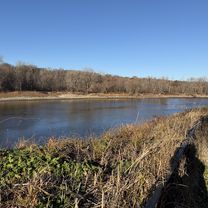
Cet itinéraire offre de nombreuses options puisque la distance est si longue. L'itinéraire tracé repose principalement sur des pistes cyclables et des sentiers. Pilot Knob a des sentiers de part et d'autre de la route, mais il faut faire preuve de prudence car le chemin traverse des intersections et des allées très fréquentées.
Le chemin continue à travers Ft Snelling et monte sur le Hiawatha Trail, où vous roulerez pratiquement à côté du tramway jusqu'au centre-ville.
Si le trafic n'est pas un problème, il serait possible de prendre Sibley Hwy (13) jusqu'au pont Mendota, mais vous devrez compter sur une bande d'arrêt d'urgence.
Une autre option est de prendre le tramway depuis le pont 494. La traversée se termine dans une impasse où vous pouvez rejoindre la route (E 80th/American Blvd) et suivre la route jusqu'à un feu de circulation. Si vous tournez à gauche sur 34th Ave/Old Shakopee, il y aura un chemin pour accéder à une station de tramway.
- -:--
- Durée
- 35,3 km
- Distance
- 212 m
- Montée
- 230 m
- Descente
- ---
- Vit. moyenne
- ---
- Altitude max.
créé il y a 17 ans
Points forts de l’itinéraire
Points d’intérêt le long de l’itinéraire
Point d'intérêt après 16 km
494 path to light rail station
Point d'intérêt après 16,9 km
Continue on path to light rail station
Point d'intérêt après 16,9 km
Light Rail station
Continuer avec Bikemap
Utilise, modifie ou télécharge cet itinéraire vélo
Tu veux parcourir B2B00357 55337>55403 via High Line Trl, Pilot Knob Rd, Mendota Bridge, Hiawatha Trl ou l’adapter à ton propre voyage ? Voici ce que tu peux faire avec cet itinéraire Bikemap :
Fonctionnalités gratuites
- Enregistre cet itinéraire comme favori ou dans une collection
- Copie et planifie ta propre version de cet itinéraire
- Synchronise ton itinéraire avec Garmin ou Wahoo
Fonctionnalités Premium
Essai gratuit de 3 jours, ou paiement unique. En savoir plus sur Bikemap Premium.
- Navigue sur cet itinéraire sur iOS et Android
- Exporter un fichier GPX / KML de cet itinéraire
- Crée ton impression personnalisée (essaie-la gratuitement)
- Télécharge cet itinéraire pour la navigation hors ligne
Découvre plus de fonctionnalités Premium.
Obtiens Bikemap PremiumDe notre communauté
Burnsville : Autres itinéraires populaires qui commencent ici
- Black Dog Rd, Burnsville to Black Dog Rd, Burnsville
- 2090 CR-42 W, Burnsville to 3228 Bryant Ave S, Minneapolis
- 26,5 km
- 148 m
- 186 m
- Burnsville, Minnesota, États Unis
- Judicial Rd, Burnsville to Upper 136th Street Ct W, Apple Valley
- 13,4 km
- 122 m
- 113 m
- Burnsville, Minnesota, États Unis
- Black Dog Rd, Burnsville to Black Dog Rd, Burnsville
- 12 km
- 3 m
- 4 m
- Burnsville, Minnesota, États Unis
- Bluff Trail, Bloomington to Bluff Trail, Bloomington
- 13,5 km
- 3 m
- 3 m
- Burnsville, Minnesota, États Unis
- Bloomington to Bluff Trail, Bloomington
- 13,3 km
- 13 m
- 9 m
- Burnsville, Minnesota, États Unis
- Black Dog Rd, Burnsville to Black Dog Rd, Burnsville
- 11,7 km
- 9 m
- 6 m
- Burnsville, Minnesota, États Unis
- 44.748° N -93.305° W to 3228 Bryant Ave S, Minneapolis
- 27,4 km
- 136 m
- 177 m
- Burnsville, Minnesota, États Unis
Ouvre-la dans l’app


