B2B00503 55408 > 55455 via Greenway, LRT, Washington
Un itinéraire vélo au départ de Minneapolis, Minnesota, États Unis.
Vue d'ensemble
À propos du circuit
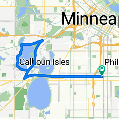
Head south on Bryant to the Greenway entrance ramp which is just south of 28th St. Take a left onto the Greenway, and head east. When you reach 28th Street/Hiawatha, take the bike bridge over Hiawatha. (Note: before you enter onto the bridge, you must cross 28th where cross traffic does not have a stop sign.) Once over the bridge, take a left to head north along the trail (alongside the Hiawathat Light Rail). When you reach the Cedar Riverside Station, take a right onto 15th, and a right onto 6th St. Take 6th St to 20th Ave, where you take a left and head into campus. 20th will end at 4th St, where you take a right, and a quick left onto the campus bike lane. Follow that north to the bike/pedestrian bridge (Washington) and follow over the River. Once on the East bank, veer right, around the curve which backtracks toward the river. Take the river road southeast for a few blocks to Harvard, and take a left to your destination.
- -:--
- Durée
- 9,4 km
- Distance
- 86 m
- Montée
- 106 m
- Descente
- ---
- Vit. moyenne
- ---
- Altitude max.
Continuer avec Bikemap
Utilise, modifie ou télécharge cet itinéraire vélo
Tu veux parcourir B2B00503 55408 > 55455 via Greenway, LRT, Washington ou l’adapter à ton propre voyage ? Voici ce que tu peux faire avec cet itinéraire Bikemap :
Fonctionnalités gratuites
- Enregistre cet itinéraire comme favori ou dans une collection
- Copie et planifie ta propre version de cet itinéraire
- Synchronise ton itinéraire avec Garmin ou Wahoo
Fonctionnalités Premium
Essai gratuit de 3 jours, ou paiement unique. En savoir plus sur Bikemap Premium.
- Navigue sur cet itinéraire sur iOS et Android
- Exporter un fichier GPX / KML de cet itinéraire
- Crée ton impression personnalisée (essaie-la gratuitement)
- Télécharge cet itinéraire pour la navigation hors ligne
Découvre plus de fonctionnalités Premium.
Obtiens Bikemap PremiumDe notre communauté
Minneapolis : Autres itinéraires populaires qui commencent ici
 6-3 On East And West River Parkway
- Distance
- 21,4 km
- Montée
- 245 m
- Descente
- 248 m
- Emplacement
- Minneapolis, Minnesota, États Unis
 30 Miles
- Distance
- 46,5 km
- Montée
- 122 m
- Descente
- 142 m
- Emplacement
- Minneapolis, Minnesota, États Unis
 1500–1562 Spruce Pl, Minneapolis to 1512 Spruce Pl, Minneapolis
- Distance
- 25 km
- Montée
- 106 m
- Descente
- 107 m
- Emplacement
- Minneapolis, Minnesota, États Unis
 TCAC Cedar Lake Loop
- Distance
- 15,9 km
- Montée
- 55 m
- Descente
- 54 m
- Emplacement
- Minneapolis, Minnesota, États Unis
 34 Spruce Pl, Minneapolis to Loring Park, Minneapolis
- Distance
- 15,3 km
- Montée
- 62 m
- Descente
- 63 m
- Emplacement
- Minneapolis, Minnesota, États Unis
 1512 Spruce Pl, Minneapolis to 1512 Spruce Pl, Minneapolis
- Distance
- 27,3 km
- Montée
- 123 m
- Descente
- 123 m
- Emplacement
- Minneapolis, Minnesota, États Unis
 East/West River Ride
- Distance
- 22,6 km
- Montée
- 216 m
- Descente
- 217 m
- Emplacement
- Minneapolis, Minnesota, États Unis
 Three Lakes
- Distance
- 15,9 km
- Montée
- 55 m
- Descente
- 56 m
- Emplacement
- Minneapolis, Minnesota, États Unis
Ouvre-la dans l’app

