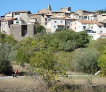
2019-14 St-Jean-du-Gard to Lablachère
Un itinéraire vélo au départ de Saint-Jean-du-Gard, Occitanie, France.
Vue d'ensemble
À propos du circuit
In 2019, we did self-supported touring for a little less than 2 months from mid-September through early November.
Day 14 - St-Jean-du-Gard to Lablachère
Today's ride was mostly on roads with moderate traffic.
D907, D129, and D50 getting to Alès were excellent. D904 occasionally had some shoulder, but more would have been better. Fortunately, on the climb after St-Ambroix, there was excellent shoulder. After the climb at the le Gard/Ardèche border, the shoulder ended. Hopefully Ardèche will someday see the light and add good shoulder. D104A was a beautiful road, but had slightly more traffic on it than we expected for such a relatively remote road. Maybe it was just the time that we were on it.
Overall, not a bad ride, though we would recommend using smaller roads if you have the time.
- -:--
- Durée
- 78,3 km
- Distance
- 649 m
- Montée
- 590 m
- Descente
- ---
- Vit. moyenne
- ---
- Altitude max.
Photos de l’itinéraire
Qualité de l’itinéraire
Types de voies et surfaces le long de l’itinéraire
Types de routes
Route
3,9 km
(5 %)
Route tranquille
3,9 km
(5 %)
surfaces
Pavé
43 km
(55 %)
Asphalte
43 km
(55 %)
Indéfini
35,2 km
(45 %)
Continuer avec Bikemap
Utilise, modifie ou télécharge cet itinéraire vélo
Tu veux parcourir 2019-14 St-Jean-du-Gard to Lablachère ou l’adapter à ton propre voyage ? Voici ce que tu peux faire avec cet itinéraire Bikemap :
Fonctionnalités gratuites
- Enregistre cet itinéraire comme favori ou dans une collection
- Copie et planifie ta propre version de cet itinéraire
- Synchronise ton itinéraire avec Garmin ou Wahoo
Fonctionnalités Premium
Essai gratuit de 3 jours, ou paiement unique. En savoir plus sur Bikemap Premium.
- Navigue sur cet itinéraire sur iOS et Android
- Exporter un fichier GPX / KML de cet itinéraire
- Crée ton impression personnalisée (essaie-la gratuitement)
- Télécharge cet itinéraire pour la navigation hors ligne
Découvre plus de fonctionnalités Premium.
Obtiens Bikemap PremiumDe notre communauté
Saint-Jean-du-Gard : Autres itinéraires populaires qui commencent ici
 Saint-Jean-du-Gard - Le Vigan
- Distance
- 53,2 km
- Montée
- 887 m
- Descente
- 892 m
- Emplacement
- Saint-Jean-du-Gard, Occitanie, France
 2019-13 St-Jean-du-Gard - Circle to Barre-des-Cévennes
- Distance
- 80,9 km
- Montée
- 1 011 m
- Descente
- 1 016 m
- Emplacement
- Saint-Jean-du-Gard, Occitanie, France
 2016 Ride Day 159 - St-Jean-du-Gard to Ispagnac
- Distance
- 70,8 km
- Montée
- 933 m
- Descente
- 592 m
- Emplacement
- Saint-Jean-du-Gard, Occitanie, France
 2019-14 St-Jean-du-Gard to Lablachère
- Distance
- 78,3 km
- Montée
- 649 m
- Descente
- 590 m
- Emplacement
- Saint-Jean-du-Gard, Occitanie, France
 2016 Ride Day 67 - Saint-Jean-du-Gard to Saint-Paul-les-Fonts
- Distance
- 82,8 km
- Montée
- 325 m
- Descente
- 422 m
- Emplacement
- Saint-Jean-du-Gard, Occitanie, France
 2016 Ride Day 158 - St-Jean-du-Gard Circle to Le Pompidou
- Distance
- 65,5 km
- Montée
- 754 m
- Descente
- 754 m
- Emplacement
- Saint-Jean-du-Gard, Occitanie, France
 30 Asclier - St Roman
- Distance
- 54,7 km
- Montée
- 1 115 m
- Descente
- 1 115 m
- Emplacement
- Saint-Jean-du-Gard, Occitanie, France
 2016 Ride Day 157 - St-Jean-du-Gard Circle to St-Martin-de-Lansuscle
- Distance
- 66,6 km
- Montée
- 891 m
- Descente
- 892 m
- Emplacement
- Saint-Jean-du-Gard, Occitanie, France
Ouvre-la dans l’app


