

saturday bike ride
Un itinéraire vélo au départ de Minnetonka Mills, Minnesota, États Unis.
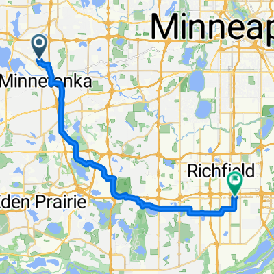
Vue d'ensemble
À propos du circuit
leaving from Dunn Bros. then south through Minnetonka, down the biggest hill in the city. Then into Eden Prairie. just for a bit. Then through Chanhassen, say hi to Randy! Then into Chaska. Dirt road #1 is about 2 miles and has some really hard packed dirt. Small rolling hills right behind the Arburitum. Then into Victoria. Once we're through the downtown area that's when the dirt roads begin. These are pretty emllow and should be packed pretty hard. Then into Waconia. food stop is optional. Once we start going around Wconia lake there's more dirt road. This road is fun even though its short and sweet. Then it's all smooth pavement after that. Most roads will have shoulders, but the ones that don't are pretty light traffic and drivers have been curtious to me in the past.
- -:--
- Durée
- 92,2 km
- Distance
- 214 m
- Montée
- 210 m
- Descente
- ---
- Vit. moyenne
- ---
- Altitude max.
Qualité de l’itinéraire
Types de voies et surfaces le long de l’itinéraire
Types de routes
Route
38,8 km
(42 %)
Route tranquille
25,8 km
(28 %)
surfaces
Pavé
38,4 km
(42 %)
Non pavé
11,3 km
(12 %)
Asphalte
34,1 km
(37 %)
Gravier
9,6 km
(10 %)
Continuer avec Bikemap
Utilise, modifie ou télécharge cet itinéraire vélo
Tu veux parcourir saturday bike ride ou l’adapter à ton propre voyage ? Voici ce que tu peux faire avec cet itinéraire Bikemap :
Fonctionnalités gratuites
- Enregistre cet itinéraire comme favori ou dans une collection
- Copie et planifie ta propre version de cet itinéraire
- Divise-le en étapes pour créer un tour sur plusieurs jours
- Synchronise ton itinéraire avec Garmin ou Wahoo
Fonctionnalités Premium
Essai gratuit de 3 jours, ou paiement unique. En savoir plus sur Bikemap Premium.
- Navigue sur cet itinéraire sur iOS et Android
- Exporter un fichier GPX / KML de cet itinéraire
- Crée ton impression personnalisée (essaie-la gratuitement)
- Télécharge cet itinéraire pour la navigation hors ligne
Découvre plus de fonctionnalités Premium.
Obtiens Bikemap PremiumDe notre communauté
Minnetonka Mills : Autres itinéraires populaires qui commencent ici
 B2B00322 55305>55402 via Shady Oak Rd, Greenway, Cedar Lake Trl, S 10th St
- Distance
- 19,7 km
- Montée
- 84 m
- Descente
- 125 m
- Emplacement
- Minnetonka Mills, Minnesota, États Unis
 Route B2B 494/McGinty Bike path
- Distance
- 3,2 km
- Montée
- 41 m
- Descente
- 23 m
- Emplacement
- Minnetonka Mills, Minnesota, États Unis
 B2B00825 55391>55420 via Baker, Rowland, 84th
- Distance
- 27,1 km
- Montée
- 197 m
- Descente
- 233 m
- Emplacement
- Minnetonka Mills, Minnesota, États Unis
 B2B00821 55426>55369 via Boone Av, Schmidt Lake Rd, Fish Lake Rd
- Distance
- 28,9 km
- Montée
- 92 m
- Descente
- 86 m
- Emplacement
- Minnetonka Mills, Minnesota, États Unis
 hopkins depot to arboretum loop
- Distance
- 56,1 km
- Montée
- 163 m
- Descente
- 161 m
- Emplacement
- Minnetonka Mills, Minnesota, États Unis
 Hopkins to University Hospital
- Distance
- 18,9 km
- Montée
- 70 m
- Descente
- 90 m
- Emplacement
- Minnetonka Mills, Minnesota, États Unis
 B2B 55343 < 55415 via Kenilworth Trail, Hennepin Ave
- Distance
- 15,5 km
- Montée
- 86 m
- Descente
- 98 m
- Emplacement
- Minnetonka Mills, Minnesota, États Unis
 B2B00474 55441>55402 via Ford Rd, Cedar Lake Trl, S10th St
- Distance
- 15,3 km
- Montée
- 67 m
- Descente
- 81 m
- Emplacement
- Minnetonka Mills, Minnesota, États Unis
Ouvre-la dans l’app